Pittsford in Monroe County, New York — The American Northeast (Mid-Atlantic)
Changing Alignments
The Canalway Trail: Pittsford
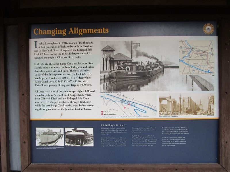
Changing Alignments
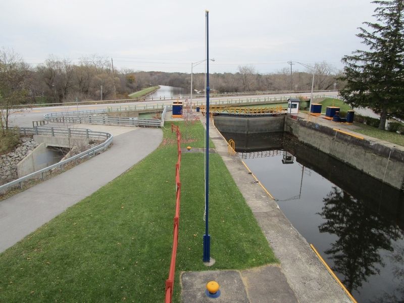
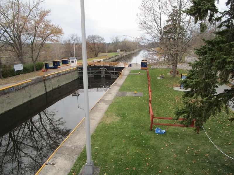
Lock 32, completed in 1916, is one of the third and last generation of locks to be built in Pittsford and in New York State. It replaced the Enlarged Erie Lock 62, built during the 1850s Enlargement which widened the original Clinton's Ditch locks.
Lock 32, like the other Barge Canal era locks, utilizes electric motors to move the large lock gates and valves that allow water into and out of the lock chamber. Locks of the Enlargement era such as Lock 62, were hand-operated and were 110' x 18' x 7' deep while Barge Canal Lock 32 is 328' x 45' x 12 feet deep. This allowed passage of barges as large as 3000 tons.
All three iterations of the canal (upper right), followed a similar path in Pittsford until King's Bend, where both Clinton's Ditch and the Enlarged Erie Canal routes veered sharply northwest through Rochester, while the later Barge Canal headed west, before rejoining the original route at the Junction Lock in Greece.
[images]
Looking west from Barge Canal Lock 32, July 7, 1921. (1) Lock No.62 (2) Path of Clinton's Ditch. The Schillner map of Enlarged Lock 62 at Pittsford, NY (c.1890s). The dotted line indicates the path of Clinton's Ditch (1825). Ongoing construction at Lock 32, September 1911.
Shipbuilding in Pittsford?
Shipbuilding in Pittsford? It seems unlikely, but its true. Pittsford played an important role in the war effort as a shipbuilding center, from 1941 to 1945.
John H. "Cap" Odenbach, owner of Dolomite Product Corporation, set up the Dolomite Maritime Corporation in 1934 to design and build electrically-welded tank and cargo ships using a method that he had recently invented.
His company built a prototype tanker and interested the Army in its unique method of construction.
By 1940, the new company, Odenbach Shipbuilding Corp. had won contracts for gasoline tankers, landing barges, tractor tugs and cranes - and built 17 in just 18 months. Odenbach shipyards operated in Galveston, Miami Beach and Pittsford, New York.
Four 300-foot tankers, including Dolomite I, were built in Pittsford in an old section of the Erie Canal near French Road, which were then floated down the canal and on to New York City.
Odenbach's biggest projects however, took place at the Dewey Avenue plant on Lake Ontario where 56 "Y" boats (180 foot-long oil tankers) were built that were destined to join the D-Day armada. .
[opposite side]
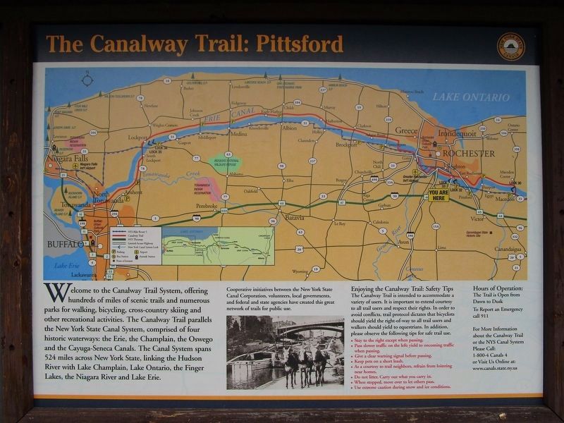
The Canalway Trail: Pittsford
Welcome to the Canalway Trail System, offering hundreds of miles of scenic trails and numerous parks for walking, bicycling, cross-country skiing and other recreational activities. The Canalway Trail
parallels the New York State.[sic]Canal System, comprised of four historic waterways: the Erie, the Champlain, the Oswego, and the Cayuga-Seneca Canals. The Canal System spans 524 miles across New York State, linking the Hudson River with Lake Champlain, Lake Ontario, the Finger Lakes, the Niagara River and Lake Erie.
Cooperative initiatives between the New York State Canal Corporation, volunteers, local governments, and federal and state agencies have created this great network of trails for public use. When completed, the Canalway Trail will span over 500 miles connecting numerous cities, towns and villages along the Canal System, making it one of the most extensive trail networks in the country.
Enjoying the Canalway Trail: Safety Tips
The Canalway Trail is intended to accommodate a variety of users. It is important to extend courtesy to all trail users and respect their rights. In order to avoid conflicts, trail protocal dictates that bicyclists should yield the right-of-way to all trail users and walkers should yield to equestrians. In addition, please observe the following tips for safe trail use.
• Stay to the right except when passing.
• Pass slower traffic on the left; yield to oncoming traffic when passing.
• Keep pets on a short leash.
• As a courtesy to trail neighbors, refrain from loitering near homes.
• Do not litter. Carry out what you carry in.
• When stopped, move over to let other pass.
Hours of Operation:
The Trail is open from Dawn to Dusk
To Report an Emergency call 911.
Erected by New York State Canals.
Topics and series. This historical marker is listed in this topic list: Waterways & Vessels. In addition, it is included in the Erie Canal series list. A significant historical year for this entry is 1916.
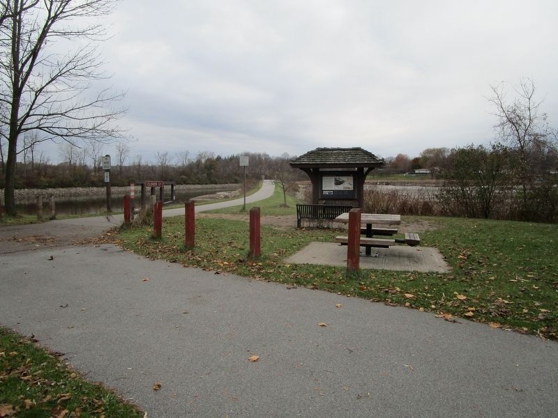
Location. 43° 5.56′ N, 77° 32.903′ W. Marker is in Pittsford, New York, in Monroe County. Marker can be reached from Clover Street, 0.2 miles west of Framingham Lane. Marker is at Lock 32 State Canal Park. Touch for map. Marker is at or near this postal address: 2759 Clover Street, Pittsford NY 14534, United States of America. Touch for directions.
Other nearby markers. At least 8 other markers are within 2 miles of this marker, measured as the crow flies. The Great American Canal (approx. 0.2 miles away); The Empire State Trail (approx. 1.1 miles away); a different marker also named The Great American Canal (approx. 1.1 miles away); Spring House - 1822 (approx. 1.2 miles away); Pittsford Village (approx. 1.7 miles away); Phoenix Hotel (approx. 1.7 miles away); Cobblestone Academy (approx. 1.7 miles away); Erie Canal (approx. 1.7 miles away). Touch for a list and map of all markers in Pittsford.
Credits. This page was last revised on November 13, 2017. It was originally submitted on November 13, 2017, by Anton Schwarzmueller of Wilson, New York. This page has been viewed 377 times since then and 51 times this year. Photos: 1, 2, 3, 4, 5, 6. submitted on November 13, 2017, by Anton Schwarzmueller of Wilson, New York.
