Georgetown in Northwest Washington in Washington, District of Columbia — The American Northeast (Mid-Atlantic)
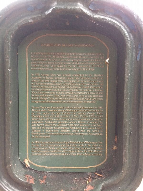
Washington Before Washington

Photographed By Devry Becker Jones (CC0), November 13, 2017
1. Washington Before Washington Marker Front
In 1608 Captain John Smith sailed up the Potomac, the first European to lay eyes on this site. At that time, ships could sail up to this point, and beautiful bluffs led down to the water. Algonquin Indians lived here in great numbers, drawn by stone quarries, fertile soil, fish and waterfowl, buffalo and deer. They called the river the Patawmeck. By 1700, as more settlers arrived, the Indians retreated into the Blue Ridge.
In 1751, George Town was formally established by the Maryland Assembly to provide inspection stations and shipping facilities for tobacco, the area's major crop. The land for the town was bought from two Scotsmen named George--George Beall and George Gordon--but the town was actually named after King George II. George Town proved an ideal port from which ships laden with tobacco could sail to Europe. Huge sums were made from the insatiable demand for tobacco in both Europe and America. Many who owned large tracts of land elsewhere lived in George Town, an economic powerhouse to which slaves were brought into provide labor and to serve the merchants' households.
George Town was incorporated with an elected government in 1789. Two years later, President George Washington selected the location for the new capital city, and included the existing George Town. Washington met here with Secretary of State Thomas Jefferson and others to plan the new capital and to secure land from the area's wealthy landowners. Washington appointed Andrew Ellicott to conduct the land survey. Ellicott was assisted by Benjamin Banneker, a free black man and self-taught mathematician. Washington also selected Pierre L'Enfant, a French-born American citizen who had served in Washington's Continental Army, to design what became a visionary plan for the new capital.
In 1800 the government moved from Philadelphia to Washington City. George Town's businesses and institutions made it the social and economic center of the new Capital City. Many members of the First Federal Congress resided here. Even Abigail Adams, the White House's first First Lady, sent someone daily to George Town to do the marketing.
Erected by Cultural Tourism DC.
Topics and series. This historical marker is listed in these topic lists: African Americans • Industry & Commerce • Native Americans • Settlements & Settlers. In addition, it is included in the DC, Art on Call, and the Former U.S. Presidents: #03 Thomas Jefferson series lists. A significant historical year for this entry is 1608.
Location. 38° 54.583′ N, 77° 3.048′ W. Marker is in Northwest Washington in Washington, District of Columbia.

Photographed By Devry Becker Jones (CC0), November 13, 2017
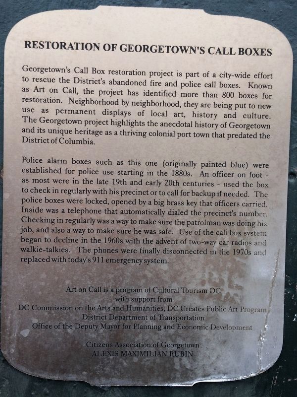
2. Washington Before Washington Marker Back
Other nearby markers. At least 8 other markers are within walking distance of this marker. Taras Shevchenko Memorial (about 500 feet away, measured in a direct line); Across 23rd St. and Rock Creek (about 600 feet away); Mustafa Kemal Atatürk (1881-1938) (about 700 feet away); The Gilded Age (about 700 feet away); Assassination of Orlando Letelier and Ronni K. Moffitt (about 800 feet away); Liberation of the Grand-Duchy of Luxembourg (about 800 feet away); Tomáš G. Masaryk (approx. 0.2 miles away); Eleftherios Venizelos (approx. 0.2 miles away). Touch for a list and map of all markers in Northwest Washington.
Credits. This page was last revised on January 30, 2023. It was originally submitted on November 13, 2017, by Devry Becker Jones of Washington, District of Columbia. This page has been viewed 286 times since then and 10 times this year. Photos: 1, 2, 3. submitted on November 13, 2017, by Devry Becker Jones of Washington, District of Columbia. • Bill Pfingsten was the editor who published this page.
