Near Perry in Aiken County, South Carolina — The American South (South Atlantic)
Indian Head / The Middle Road
(obverse)
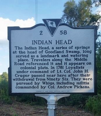
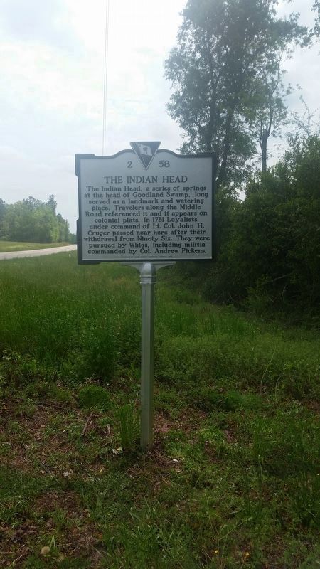
Indian Head
The Indian Head, a series of springs at the head of Goodland Swamp, long served as a landmark and watering place. Travelers along the Middle Road referenced it and it appears on colonial plats. In 1781 Loyalists under command of Lt. Col. John H. Cruger passed near here after their withdrawal from Ninety Six. They were pursued by Whigs, including militia commanded by Col. Andrew Pickens.
(reverse)
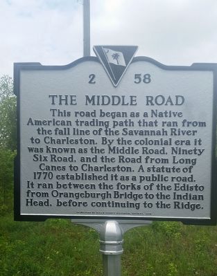
The Middle Road
This road began as a Native American trading path that ran from the fall line of the Savannah River to Charleston. By the colonial era it was known as the Middle road, Ninety Six Road, and the Road from Long Canes to Charleston. A statute of 1770 established it as a public road. It ran between the forks of the Edisto from Orangeburgh Bridge to Indian Head, before continuing to the Ridge.
Erected 2016 by Aiken County Historical Society. (Marker Number 2 58.)
Topics. This historical marker is listed in these topic lists: Colonial Era • Native Americans • Roads & Vehicles • War, US Revolutionary. A significant historical year for this entry is 1770.
Location. 33° 37.42′ N, 81° 17.73′ W. Marker is near Perry, South Carolina, in Aiken County. Marker is on John Nunn Highway (State Highway 389) half a mile east of Poole Road, on the right when traveling east. Touch for map. Marker is in this post office area: Salley SC 29137, United States of America. Touch for directions.
Other nearby markers. At least 8 other markers are within 6 miles of this marker, measured as the crow flies. Commemorative Memorial (approx. one mile away); Old Indian Trail (approx. 1.6 miles away); The Salley Family (approx. 3.9 miles away); Capt. Dempsey Hammond Salley (approx. 3.9 miles away); Wagener (approx. 3.9 miles away); Wagener Memorial Monument (approx. 4.2 miles away); Wagener Museum (approx. 4.3 miles away); The Crawfords Memorial (approx. 5.7 miles away).
Additional commentary.
1. The Middle Road
The Middle Road, an old Indian trail running between the N & S Edisto Rivers from Long Canes to Orangeburg passing through The Indian Head. The 1770 SC Statutes ordered the trail to be widened to accommodate carts and wagons.
— Submitted April 18, 2017, by John J. Howell of Columbia, South Carolina.
Credits. This page was last revised on January 19, 2018. It was originally submitted on April 18, 2017, by John J. Howell of Columbia, South Carolina. This page has been viewed 3,709 times since then and 192 times this year. Photos: 1. submitted on April 9, 2017, by John J. Howell of Columbia, South Carolina. 2, 3. submitted on April 18, 2017, by John J. Howell of Columbia, South Carolina. • Bernard Fisher was the editor who published this page.


