Near Waimea in Hawaii County, Hawaii — Hawaiian Island Archipelago (Pacific Ocean)
Clues from the Past... The Archaeology of Lapakahi
Inscription.
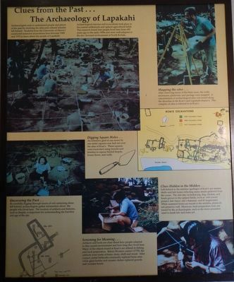
Archaeologists seek to understand people and places of the past by studying the sites and cultural remains left behind. Students from the University of Hawai'i conducted extensive excavations here between 1968 and 1970 to learn about the people of Lapakahi.
Archaeological surveys and excavations took place in the coastal settlements and upland agricultural fields. This research found that people lived here from 600 years ago to the early 1900s and were well-adapted to the dry, leeward environment of North Kohala.
Mapping the site...
After removing many of the kiawe trees, the walls, enclosures, platforms and pavings were mapped. A concentration of archaeological sites was found along the shoreline in the Koai'e and Lapakahi ahupua'a. This complex of sites is referred to as Koai'e.
Digging Square Holes...
An extensive grid of one meter by on meter squares was laid out over the sites of Koai'e. These squares were excavated using trowels and brushes to expose buried fiercest, house floors, and walls.
Uncovering the Past...
By carefully digging through layers of soil containing items left behind, archaeologists gather information about the people who lived here. The location of artifacts and features, such as firepits, is important for understanding the function and age of the site.
Screening for Meaning...
Artifacts and tools are clues about how people adapted to this coastal environment and how long they lived here. Many objects food at Koai'e related to fishing and food preparation. Before Western contact (1778), the artifacts were made of bone, stone, shell, and wood. After contact, metal fishhooks eventually replaced bone ones while glass bottles and ceramic dishes replaced gourds and wooden bowls.
Clues Hidden in the Midden...
Left behind in the midden (garbage) of Koai'e are marine shells and fish bones reflecting many meals gathered from the ocean. The diet also included pig, dog, chicken, and food grown in the upland fields, such as 'uala (sweet potato), kale (taro), mai'a (banana), and kō (sugarcane). While mammal bones are found in the middens, plants do not preserve well. However, food preparation tools are found by the archaeologists, such as the stone pounders used to mash kale and make poi.
Erected by State of Hawai'i, Department of Land ad Natural Resources, Division of State Parks.
Topics. This historical marker is listed in this topic list: Paleontology.
Location. 20° 10.516′ N, 155° 53.877′ W. Marker is near Waimea, Hawaii, in Hawaii County. Marker can be reached from Akoni Pule Highway (Hawaii Route 270), on the left when traveling north. Touch for map. Marker is in this post office area: Kamuela HI 96743, United States of America. Touch for directions.
Other nearby markers. At least 8 other markers are within 12 miles of this marker, measured as the crow flies. Farming the Land, Fishing the Sea (within shouting distance of this marker); 1st BN., 141st Infantry Regiment (approx. 7˝ miles away); Pelekane (approx. 11.3 miles away); Hale o Kapuni Heiau (approx. 11.3 miles away); Pu'ukohola Heiau (approx. 11.3 miles away); Mailekini Heiau (approx. 11.3 miles away); Pu'ukohlā Heiau (approx. 11.4 miles away); Pu'ukoholā Heiau (approx. 11.4 miles away). Touch for a list and map of all markers in Waimea.
More about this marker. This marker is located at Lapakahi State Historical Park.
Credits. This page was last revised on November 20, 2017. It was originally submitted on November 20, 2017, by Barry Swackhamer of Brentwood, California. This page has been viewed 237 times since then and 13 times this year. Photo 1. submitted on November 20, 2017, by Barry Swackhamer of Brentwood, California.
Editor’s want-list for this marker. A mid-distance view of this marker • Can you help?
