Near Lenore in Nez Perce County, Idaho — The American West (Mountains)
Nimiipuu Daily Life
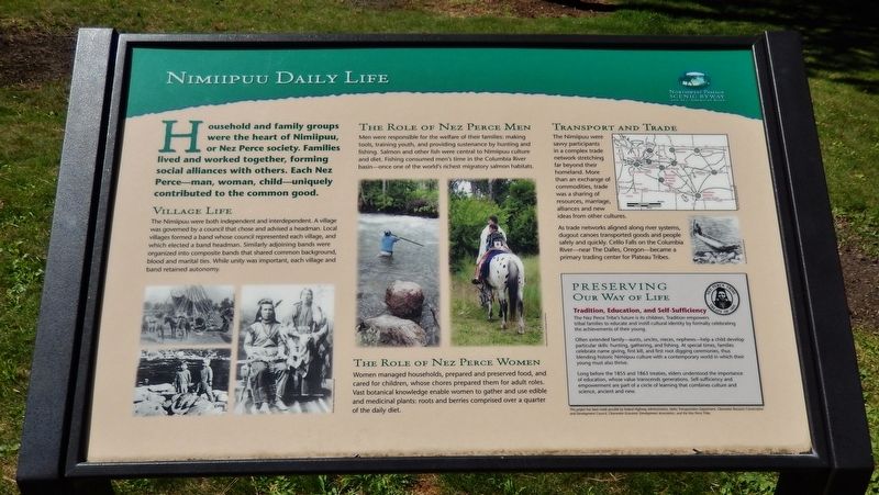
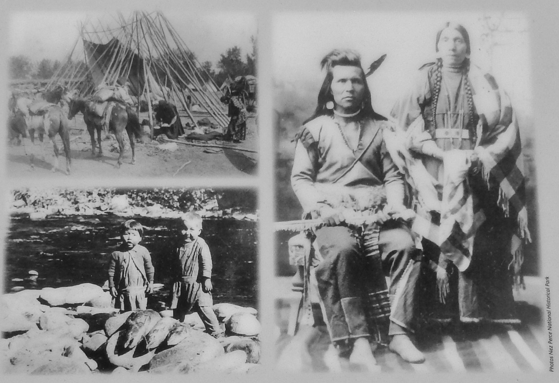
Household and family groups were the heart of Nimiipuu, or Nez Perce society. Families lived and worked together, forming social alliances with others. Each Nez Perce – man, woman, child – uniquely contributed to the common good.
Village Life
The Nimiipuu were both independent and interdependent. A village was governed by a council that chose and advised a headman. Local villages formed a band whose council represented each village, and which elected a band headman. Similarly adjoining bands were organized into composite bands that shared common background, blood and marital ties. While unity was important, each village and band retained autonomy.
The Role of Nez Perce Men
Men were responsible for the welfare of their families: making tools, training youth, and providing sustenance by hunting and fishing. Salmon and other fish were central to Nimiipuu culture and diet. Fishing consumed men’s time in the Columbia River basin – once one of the world’s richest migratory salmon habitats.
The Role of Nez Perce Women
Women managed households, prepared and preserved food, and cared for children, whose chores prepared them for adult roles. Vast botanical knowledge enabled women to gather and use edible and medicinal plants: roots and berries comprised over a quarter of the daily diet.
Transport and Trade
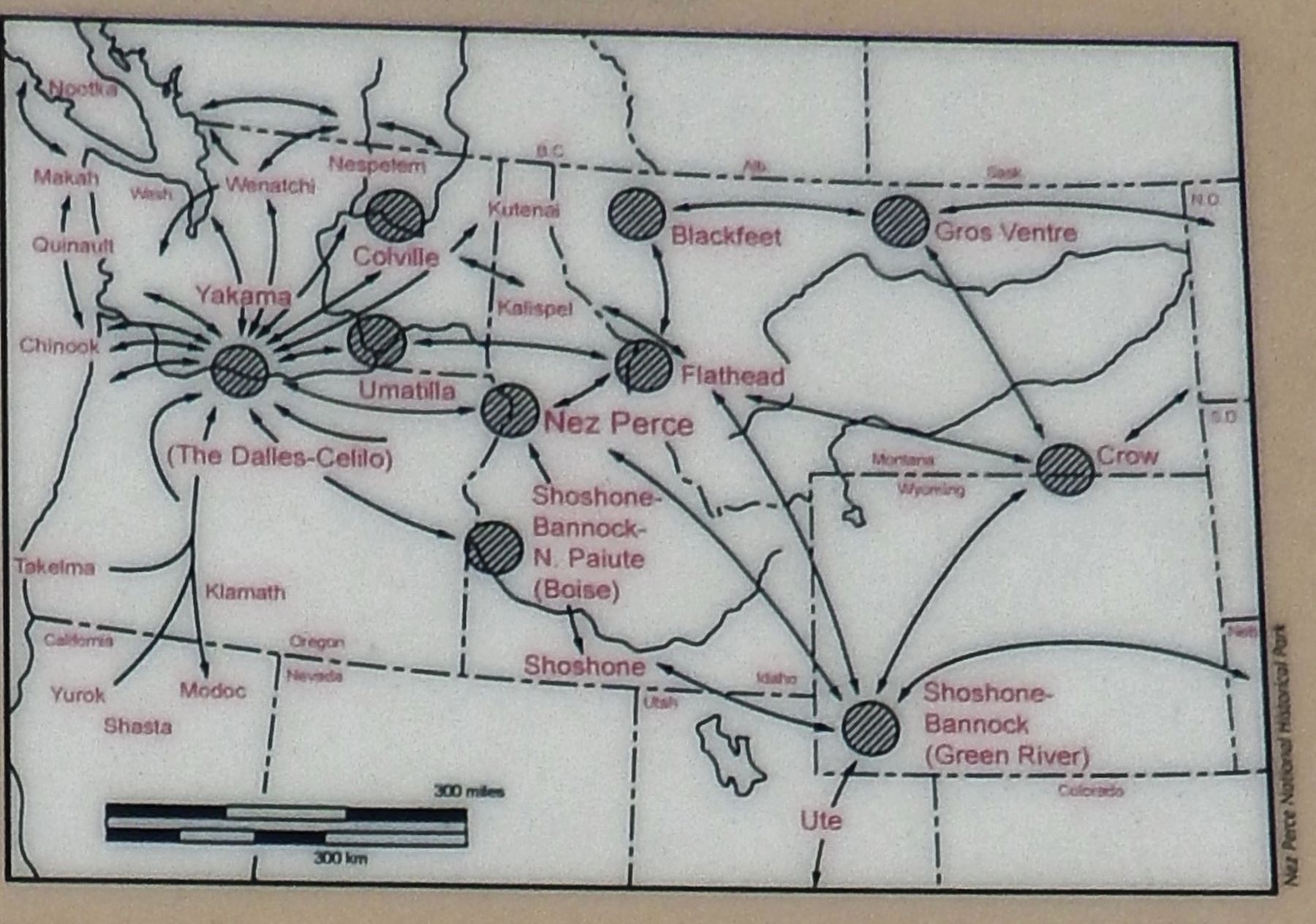
The Nimiipuu were savvy participants in a complex trade network stretching far beyond their homeland. More than an exchange of commodities, trade was a sharing of resources, marriage, alliances and new ideas from other cultures.
As trade networks aligned along river systems, dugout canoes transported goods and people safely and quickly. Celilo Falls on the Columbia River – near The Dalles, Oregon – became a primary trading center for Plateau Tribes.
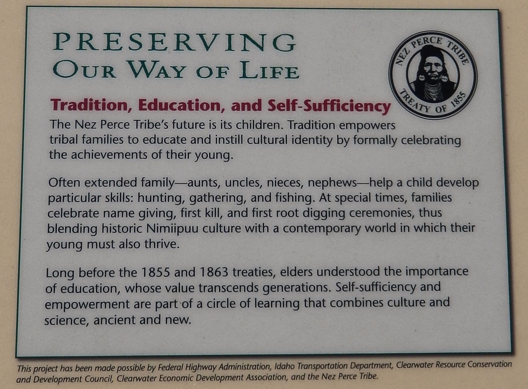
Preserving Our Way of Life
Tradition, Education, and Self-Sufficiency
The Nez Perce Tribe’s future is its children. Tradition empowers tribal families to educate and instill cultural identity by formally celebrating the achievements of their young.
Often extended family – aunts, uncles, nieces, nephews – help a child develop particular skills: hunting, gathering, and fishing. At special times, families celebrate name giving, first kill, and first root digging ceremonies, thus blending historic Nimiipuu culture with a contemporary world in which their young must also thrive.
Long before the 1855 and 1863 treaties, elders understood the importance of education, whose value transcends generations. Self-sufficiency and empowerment are part of a circle of learning that combines culture and science, ancient and new.
Erected by Federal Highway Administration, Idaho Transportation Department, Clearwater Resource Conservation Council, Clearwater Economic Development Assoc., Nez Perce Tribe.
Topics and series. This historical marker is listed in these topic lists: Anthropology & Archaeology • Native Americans • Women. In addition, it is included in the The Nez Perce Trail series list.
Location. 46° 30.661′ N, 116° 33.681′ W. Marker is near Lenore, Idaho, in Nez Perce County. Marker is on U.S. 12, 0.6 miles west of Lenore Grade, on the right when traveling west. Marker is located in the Lenore Rest Area, a pull-out and parking lot on the north side of US Highway 12, overlooking the Clearwater River. Touch for map. Marker is in this post office area: Lenore ID 83541, United States of America. Touch for directions.
Other nearby markers. At least 6 other markers are within 13 miles of this marker, measured as the crow flies. Slaterville (a few steps from this marker); Indian Houses (about 600 feet away, measured in a direct line); Lenore Tram (approx. half a mile away); Culdesac (approx. 10.8 miles away); St. Joseph's Mission (approx. 12˝ miles away); Railroad Tunnels (approx. 12˝ miles away).
Also see . . .
1. Nez Perce Indians.
The Nez Perce Indians are a tribe that lived in the Pacific Northwest of the United States. At the time of the Lewis and Clark expedition, the Nez Perce territory covered about 17 million acres, covering parts of Washington, Oregon, and Idaho. Although the Nez Perce Indians were known as warriors and were strategic in battle, the Lewis and Clark expedition recorded them as a helpful tribe that was very peaceful. (Submitted on November 27, 2017, by Cosmos Mariner of Cape Canaveral, Florida.)
2. Nez Perce Indian Culture and History.
Here is a collection of indexed links about the Nez Perce tribe and their society. Nez Perces and other American Indians are living people with a present and a future as well as a past. Nez Perce history is interesting and important, but the Nez Perce Indians are still here today, too, and we try to feature modern writers as well as traditional folklore, contemporary art as well as museum pieces, and issues and struggles of today as well as the tragedies of yesterday. (Submitted on November 27, 2017, by Cosmos Mariner of Cape Canaveral, Florida.)
3. Cultural Heritage of the Nez Perce People.
The Nez Perce, or Nimiipu, belong to the Sahaptin linguistic group of Northwest Plateau Region. Traditionally the Nez Perce existed as a semi-nomadic people whose settlement organizations changed consistently with different seasons. At one point in time they occupied an area that covered parts of North Central Idaho, Northeastern Oregon, and Southeastern Washington. Although the U.S. Treaty of 1855 reserved much of the Nez Perce's ancestral lands, the discovery of gold in the 1860's led to the Treaty of 1863 (referred to as the "non-treaty"), which re-adjusted Reservation boundaries (Submitted on November 27, 2017, by Cosmos Mariner of Cape Canaveral, Florida.)
Credits. This page was last revised on April 16, 2018. It was originally submitted on November 27, 2017, by Cosmos Mariner of Cape Canaveral, Florida. This page has been viewed 422 times since then and 49 times this year. Photos: 1, 2, 3, 4, 5. submitted on November 27, 2017, by Cosmos Mariner of Cape Canaveral, Florida. • Bill Pfingsten was the editor who published this page.
