Near Union in Union County, South Carolina — The American South (South Atlantic)
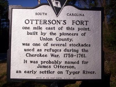
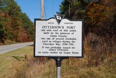
Otterson's Fort
One mile east of this point, built by the pioneers of Union County, was one of the several stockades used as refuges during the Cherokee War, 1759-1761. It was probably named for James Otterson, an early settler on Tyger River.
Erected 1957 by Fair Forest Chapter, National Society Daughters of the American Revolution. (Marker Number 44-1.)
Topics and series. This historical marker is listed in these topic lists: Colonial Era • Forts and Castles • Military • Settlements & Settlers • Wars, US Indian. In addition, it is included in the Daughters of the American Revolution series list.
Location. 34° 35.353′ N, 81° 35.277′ W. Marker is near Union, South Carolina, in Union County. Marker is on Whitmire Highway (U.S. 176) north of Beatty's Bridge Road. Marker is located between Union and Whitmire, South Carolina. Touch for map. Marker is in this post office area: Union SC 29379, United States of America. Touch for directions.
Other nearby markers. At least 10 other markers are within 9 miles of this marker, measured as the crow flies. Poplar Grove School (approx. 4 miles away); Rose Hill Mansion (approx. 4.6 miles away); Gist Cemetery (approx. 5.3 miles away); Veterans Memorial (approx. 5.7 miles away); Whitmire War Memorial (approx. 6.1 miles away); Our Heroes of World War II (approx. 6.1 miles away); Textile Memorial (approx. 6.2 miles away); Union Memorial Gardens Veterans Monument (approx. 7.4 miles away); Sims High School (approx. 7.8 miles away); a different marker also named Sims High School (approx. 8.3 miles away). Touch for a list and map of all markers in Union.
Also see . . .
1. Anglo-Cherokee War. The Anglo-Cherokee War (1758–1761) (Cherokee: "war with those in the red coats" or "war with the english"), also known (from the Anglo-European perspective) as the Cherokee War, the Cherokee Uprising, the Cherokee Rebellion, was a conflict between British forces in North America and Cherokee Indians during the French and Indian War. (Submitted on February 22, 2009, by Brian Scott of Anderson, South Carolina.)
2. Beatty Bridge Site, Union County SC. US Highway 176 crosses the Tyger River at Beatty Bridge, in the southern part of Union County SC. (Submitted on March 7, 2009, by Brian Scott of Anderson, South Carolina.)
Additional commentary.
1. About James Otterson and His Family
James Otterson's wife was named Rebecca. They migrated from Pennsylvania to Union County around 1750s. They had two children.
1) Major Samuel Otterson. Wife: Ruth Gordon. Daughter: Sarah Otterson, married to Amos Lay. Major Otterson took his family to Greene County, Alabama in 1821. Ruth Gordon was the daughter of Thomas Gordon and Elizabeth Caldwell.
2) Sarah Otterson. Husband: John Johnston, a Patriot who was captured by the British in 1780 at the Battle of Blackstock's Ford. By the order of Col. Banastre Tarleton, Johnston was taken to his nearby home and hung while his wife and six children watched helplessly. (Source: http://magnolia.cyriv.com/GreeneAlgenweb/Surnames/PattonReprint/Patton110-111.pdf.)
— Submitted June 11, 2009, by Brian Scott of Anderson, South Carolina.
Credits. This page was last revised on June 16, 2016. It was originally submitted on September 6, 2008, by M. L. 'Mitch' Gambrell of Taylors, South Carolina. This page has been viewed 2,087 times since then and 56 times this year. Photos: 1. submitted on September 6, 2008, by M. L. 'Mitch' Gambrell of Taylors, South Carolina. 2. submitted on November 9, 2008, by Brian Scott of Anderson, South Carolina. • Kevin W. was the editor who published this page.

