Wharton Township near Farmington in Fayette County, Pennsylvania — The American Northeast (Mid-Atlantic)
The Great Meadows Campaign
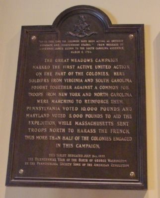
“Up to this time the colonies have been acting as entirely separate and independent states.” From message of Governor James Glenn to the South Carolina Assembly, March 5, 1754.
The Great Meadows Campaign marked the first active united action on the part of the colonies. Here soldiers from Virginia and South Carolina fought together against a common foe. Troops from New York and North Carolina were marching to reinforce them. Pennsylvania voted 10,000 pounds and Maryland voted 5,000 pounds to aid the expedition, while Massachusetts sent troops north to harass the French. Thus more than half the colonies engaged in this campaign.
This tablet dedicated July 3rd, 1932, the Bicentennial Year of the birth of George Washington, by the Pennsylvania Society Sons of the American Revolution.
Erected 1932 by the Pennsylvania Society, Sons of the American Revolution.
Topics and series. This historical marker is listed in this topic list: War, French and Indian. In addition, it is included in the Sons of the American Revolution (SAR) series list. A significant historical date for this entry is March 5, 1820.
Location. 39° 48.867′ N, 79° 35.183′ W. Marker is near Farmington, Pennsylvania, in Fayette County. It is in Wharton Township. Marker can be reached from Washington Parkway east of National Pike (U.S. 40), on the right when traveling east. Marker is in the Fort Necessity Visitors Center. Touch for map. Marker is at or near this postal address: Washington Pkwy, Farmington PA 15437, United States of America. Touch for directions.
Other nearby markers. At least 8 other markers are within walking distance of this marker. Do you measure up in Washington's Army? / Are you dressed for the campaign? (a few steps from this marker); Civilian Conservation Corps at Fort Necessity (a few steps from this marker); Fort Necessity National Battlefield (within shouting distance of this marker); Building Fort Necessity (about 600 feet away, measured in a direct line); British Defenses (about 700 feet away); Surrender Negotiations (about 800 feet away); The French Attack (about 800 feet away); Fort Necessity (approx. 0.2 miles away). Touch for a list and map of all markers in Farmington.
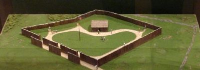
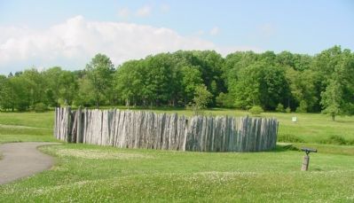
More about this marker. This was one of the bronze tablets originally posted outdoors in the replica of Fort Necessity constructed in 1932. The replica, now called the Square Fort, was found to be historically inaccurate and replaced by the much smaller round stockade fort now on the site. The tablet is now itself a piece of history, mounted in an exhibit in the Fort Necessity/National Road Interpretive and Education Center (the Visitor’s Center).
Also see . . .
Fort Necessity National Battlefield, Pennsylvania. National Park Service website entry (Submitted on June 8, 2022, by Larry Gertner of New York, New York.)
Credits. This page was last revised on February 7, 2023. It was originally submitted on June 9, 2007, by J. J. Prats of Powell, Ohio. This page has been viewed 1,762 times since then and 21 times this year. Last updated on July 6, 2022, by Carl Gordon Moore Jr. of North East, Maryland. Photos: 1, 2, 3. submitted on June 9, 2007, by J. J. Prats of Powell, Ohio. • Devry Becker Jones was the editor who published this page.


