Near La Grande in Union County, Oregon — The American West (Northwest)
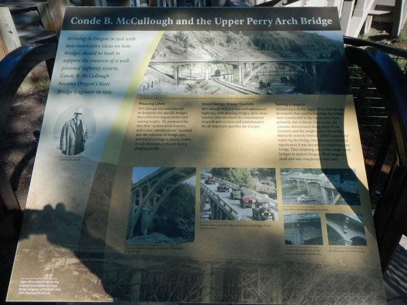
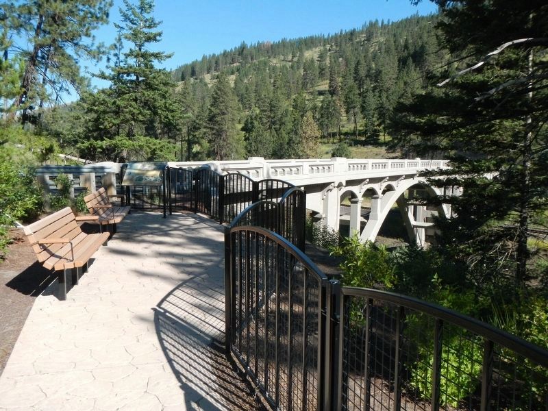
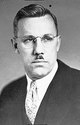
Conde B. McCullough and Upper Perry Arch Bridge

Photographed By Barry Swackhamer, June 30, 2017
1. Conde B. McCullough and Upper Perry Arch Bridge Marker
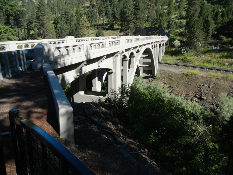
Captions: (upper right) Side view of the Upper Perry Arch Bridge showing arches spanning both Grande Ronde River and the Union Pacific Railroad.; (bottom left) Soaring arches are indicative of Conde B. McCullough's bridge designs.; (bottom center) Antique vehicles cross the bridge, a reenactment of the Upper Perry's original tourists.; (bottom right, 3 images) Upper Perry Arch Bridge during restoration, Concrete flaking off the bridge prior to restoration, March 2004, Restored concrete, October 2009; (background) Upper Perry Arch Bridge during original construction by Union Bridge Company of Portland, circa 1924. Final cost $53,814.43.
Pleasing Lines
McCullough was instrumental in designing site-specific bridges that exhibited elegant arches and soaring heights. He promoted the idea that "architectural features and scenic considerations" factored into the selection of bridge type, and that if a bridge is plainly visible in side elevation, it should have a pleasing profile.
Good Design Draws Tourists
McCullough believed that well-maintained highways, with pleasing bridges, drew more tourists, who increased the consumption of goods and services and contributed to the all important gasoline tax receipts.
Saving a Legacy
Maintenance of the Upper Perry Arch Bridge decreased when nearby Interstate 84 bridges were constructed in the 1960s. Over time, primarily due to freeze-thaw cycles, the concrete deteriorated along much of the structure and the weight across the bridge had to be severely limited. ODOT considered replacing the bridge, but due to its historical significance it was decided to rehabilitate the bridge. Thus retaining one of two single arch bridges in eastern Oregon. Work began in 2008 and was completed a year later.
Erected by Oregon Department of Transportation.
Topics. This historical marker is listed in this topic list: Bridges & Viaducts. A significant historical year for this entry is 1916.
Location. 45° 21.123′ N, 118° 10.208′ W. Marker is near La Grande, Oregon, in Union County. Marker is on Hamilton Creek Frontage Road near Interstate 84, on the right when traveling north. Touch for map. Marker is in this post office area: La Grande OR 97850, United States of America. Touch for directions.
Other nearby markers. At least 8 other markers are within 8 miles of this marker, measured as the crow flies. Highway US30 and Perry, Oregon (about 400 feet away, measured in a direct line); Hilgard Junction Oregon Trail Kiosk (approx. 3.2 miles away); "Wagons East " 1975-1976 (approx. 3.2 miles away); Historic La Grande (approx. 3.2 miles away); The First L.D.S. Church (approx. 4.1 miles away); A Beautiful Rough Road (approx. 7.7 miles away); A Native American Trail (approx. 7.7 miles away); Parade of Survivors (approx. 7.7 miles away). Touch for a list and map of all markers in La Grande.
Credits. This page was last revised on July 21, 2023. It was originally submitted on December 13, 2017, by Barry Swackhamer of Brentwood, California. This page has been viewed 380 times since then and 53 times this year. Photos: 1, 2, 3, 4. submitted on December 13, 2017, by Barry Swackhamer of Brentwood, California.


