Teotihuacán de Arista in Teotihuacán, Mexico State, Mexico — The Central Highlands (North America)
The Pyramid of the Moon
Pirámide de la Luna
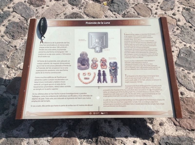
A diferencia de la pirámide del Sol, ésta fue construida en al menos siete etapas entre los años 100 y 650 d.С. Desde una vista aérea, la pirámide presenta una forma rectangular: 150 metros en su eje este-oeste y 130 metros en el norte-sur.
Al frente de la pirámide, está adosado un cuerpo saliente, de mayores dimensiones que el de la estructura adosada al frente de la Pirámide del Sol, al parecer no es una superposición posterior, sino que forma parte de la misma construcción.
Como muchos edificios de Teotihuacan presenta cuatro cuerpos escalonados con talud (muro inclinado) y tablero (muro vertical) y al igual que en el resto de los basamentos piramidales, debió haber existido un templo en la parte superior.
En los últimos años se han hecho nuevas investigaciones y grandes hallazgos, como los entierros de individuos sacrificados y ricas ofrendas de objetos de jade. Todo esto, era colocado al momento de hacer una nueva ampliación del templo.
Si vas a subir, ¡Recuerda que hasta la parte de arriba son 42 metros de altura!
Pie de dibujos:
Vista aérea de la Pirámide de la Luna
Cuerpos
Cuerpo saliente
Piezas procedentes de diversos entierros
Pirámide de la Luna
In Metztli Teocalli, quipiya ce nànauhpa tlalcahuayan; in tlen quipiya 150 m. in quenin hueyac, onoço mohueyitlaza ic iquizayan in tonatiuh-icalaquiyan tonatiuh, ihuan 130 m. ipan ic mictlampa-çohuatlampa, ica 42 m. in axan huecapa quipiya. Ic ixpa inin Teocalli onca occe caltepantli in tlen ixtlacha, ihuan inin ocachi hueyi in tlen noço onca ixpa in Tonatiuh Teocalli, ihuan inin mate amo monenepano, tleca inin mate çan ce tecpanchichihualiztli omochichiuh. Inin tecpanchichihualiztli quipiya nanahui caltepantin in tlen moyeyecatia ica cequi tepamitl in tlen itoca talud-tablero. Ihuan itlanacaztla inin caltepamitl in tlen monepano, oncate ome apantoton in tlen cuali quiza in atl in cuac quiahui, ininque tlami ica tepantoton in tlen mixtiachiya in tlen itoca alfardas.
Ihuan in mochtin in tlaltetzontin in tlen quipipiya in teteocaltin cuali mohta ipan in mochi in Caltecpanchichihualiztli in tlen axan itoca. Zona Arqueologica, mochi onca icpac, tleca mate ompa icpac catca ce teopantli, in tlen cuali yomixtlamachili mate inin çan ce hueyi caltepantli catca in tlen yexpa moxelohuaya itec.
The Pyramid of the Moon
The Pyramid of the Moon has a rectangular base with an
east-west length of 500 feet and a north-south width of 433 feet, whereas at present its height measures 140 feet.
Annexed to the front of the pyramid is a jutting body with greater dimensions than those of the structure annexed to the Pyramid of the Sun and which does not seem to be superimposed but, rather, an integral part of the building itself. This annexed structure consists of four stepped tiers with slope-panel walls. On the side of this superimposed body are two ample gutters lined with low walling similar to stairway reinforcements.
As with the rest of the pyramidal buildings seen throughout fue (sic, the) Archaeological Zone, the summit of this one must have supported a temple. And, according to data from archaeological excavations undertaken here, it would seem that this temple had a single room partitioned into three parts.
The text in English on the marker for some reason is different from the Spanish text shown on the marker. Here follows a translation of the entire Spanish text shown on the marker.
Unlike the Pyramid of the Sun, this pyramid was built in at least seven stages between 100-650 AD. From an aerial view, the pyramid presents a rectangular shape: 150 meters on its east-west axis and 130 meters from north to south.
In front of the pyramid, a protruding, larger body is attached, larger than the one attached to the front of the Pyramid of the Sun. Apparently it is not a later addition, but is part of the same construction as the rest of the pyramid.
Like many Teotihuacan buildings, it presents four staggered bodies with talud (inclined wall) and tablero (vertical wall) construction and as in the rest of the pyramids, there must have been a temple on the highest part.
In recent years new and larger investigations have made additional discoveries, such as the burials of sacrificed individuals and rich offerings of jade objects. All of these objects were placed at the time of additions to the pyramid.
If you are going to climb, remember that the top is 42 meters high!
Note: Climbing to the absolute top of the pyramid is no longer permitted as of this viewing.
Captions:
Aerial view of the Pyramid of the Moon
Levels of the pyramid
The additional, outward portion of the pyramid
Pieces or artifacts found from different burials at the pyramid
Erected by Instituto Nacional de Antropología e Historia (INAH).
Topics. This historical marker is listed in these topic lists: Anthropology & Archaeology • Architecture • Man-Made Features • Native Americans.
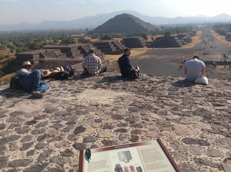
Location. 19° 41.937′ N, 98° 50.642′ W. Marker is in Teotihuacán de Arista, Estado de Mexico (Mexico State), in Teotihuacán. Marker can be reached from Calle Paloma just west of Calle Tuxpan. The marker is at the highest portion of the Pyramid of the Moon that can be visited on a normal tour. Touch for map. Marker is in this post office area: Teotihuacán de Arista MEX 55880, Mexico. Touch for directions.
Other nearby markers. At least 8 other markers are within walking distance of this marker. Miccoatli (about 180 meters away, measured in a direct line); Palacio de Quetzalpapalotl (about 180 meters away); The Quetzalpapálotl Architectural Complex (about 210 meters away); The Temple of Agriculture (approx. 0.3 kilometers away); Late Occupation of Teotihuacan and the Mexica Presence (approx. 0.3 kilometers away); The Puma Mural (approx. 0.4 kilometers away); The History of Teotihuacán (approx. half a kilometer away); The Importance of the Pyramid of the Sun (approx. 0.6 kilometers away). Touch for a list and map of all markers in Teotihuacán de Arista.
Credits. This page was last revised on December 18, 2017. It was originally submitted on December 18, 2017, by J. Makali Bruton of Accra, Ghana. This page has been viewed 150 times since then and 17 times this year. Photos: 1, 2. submitted on December 18, 2017, by J. Makali Bruton of Accra, Ghana.

