The Jewel Tower
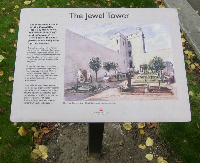
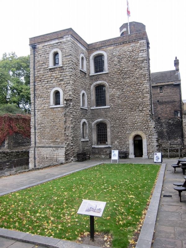
The walls are mainly built of Kentish Ragstone from Maidstone. Other stone came from Reigate, Beer (Devon) and Caen (France), while timber for the roof came from Surrey. The windows were of highly decorative glass protected by iron grilles.
To give the tower better protection (and provide fish for the king's table), it was surrounded by a moat. This was constructed in July 1366 and took 23 navvies 10 days to dig. The water came from a ditch leading directly into the River Thames.
From 1621 the Jewel Tower was used for the storage of parliamentary records and by the end of the century it is likely that the ditch and the moat had been partially filled in. In 1869 it became the centre for the Board of Trade's Standards Department, which tested standards of weight and measure.
Erected by English Heritage.
Topics. This historical marker is listed in this topic list: Forts and Castles. A significant historical month for this entry is July 1366.
Location. 51° 29.909′ N, 0° 7.567′ W. Marker is in City of Westminster, England, in Greater London. Marker
Other nearby markers. At least 8 other markers are within walking distance of this marker. Emmeline Pankhurst (within shouting distance of this marker); Trial of William Wallace (about 120 meters away, measured in a direct line); The Burghers of Calais (about 150 meters away); T.E. Lawrence (about 150 meters away); Cromwell Association Memorial Tablet (about 180 meters away); Lord Reith (about 180 meters away); Sir John Gielgud (about 180 meters away); Parliament Square (about 180 meters away). Touch for a list and map of all markers in City of Westminster.
Also see . . .
1. Jewel Tower (English Heritage). "The Jewel Tower dates back almost 650 years and is an intriguing visitor attraction in the heart of Westminster. It was built around 1365 to house Edward III’s treasures and was known as the ‘King’s Privy Wardrobe’....One of only two buildings from the medieval Palace of Westminster to survive the fire of 1834, the tower features a 14th century ribbed vault." (Submitted on December 19, 2017.)
2. Jewel Tower (Wikipedia). "The Jewel Tower is a 14th-century surviving element of the royal Palace of Westminster, in London, England. It was built between 1365 and 1366, under the direction of William of Sleaford and Henry de Yevele, to house the personal treasure of Edward III. The tower, a three-storey, crenellated stone building, occupied a secluded part of the palace and was protected by a moat linked to the River Thames. The ground floor featured elaborate carved vaulting, described by historian Jeremy Ashbee as "an architectural masterpiece". The tower continued to be used for storing the monarch's treasure and personal possessions until 1512, when a fire in the palace caused Henry VIII to relocate his court to Whitehall." (Submitted on December 19, 2017, by Andrew Ruppenstein of Lamorinda, California.)
Credits. This page was last revised on January 27, 2022. It was originally submitted on December 19, 2017, by Andrew Ruppenstein of Lamorinda, California. This page has been viewed 199 times since then and 13 times this year. Photos: 1, 2. submitted on December 19, 2017, by Andrew Ruppenstein of Lamorinda, California.

