St. Augustine in St. Johns County, Florida — The American South (South Atlantic)
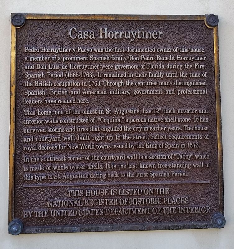
Casa Horruytiner
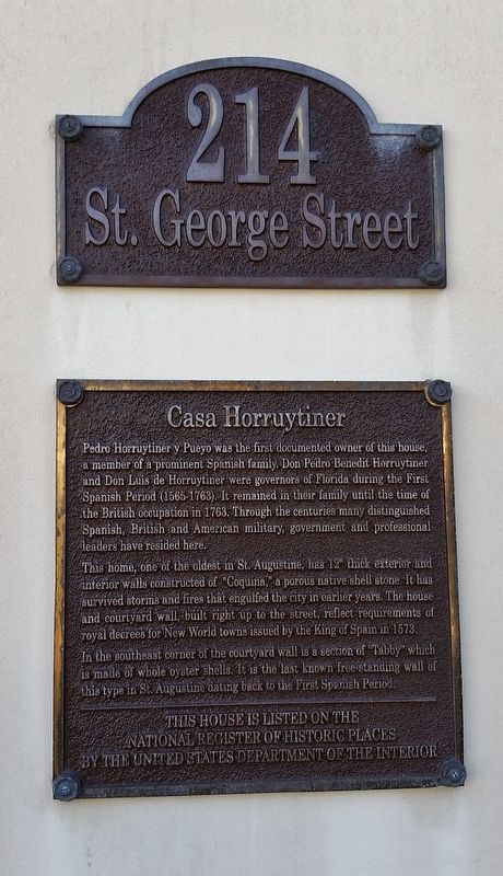
Pedro Horruytiner y Pueyo was the first documented owner of this house, a member of a prominent Spanish family. Don Pedro Benedit Horruytiner and Don Luis de Horruytiner were governors of Florida during the First Spanish Period (1565-1763). It remained in their family until the time of the British occupation in 1763. Through the centuries many distinguished Spanish, British and American military, government and professional leaders have resided here.
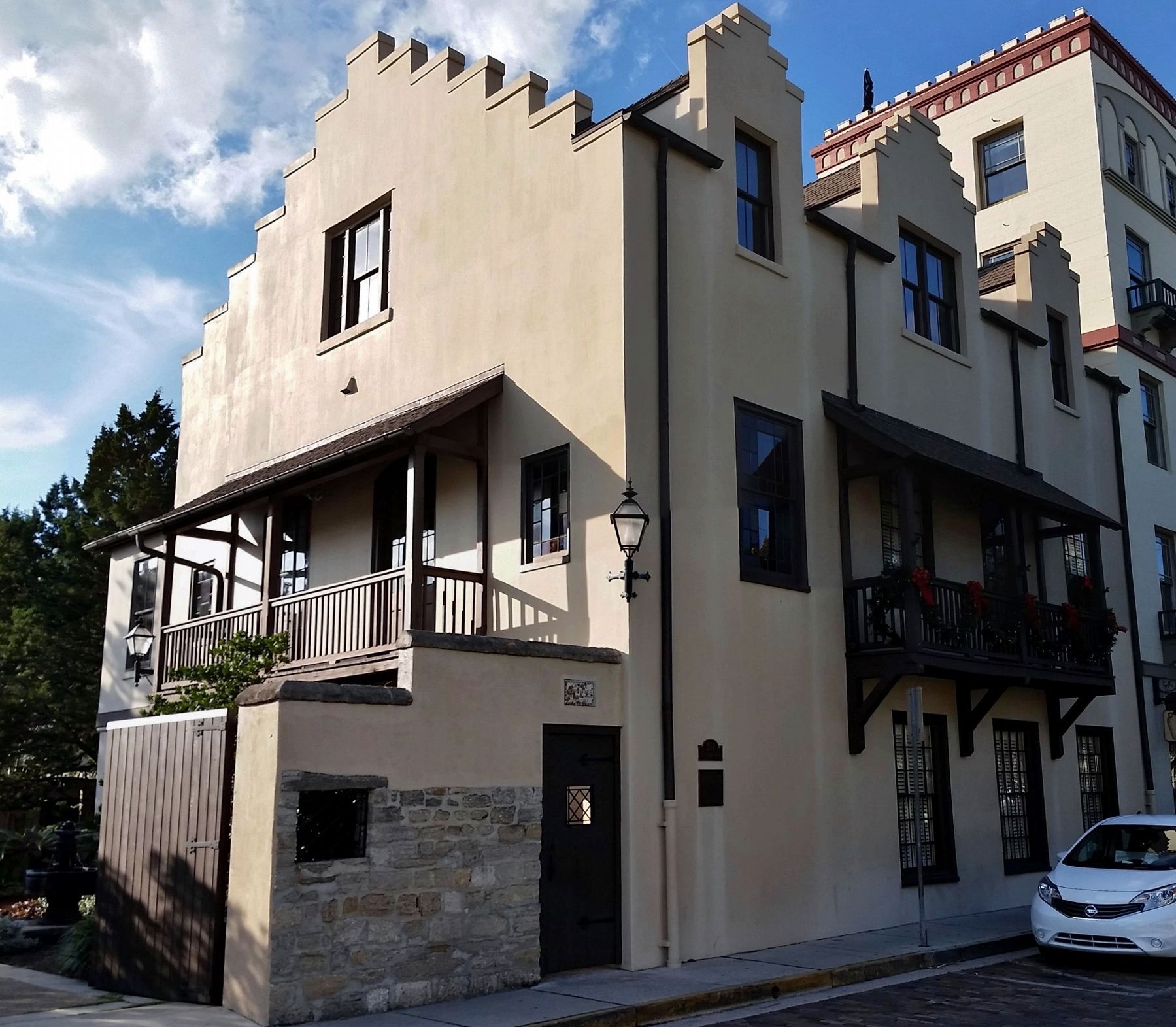
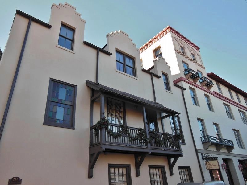
This home, one of the oldest in St. Augustine, has 12” thick exterior and interior walls constructed of “Coquina,” a porous native shell stone. It has survived storms and fires that engulfed the city in earlier years. The house and courtyard wall, built right up to the street, reflect requirements of royal decrees for New World towns issued by the King of Spain in 1573.
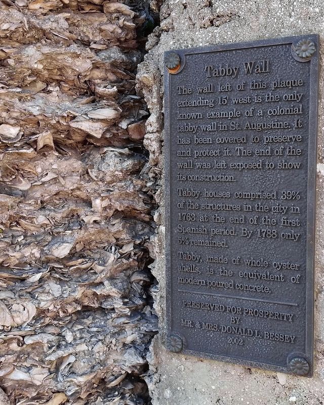
In the southeast corner of the courtyard wall is a section of “Tabby” which is made of whole oyster shells. It is the last known free-standing wall of this type in St. Augustine dating back to the First Spanish Period.
Topics. This historical marker is listed in this topic list: Notable Buildings.
Location. 29° 53.502′ N, 81° 18.763′ W. Marker is in St. Augustine, Florida, in St. Johns County. Marker is on Saint George Street south of King Street (Business U.S. 1), on the right when traveling south. Marker is mounted directly on subject building, near the southeast corner. Touch for map. Marker is at or near this postal address: 214 Saint George Street, Saint Augustine FL 32084, United States of America. Touch for directions.
Other nearby markers. At least 8 other markers are within walking distance of this marker. Trinity Episcopal Church (within shouting distance of this marker); Trinity Parish Church (within shouting distance of this marker); Prisoners of War in St. Augustine During the American Revolution (within shouting distance of this marker); Andrew Young Crossing (within shouting distance of this marker); Government House and the Plaza (about 300 feet away, measured in a direct line); 31 King Street (about 300 feet away); Constitution Monument (about 300 feet away); Government House: National Significance (about 300 feet away). Touch for a list and map of all markers in St. Augustine.
Also see . . .
1. Don Pedro Horruytiner House.
A house can be identified on the site with some degree of certainty at the time of the first Spanish evacuation in 1763. This is described as a "house of stone" belonging to Don Pedro Benedit Horruytiner y Pueyo. When Charles Howard bought the property from Robert Gatherwood in 1785, he described the house as "uninhabitable." When Howard sold the property to Juan Cavedo in September of the same year the house is described as a "stone house of 2 stories." (Submitted on December 21, 2017, by Cosmos Mariner of Cape Canaveral, Florida.)
2. Pedro Benedit Horruytiner.
Pedro Benedit Horruytiner was appointed acting co-governor of Florida on 11 April 1646. Horruytiner's term as interim governor of Florida ended on 8 January 1648; he was reappointed as governor on 19 October 1651. He retired on 18 June 1654, and was replaced by Diego de Rebolledo. Horruytiner died at the age of 71 on November 20, 1684, still in the service of the Spanish Crown. (Submitted on December 21, 2017, by Cosmos Mariner of Cape Canaveral, Florida.)
Photographed By Cosmos Mariner, December 20, 2017
4. Tabby Wall
The wall left of this plaque extending 15’ west is the only known example of a colonial tabby wall in St. Augustine. It has been covered to preserve and protect it. The end of the wall was left exposed to show its construction.
Tabby houses comprised 39% of the structures in the city in 1763 at the end of the first Spanish period. By 1788 only 5% remained.
Tabby, made of whole oyster shells, is the equivalent of modern poured concrete.
by
Mr. & Mrs. Donald L. Bessey
2002
Credits. This page was last revised on January 2, 2019. It was originally submitted on December 20, 2017, by Cosmos Mariner of Cape Canaveral, Florida. This page has been viewed 737 times since then and 76 times this year. Photos: 1, 2. submitted on December 20, 2017, by Cosmos Mariner of Cape Canaveral, Florida. 3, 4. submitted on December 21, 2017, by Cosmos Mariner of Cape Canaveral, Florida. 5. submitted on November 22, 2018, by Cosmos Mariner of Cape Canaveral, Florida. • Bernard Fisher was the editor who published this page.
