Tallapoosa in Haralson County, Georgia — The American South (South Atlantic)
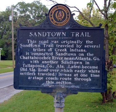
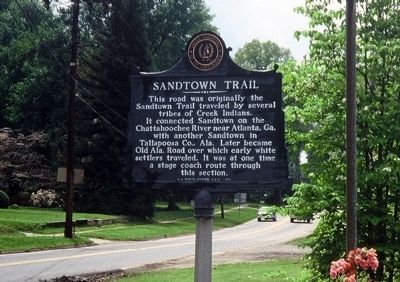
Sandtown Trail
Erected 1970 by A. J. McBride Chapter, United Daughters of the Confederacy.
Topics and series. This historical marker is listed in these topic lists: Native Americans • Roads & Vehicles • Settlements & Settlers. In addition, it is included in the United Daughters of the Confederacy series list.
Location. 33° 45.251′ N, 85° 17.564′ W. Marker is in Tallapoosa, Georgia, in Haralson County. Marker is at the intersection of Broad Street (Georgia Route 120) and Bowden Street (Georgia Route 100), on the left when traveling west on Broad Street. Touch for map. Marker is in this post office area: Tallapoosa GA 30176, United States of America. Touch for directions.
Other nearby markers. At least 8 other markers are within 17 miles of this marker, measured as the crow flies. Seven Chestnuts (approx. ¼ mile away); Historic Tallapoosa (approx. 0.8 miles away); Hungarian Colony (approx. 5.1 miles away); Haralson County (approx. 6.8 miles away); Hernando de Soto in Alabama (approx. 7.4 miles away in Alabama); Sacred Harp Singing (approx. 9½ miles away); First “REA” Substation in Carroll County (approx. 16.9 miles away); University of West Georgia (approx. 17 miles away). Touch for a list and map of all markers in Tallapoosa.
Credits. This page was last revised on January 29, 2021. It was originally submitted on September 7, 2008, by David Seibert of Sandy Springs, Georgia. This page has been viewed 2,672 times since then and 62 times this year. Photos: 1. submitted on September 7, 2008, by David Seibert of Sandy Springs, Georgia. 2. submitted on September 9, 2008, by David Seibert of Sandy Springs, Georgia. 3. submitted on September 7, 2008, by David Seibert of Sandy Springs, Georgia. • Kevin W. was the editor who published this page.


