Ninety Six in Greenwood County, South Carolina — The American South (South Atlantic)
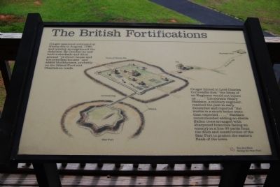
The British Fortifications
Cruger hinted to Lord Charles Cornwallis that 'the Ideas of an Engineer would not injure us..." Lieutenant Henry Haidans, a military engineer, reached the post in early December and reported "the works in a much better state than expected..." Haldane recommended adding an abatis (fallen trees arranged with sharpened branches facing an enemy) on a line 30 yards from the ditch and construction of the Star Fort to protect the eastern flank of the town.
Erected by National Park Service.
Topics. This historical marker is listed in these topic lists: Forts and Castles • War, US Revolutionary. A significant historical year for this entry is 1780.
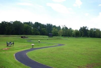
Location. 34° 8.863′ N, 82° 1.118′ W. Marker is in Ninety Six, South Carolina, in Greenwood County. Marker is on South Cambridge Street. Marker is located in the observation tower on the north end o the battlefield. Touch for map. Marker is in this post office area: Ninety Six SC 29666, United States of America. Touch for directions.
Other nearby markers. At least 8 other markers are within walking distance of this marker. The Patriots Lay Siege to the Star Fort (here, next to this marker); Patriot Soldier (a few steps from this marker); a different marker also named The Patriots Lay Siege to the Star Fort (a few steps from this marker); The Patriot Force Arrives (within shouting distance of this marker); The Artillery (within shouting distance of this marker); Trader with Pack Horse (within shouting distance of this marker); Island Ford Road (within shouting distance of this marker); Approach Trench (about 300 feet away, measured in a direct line). Touch for a list and map of all markers in Ninety Six.
More about this marker. This is the fourth marker on the Ninety Six Historical Park Walking Tour.
Also see . . .
1. Ninety Six National Historic Site. (Submitted on September 7, 2008, by Brian Scott of Anderson, South Carolina.)
2. Loyalist Institute: Memorial of John Harris Cruger of New York. (Submitted on September 7, 2008, by Brian Scott of Anderson, South Carolina.)
Credits. This page was last revised on November 20, 2020. It was originally submitted on September 7, 2008, by Brian Scott of Anderson, South Carolina. This page has been viewed 868 times since then and 20 times this year. Photos: 1, 2. submitted on September 7, 2008, by Brian Scott of Anderson, South Carolina. • Craig Swain was the editor who published this page.

