Near Gaffney in Cherokee County, South Carolina — The American South (South Atlantic)
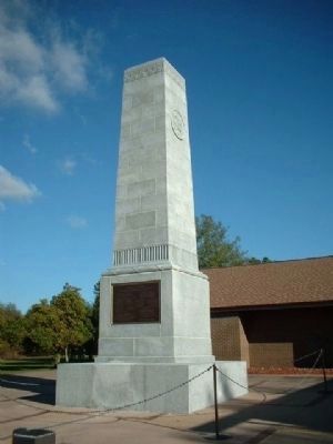
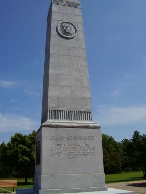
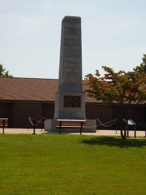
Battle of Cowpens Monument
Inscription.
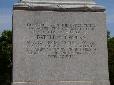
South Inscription:
has caused this Monument to be
erected on the site of the
Battle of Cowpens
as a testimonial to the valor and
in appreciation of the services of
the American Troops on this field in
behalf of The Independence of
their country.
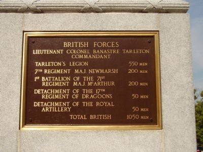
East Plaque:
Lieutenant Colonel Banastre Tarleton
Commandant
Tarleton's Legion: 550 men
7th Regiment Maj. Newmarsh: 200 men
1st Battalion of the 71st
Regiment of Maj. McArthur: 200 men
Detachment of the 17th
Regiment of Dragoons: 50 men
Detachment of the Royal
Artillery: 500 men
Total British: 1050 men
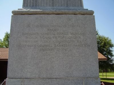
North Inscription:
under
Brigadier General Daniel Morgan
won a signal victory over a
British Force Commanded by
Lieutenant Colonel Banastre Tarleton
January 17, 1781.
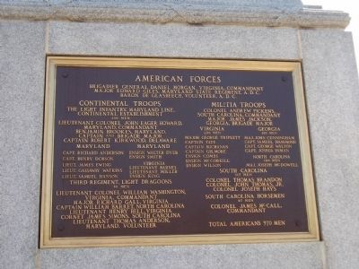
West Plaque:
Brigadier General Daniel Morgan, Virginia Commandant
Major Edward Giles, Maryland State Regiment, A.D.C.
Baron de Glasbeech, Volunteer, A.D.C.
Continental Troops
The Light Infantry, Maryland Line,
Continental Establishment
290 men
Lieutenant Colonel John Eager Howard,
Maryland Commandant
Benjamin Brookes, Maryland,
Captain and Brigade Major
Captain Robert Kirkwood, Delaware
Maryland
Capt. Richard Anderson
Capt. Henry Dobson
Lieut. James Ewing
Lieut. Gassaway Watkins
Lieut. Samuel Hanson
Ensign Walter Dyer
Ensign Smith
Virginia
Lieutenant Barnes
Lieutenant Miller
Ensign King
Third Regiment, Light Dragoons
80 men
Lieutenant Colonel William Washington
Virginia, Commandant
Major Richard Gall, Virginia
Captain William Barrett, North Carolina
Lieutenant Henry Bell, Virginia
Cornet James Simons, South Carolina
Lieutenant Thomas Anderson
Maryland, Volunteer
Militia Troops
Colonel Andrew Pickens
South Carolina Commandant
Major James Jackson
Georgia, Brigade Major
Virginia
200 men
Captain Tate
Captain Buchanan
Captain Gilmore
Ensign Combs
Ensign McCorkill
Ensign Wilson
Georgia
100 men
Maj. John Cunningham
Capt. Samuel Hammond
Capt. George Walton
Capt. Joshua Inman
North Carolina
140 men
Maj. Joseph McDowell
South
Carolina
115 men
Colonel Thomas Brandon
Colonel John Thomas, Jr.
Colonel Joseph Hays
South Carolina Horsemen
45 men
Colonel James McCall,
Commandant
Total Americans 970 men
Erected 1932 by United States Congress.
Topics and series. This historical marker and monument is listed in these topic lists: Heroes • Notable Events • Notable Places • War, US Revolutionary. In addition, it is included in the Battlefield Trails - Revolutionary War series list. A significant historical month for this entry is January 1828.
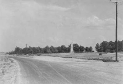
Location. 35° 8.207′ N, 81° 49.086′ W. Marker is near Gaffney, South Carolina, in Cherokee County. Marker can be reached from Chesnee Highway. This Marker is located in Cowpens National Battlefield. Touch for map. Marker is at or near this postal address: 4001 Chesnee Highway, Gaffney SC 29341, United States of America. Touch for directions.
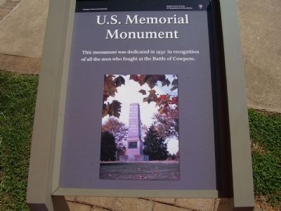
Other nearby markers. At least 10 other markers are within walking distance of this marker. U.S. Memorial Monument (here, next to this marker); The Battle of Cowpens: Prelude to Victory (within shouting distance of this marker); Morgan's Flying Army (about 600 feet away, measured in a direct line); Spirit up the People (about 700 feet away); Race to the Dan River (about 800 feet
away); The Cavalry (Dragoons) at Cowpens (approx. 0.2 miles away); After Victory (approx. ¼ mile away); The Continental Army at Cowpens (approx. 0.3 miles away); Washington Light Infantry Monument (approx. 0.3 miles away); a different marker also named Washington Light Infantry Monument (approx. 0.3 miles away). Touch for a list and map of all markers in Gaffney.
Related markers. Click here for a list of markers that are related to this marker. The Battle of Cowpens virtual tour by markers.
Also see . . .
1. Battle of Cowpens. The Battle of Cowpens, January 17, 1781, took place in the latter part of the Southern Campaign of the American Revolution and of the Revolution itself. (Submitted on October 27, 2008, by Craig Swain of Leesburg, Virginia.)
2. Battle of Cowpens. The Battle of Cowpens (January 17, 1781) was a decisive victory by American Revolutionary forces under Brigadier General Daniel Morgan, in the Southern campaign of the American Revolutionary War. (Submitted on July 5, 2010, by Brian Scott of Anderson, South Carolina.)
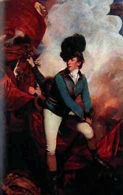
3. Banastre Tarleton. General Sir Banastre Tarleton, 1st Baronet, GCB
(21 August 1754 – 16 January 1833) was a British soldier and politician. (Submitted on July 5, 2010, by Brian Scott of Anderson, South Carolina.)
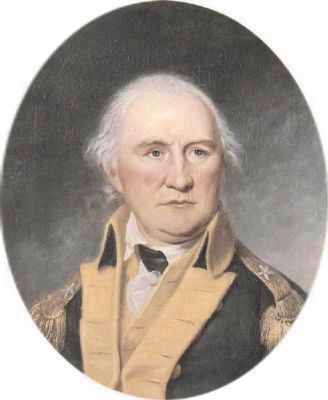
4. Daniel Morgan. Daniel Morgan (1736 – July 6, 1802) was an American pioneer, soldier, and United States Representative from Virginia. (Submitted on July 5, 2010, by Brian Scott of Anderson, South Carolina.)
Photographed By Brian Scott, May 12, 2010
5. Battle of Cowpens Monument
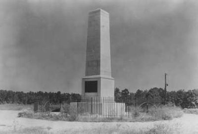
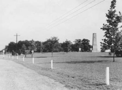
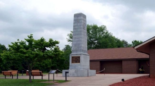
Erected in 1932, the War Department Monument is a granite shaft 32 feet high and 7 feet square. The base of the monument is 11'4" square and is also made of granite. On the north face of the monument at a height of 25 feet there is a seal that is approximately 3 feet in diameter. There are inscriptions on the north and south faces of the monument and commemorative plaques on the east and west faces. (Source: Cowpens National Battlefield National Register Nomination Form.)
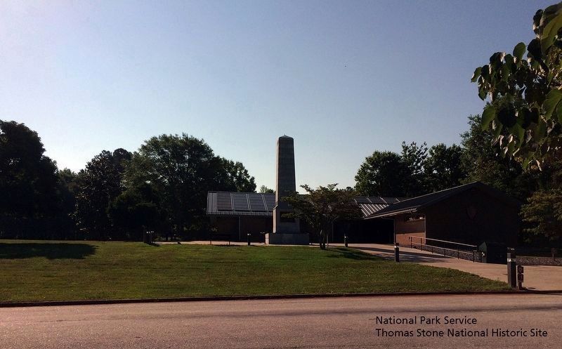
National Park Service, Thomas Stone National Historic Site, May 28, 2019
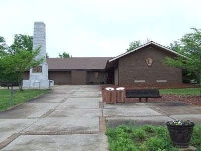
12. Battle of Cowpens Monument and Visitor Center exterior.
Viewing east towards the American Forces side of the Battle of the Cowpens Monument.
The U.S. Memorial Monument marker is partially hidden by the tree on the right side of the Battle of the Cowpens Monument.
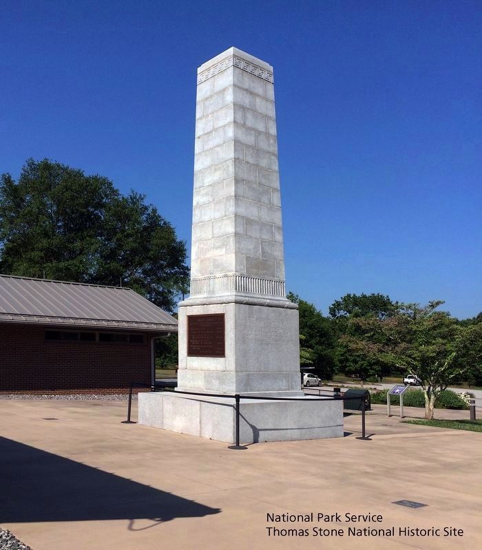
National Park Service, Thomas Stone National Historic Site, May 28, 2019
13. Battle of Cowpens Monument and Visitor Center exterior.
Viewing south towards the British Forces side and the "On This Field" side of the Battle of the Cowpens Monument.
The U.S. Memorial Monument marker is on the right side of the Battle of the Cowpens Monument.
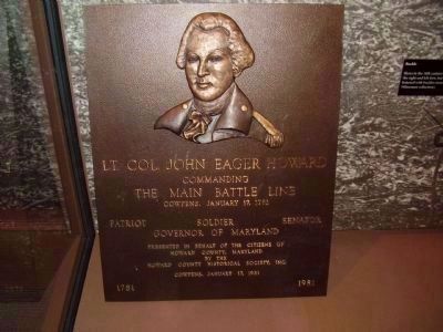
Photographed By Stanley and Terrie Howard
22. Lt. Col. John Eager Howard Marker Inside the Visitors Center
Born to a wealthy Baltimore County family in 1752, he made his name in the American Revolution, gaining recognition for military prowess and courage. This marker reads:
Lt. Col. John Eager Howard
Commanding
The Main Battle Line
Cowpens, January 17, 1781
Patriot Soldier Senator
Governor of Maryland
Presented in behalf of the citizens of Howard County, Maryland by The Howard County Historical Society, Inc. (1981)
Commanding
The Main Battle Line
Cowpens, January 17, 1781
Patriot Soldier Senator
Governor of Maryland
Credits. This page was last revised on November 13, 2020. It was originally submitted on September 7, 2008, by Stanley and Terrie Howard of Greer, South Carolina. This page has been viewed 5,755 times since then and 127 times this year. Photos: 1, 2, 3, 4. submitted on September 7, 2008, by Stanley and Terrie Howard of Greer, South Carolina. 5. submitted on July 5, 2010, by Brian Scott of Anderson, South Carolina. 6. submitted on September 8, 2008, by Stanley and Terrie Howard of Greer, South Carolina. 7. submitted on September 7, 2008, by Stanley and Terrie Howard of Greer, South Carolina. 8. submitted on June 26, 2010, by Brian Scott of Anderson, South Carolina. 9. submitted on January 14, 2012, by Brian Scott of Anderson, South Carolina. 10. submitted on July 5, 2010, by Mike Stroud of Bluffton, South Carolina. 11. submitted on September 7, 2008, by Stanley and Terrie Howard of Greer, South Carolina. 12, 13. submitted on August 29, 2019. 14. submitted on September 7, 2008, by Stanley and Terrie Howard of Greer, South Carolina. 15. submitted on July 5, 2010, by Brian Scott of Anderson, South Carolina. 16. submitted on June 26, 2010, by Brian Scott of Anderson, South Carolina. 17, 18, 19, 20, 21. submitted on May 25, 2011, by Brian Scott of Anderson, South Carolina. 22. submitted on September 7, 2008, by Stanley and Terrie Howard of Greer, South Carolina. 23. submitted on October 28, 2008, by Stanley and Terrie Howard of Greer, South Carolina. • Craig Swain was the editor who published this page.
