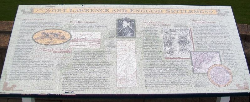
Fort Lawrence and English Settlement
Fort Lawrence
In the 18th century, the Chignecto Isthmus played an important role in the struggle between France and Britain for North American supremacy. In 1713 the Treaty of Utrecht had failed to clearly establish the border of Nova Scotia. To protect French interests west of the Missiquash River and access to the Bay of Fundy, Chevalier de la Corne and 600 men, occupied Chignecto in the winter of 1749-50.
In September 1750, British troops, led by Major Charles Lawrence, answered the French threat with the construction of Fort Lawrence near the original French settlement of Beaubassin, east of the Missiquash. The finished fort was a quadrilateral with four corner bastions, picketed curtains, and a deep fosse. Blockhouses stood in the northwest and the southeast bastions. The Commandant’s house, barracks, guardrooms and stores were all located within the main enclosure. A stables, Fives court, brewery and other dwellings, along with the Commandant’s summer house occupied the southern slope. The battery of guns all faced north.
Although never attacked, Fort Lawrence was a powerful deterrent and served as a launching pad for the eventual siege of Fort Beauséjour. In 1756, after acting as a secure holding area for Acadians waiting to be expelled, it was abandoned. A large granite monument, is the only tangible
reminder of its role in the history of British colonial control of Atlantic Canada.
Fort Beauséjour
Fort Beauséjour is located on a ridge three kilometres northwest of Fort Lawrence. Begun by the French in April 1751, under Joseph Gaspard de Lery it was to be a counter measure to the British fort.
In 1754, William Shirley, Governor of Massachusetts, convinced Governor Lawrence that Beauséjour posed a threat to British interests in New England. Subsequently, on June 16, 1755, a force of over 2,000 New Englanders, commanded by Robert Monckton, laid siege to Beauséjour.
Beauséjour, at the time, was still largely unfinished and undermanned. Moreover, the Acadians refused to help in its defence, claiming that “they did not wish to remain and sacrifice themselves needlessly.” This left a garrison of some 165 men to face a vastly superior force. Nevertheless, Beauséjour occupied a commanding position and was well defended by artillery. A long siege seemed likely.
Monckton pressed his attack from ground overlooking the fort. For ten days the garrison, augmented by a few Indian and Acadian allies, gallantly defended its position. In the end, during an exchange of fire, a shell exploded in a casement killing a French officer, an interpreter, and a British prisoner. Surrender followed. This was to be a turning point in the struggle for supremacy in
The Expulsion of the Acadians
The Acadians, despite a desire not to become embroiled in the Anglo-French power struggle, were eventually drawn into the conflict. The British, now established at the newly named Fort Cumberland, began to question their allegiances. Sworn oaths of loyalty and declarations of Acadian neutrality failed to allay British fears. Moreover, Governor Lawrence strongly believed that the Acadians had supplied the French with “intelligence, Quarters, provisions, and assistance in annoying the Government.” In the eyes of the British authorities they were no longer to be trusted.
The misguided solution put forward by Lawrence and the Nova Scotia magistrates, called for the immediate expulsion of the Acadians. Thus the French supply line would be severed and a source of potential trouble removed. Although the policy was eventually to apply to all Nova Scotian Acadians it was those in Chignecto who were its first victims. On August 11, 1755 the Acadian inhabitants were rounded up and held at Fort Cumberland prior to deportation to other British North American colonies.
In the process of the expulsions many people died of disease and illness and families were separated. Most tragically, a proud and industrious people had been banished from the land
they had called home for over a century.
”Made for Righteousness”
In the wake of the Acadian expulsions, new settlers came to the Chignecto region. Among these were eleven shiploads of Yorkshire immigrants who arrived in the 1770s seeking economic and religious freedom. One of the early arrivals, Charles Dixon, wrote, of the new problems which faced these hardy souls in their adoptive land: “At first glance things wore a gloomy aspect. There were few inhabitants but wanted to sell their lands and go hence.” In due course, however, Dixon was to purchase 2,500 acres (for a sum of £260.) from Daniel Hawkins of Sackville.
Through industry and hard work the Yorkshire settlers prospered. Families, such as Black, Robinson, Oxley and Forster, brought up farms in and around Amherst. Many supplanted earlier New England settlers who, unused to the farming life, had moved on elsewhere. Today, many Chignecto families trace their descent to those Yorkshire settlers.
Immigration into Chignecto continued through the 19th century. Irish immigrants in the 1830s and 40s, however, were the last major group to settle in the region.
[Image captions, from left to right, read]
[Background] Map of the Isthmus of Chignecto illustrating the fortifications in the area.
• View of the British defences of Fort Lawrence
• View of the French encampment of Fort Beauséjour, later to become Fort Cumberland.
• Hon. Robert Monckton, commander of the force that captured Fort Beauséjour in 1755.
• 1751 map of the Chignecto Isthmus, showing Acadian settlement.
• (Background) Fort Lawrence
• Acadian men signed their name or placed their mark below the oath of allegiance. Chignecto 1727.
• Map of what is now the Maritimes and New England.
• This detail, of a circa 1770s map of England, shows the County Yorkshire from which large numbers of immigrants came to settle the Chignecto area after the expulsion of the Acadians.
Topics and series. This historical marker is listed in these topic lists: Agriculture • Colonial Era • Disasters • Forts and Castles. In addition, it is included in the Acadian History series list. A significant historical month for this entry is April 1751.
Location. 45° 51.176′ N, 64° 15.596′ W. Marker is near Fort Lawrence, Nova Scotia, in Cumberland County. Marker is 50 meters NNW of the Nova Scotia Welcome Centre. Touch for map. Marker is at or near this postal address: 90 Cumberland Loop, Fort Lawrence NS B4H 3Y5, Canada. Touch for directions.
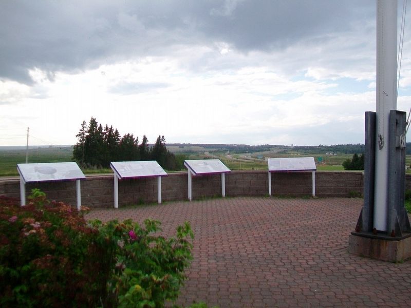
Other nearby markers. At least 8 other markers are within 5 kilometers of this marker, measured as the crow flies. Early Inhabitants (here, next to this marker); Amherst – Modern Period 1800s and 1900s (here, next to this marker); Natural History (here, next to this marker); Beaubassin (within shouting distance of this marker); Un hommage à/A Tribute to Jacob (Jacques) Bourgeois (within shouting distance of this marker); Beaubassin 1672-1750 (about 90 meters away, measured in a direct line); Trans Canada Highway (about 120 meters away in New Brunswick); Jonathan McCully (approx. 4.2 kilometers away). Touch for a list and map of all markers in Fort Lawrence.
More about this marker. The marker is heavily checkered from weathering and is difficult to read.
Also see . . .
1. Fort Lawrence National Historic Site of Canada. (Submitted on January 1, 2018, by William Fischer, Jr. of Scranton, Pennsylvania.)
2. Fort Beauséjour – Fort Cumberland National Historic Site of Canada. (Submitted on January 1, 2018, by William Fischer, Jr. of Scranton, Pennsylvania.)
3. Father Le Loutre's War (1749-1755). (Submitted on January 1, 2018, by William Fischer, Jr. of Scranton, Pennsylvania.)
Credits. This page was last revised on October 12, 2021. It was originally submitted on January 1, 2018, by William Fischer, Jr. of Scranton, Pennsylvania. This page has been viewed 304 times since then and 21 times this year. Photos: 1, 2. submitted on January 1, 2018, by William Fischer, Jr. of Scranton, Pennsylvania.

