The Perpetual Challenge / Le defi perpétuel
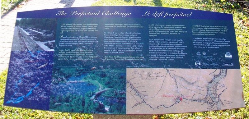
Since the Rideau Canal opened in 1832, water management has been essential to its successful operation. Initially, water concerns focused on maintaining navigation and protecting engineering structures, with the excess water supplied to power mills.
For more than 150 years of canal operation, lumbering, settlement, commercial transport, industry, agriculture, recreation, hydro-electric power generation, tourism and urbanization have had their own effect on water management practices. Today, water management has evolved into a complex science: balancing the needs to ensure water levels, regulate water flow, maintain water quality and protect fish and wildlife.
A team of more than 10 organizations collaborate in the annual cycle of activities. Procedures are dictated by the weather and guided by historic records, a computer simulation model and years of experience. The mechanics include more than 50 dams and weirs, 13 electronic monitoring stations, water level recording at 24 lock stations, snow surveys, water sampling and thousands of hours of surveillance, adjustments and maintenance.
As an UNESCO World Heritage
site, the perpetual challenge of water management and protection extends beyond the Rideau Canal. It is a challenge of shared responsibility to individuals from around the world to value and preserve our natural environment for the future generations.————————————————
Les pratiques de gestion de l'eau utilisées depuis la mise en fonction du canal il y a plus d'un siècle et demi ont été influencées par l'exploitation forestière, le peuplement de la région, le transport commercial, l'industrie, l'agriculture, les loisirs, la production d'hydroélectricité, le tourisme et l'urbanisation. De nos jours, la gestion de l'eau est devenue une science complexe : elle consiste à trouver un équilibre entre les divers besoins afin de maintenir un niveau d'eau suffisant, à régulariser le débit, à préserver la qualité de l'eau ainsi qu'à protéger les poissons et la faune.
Le canal Rideau, désigné site du patrimoine mondial par l'UNESCO, n'est pas le seul endroit où la protection et la gestion de l'eau
• Long Island Lockstation/Post d'eclusage de Long Island
• Sketch of the Rideau Canal by Colonel By / Croquis du canal Rideau par Colonel By
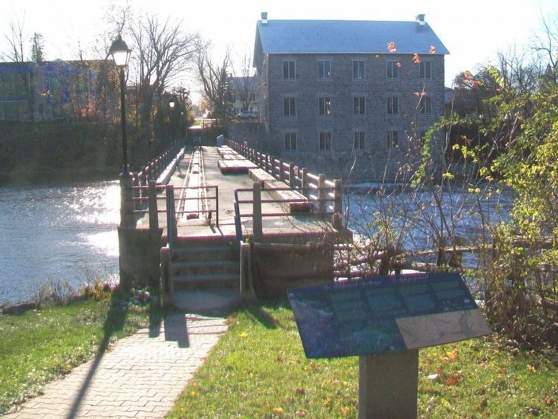
Erected by Watson's Mill Manotick, Inc., Parks Canada, and UNESCO.
Topics. This historical marker is listed in these topic lists: Industry & Commerce • Man-Made Features • Waterways & Vessels. A significant historical year for this entry is 1832.
Location. 45° 13.637′ N, 75° 40.921′ W. Marker is in Ottawa, Ontario. It is in Manotick. Touch for map. Marker is at or near this postal address: 5525 Dickinson Street, Ottawa ON K4M 1A2, Canada. Touch for directions.
Other nearby markers. At least 8 other markers are within walking distance of this marker. A Safety Valve and Power Source (within shouting distance of this marker); The Mill and Manotick / Le moulin et Manotick (within shouting distance of this marker); The Long Island Mill (about 90 meters away, measured in a direct line); Carriage Shed / Hangar à chariots (about 90 meters away); War Memorial Cenotaph (about 90 meters away); A Square for All Time / Un place en permanence
Also see . . .
1. Rideau Canal National Historic Site. (Submitted on January 6, 2018, by William Fischer, Jr. of Scranton, Pennsylvania.)
2. History of the Rideau Canal. (Submitted on January 6, 2018, by William Fischer, Jr. of Scranton, Pennsylvania.)
3. Watson's Mill History. (Submitted on January 6, 2018, by William Fischer, Jr. of Scranton, Pennsylvania.)
Credits. This page was last revised on January 7, 2018. It was originally submitted on January 6, 2018, by William Fischer, Jr. of Scranton, Pennsylvania. This page has been viewed 145 times since then and 6 times this year. Photos: 1, 2. submitted on January 6, 2018, by William Fischer, Jr. of Scranton, Pennsylvania. 3. submitted on November 19, 2017, by William Fischer, Jr. of Scranton, Pennsylvania.


