Cave Junction in Josephine County, Oregon — The American West (Northwest)
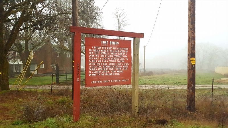
Fort Briggs
Erected by Josephine County Historical Society.
Topics. This historical marker is listed in these topic lists: Forts and Castles • Settlements & Settlers • Wars, US Indian. A significant historical year for this entry is 1854.
Location. 42° 7.961′ N, 123° 36.672′ W. Marker is in Cave Junction, Oregon, in Josephine County. Marker is on Holland Loop Rd, on the right when traveling east. Touch for map. Marker is in this post office area: Cave Junction OR 97523, United States of America. Touch for directions.
Other nearby markers. At least 5 other markers are within 13 miles of this marker, measured as the crow flies. Triple Nickles (approx. 4.1 miles away); Smokejumper Tree (approx. 4.1 miles away); Kerby(ville) 1850's to Present (approx. 4.9 miles away); Oregon Caves National Monument (approx. 10.7 miles away); Fort Hay (approx. 12.4 miles away).
Also see . . . Fort Briggs history . The website contains a photo of the cabin/fort and additional history. (Submitted on January 11, 2018, by Douglass Halvorsen of Klamath Falls, Oregon.)
Additional keywords. Fort Indian settlement cabin Oregon
Credits. This page was last revised on January 14, 2018. It was originally submitted on January 10, 2018, by Douglass Halvorsen of Klamath Falls, Oregon. This page has been viewed 381 times since then and 48 times this year. Photo 1. submitted on January 10, 2018, by Douglass Halvorsen of Klamath Falls, Oregon. • Bill Pfingsten was the editor who published this page.
