Home Sweet Home
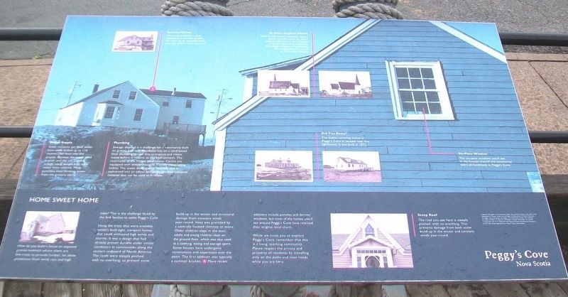
How do you build a house on exposed granite bedrock where there are few trees to provide lumber, let alone protection from wind, rain and high tides? This is the challenge faced by the first families to settle Peggy's Cove.
Using the trees that were available, settlers built tight, compact homes that could withstand high winds and storms. It was design that had already proven durable under similar conditions in communities along the eastern seaboard of North America. The roofs were steeply pitched, with no overhand, to prevent snow build-up in the winter and structural damage from constant winds year-round. Heat was provided by a centrally located chimey or stove. Older children slept in the attic; adults and young children slept on the ground floor, which was also used as a cooking, eating and storage space. Some houses have undergone renovations and expansions over the years. The first addition was typically a summer kitchen.[1] More recent additions include porches and dormer windows, but most of the homes you'll see around Peggy's Cove have retained their original, local charm.
While we invite you to explore Peggy's Cove, remember that this is a living, working community. Please respect the privacy and property of residents by travelling only on the paths and main roads while you are here.
Water Supply
Some
Plumbing
Sewage disposal is a challenge for a community built on granite bedrock. Residents rely on a sand-based filter system that processes and cleans waste before it returns to the environment. The restrooms at the Visitor Information Centre are equipped with environmentally friendly composting toilets. The waste decomposes naturally and is converted into an odour-and-pathogen-free compost material that can be used as fertilizer.
Summer Kitchen
This house presents a clear example of a summer kitchen, seen here as an extension built onto the home's basic structure.
St. John's Anglican Church
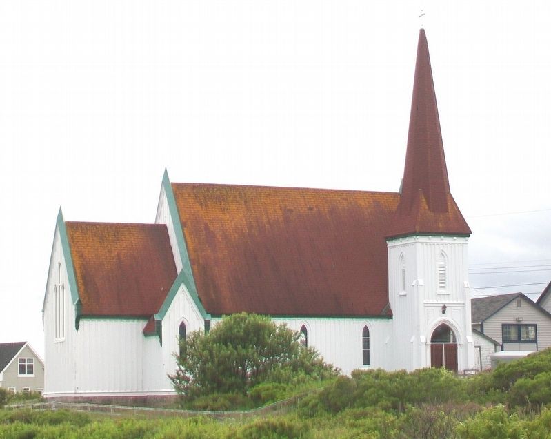
With its tall, arched windows, corner tower and slim spire, St. John's Anglican Church is a fine example of Gothic Revival architecture. The Halifax Regional Municipality has designated this church as a heritage building.
Steep Roof
The roof you see here is steeply pitched, with no overhang. This prevents damage from both snow build-up in the winter and constant winds year-round.
Six-Pane Window
The six-pane windows you'll see in the houses around the community
Did You Know?
The oldest surviving house in Peggy's Cove is located near the lighthouse. It was built in 1812.
Topics. This historical marker is listed in these topic lists: Environment • Man-Made Features • Settlements & Settlers. A significant historical year for this entry is 1812.
Location. 44° 29.638′ N, 63° 54.827′ W. Marker is in Peggy's Cove, Nova Scotia, in Halifax Region. Marker is on Peggy's Point Road, 0.4 kilometers south of Prospect Road (Nova Scotia Route 333), on the left when traveling south. Marker is at the Nova Scotia Provincial Visitor Information Centre. Touch for map. Marker is at or near this postal address: 96 Peggy's Point Road, Peggy's Cove NS B3Z 3S2, Canada. Touch for directions.
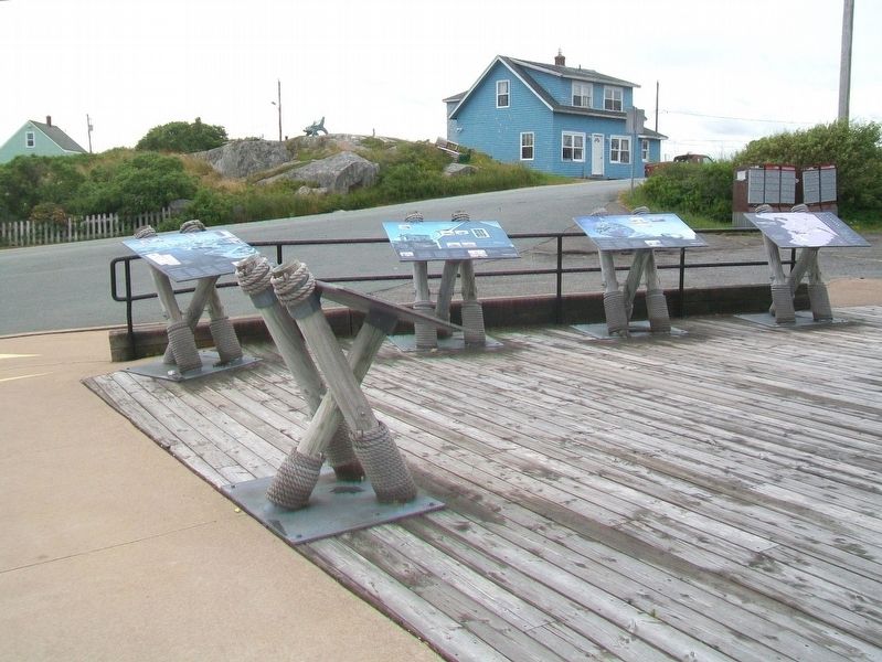
Other nearby markers. At least 8 other markers are within walking distance of this marker. The Cold, Hard Facts About Glaciers (here, next to this marker); The Lure of Peggy's Cove (here, next to this marker); When Continents Collide / Carving A Cove (here, next to this marker); Peggy's Cove (a few steps from this marker); Fishermen's Monument (within shouting distance of this marker); A Monumental Work Of Art (within shouting distance of this marker); The Art of deGarthe (within shouting distance of this marker); A Natural Masterpiece (within shouting distance of this marker). Touch for a list and map of all markers in Peggy's Cove.
Also see . . .
1. The Story of Peggy's Cove. (Submitted on January 13, 2018, by William Fischer, Jr. of Scranton, Pennsylvania.)
2. Peggy's Cove Nova Scotia on YouTube. (Submitted on January 13, 2018, by William Fischer, Jr. of Scranton, Pennsylvania.)
Credits. This page was last revised on January 13, 2018. It was originally submitted on January 13, 2018, by William Fischer, Jr. of Scranton, Pennsylvania. This page has been viewed 267 times since then and 15 times this year. Photos: 1. submitted on January 13, 2018, by William Fischer, Jr. of Scranton, Pennsylvania. 2. submitted on January 12, 2018, by William Fischer, Jr. of Scranton, Pennsylvania. 3. submitted on January 13, 2018, by William Fischer, Jr. of Scranton, Pennsylvania.


