Adams Morgan in Northwest Washington in Washington, District of Columbia — The American Northeast (Mid-Atlantic)
Archaeology in Adams Morgan
Surveying the Cemeteries in Walter Pierce Park, 2005-2013
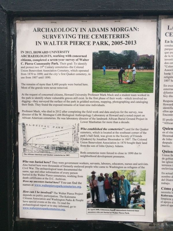
In 2013, Howard University archaeologists, working with concerned citizens, completed a seven-year survey of Walter C. Pierce Community Park. Their goal: to identify and protect two 19th Century cemeteries--the Colored Union Benevolent Association Cemetery, which operated from 1870 to 1890; and the city's first Quaker cemetery, in use from 1807 until 1890.
The remains of more than 8,400 people were buried here. Most of the graves were never removed.
At the request of concerned citizens, Howard University Professor Mark Mack and a student team worked in the park to identify where vulnerable graves still exist. In the first phase of their work—which involved no digging—they surveyed the surface of the park in gridded sections, mapping, photographing and cataloging their finds. They found the exposed remains of at least nine individuals.
Professor Mack, who died in 2012 after completing the field work and data analysis for the survey, was director of the W. Montague Cobb Biological Anthropology Laboratory at Howard and a noted expert on African American cemeteries. He was laboratory director of the landmark African Burial Ground Project in Lower Manhattan for more than a decade.
Who established the cemeteries? Land for the Quaker cemetery, which is located at the southeast corner of the park's ball field, was given to the Society of Friends (Quakers) by Jonathan Shoemaker in 1807. The Colored Union Benevolent Association in 1870 bought their land from the son of John Quincy Adams.
Both cemeteries were forced to close in 1890 due to neighborhood development pressures.
Who was buried here? They were government workers, servants, laborers, educators, nurses and activists. Also buried here were thousands of formerly enslaved people who came to Washington as refugees of the Civil War. The archaeological team documented the name, age and other information of every person buried in the Walter Pierce cemeteries, working from death certificates at the D.C. Archives.
Were my ancestors buried here? You can find the names at www.walterpierceparkcemeteries.org.
How can I be involved? The Walter Pierce Project depends on public participation. The Kalorama Citizens Association and Washington Parks & People have special events at the site. To read the archaeological report or to stay informed, go to www.walterpierceparkcemeteries.org.
Captions:
The African

Photographed By Devry Becker Jones (CC0), January 13, 2018
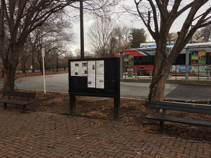
2. Archaeology in Adams Morgan Marker in Spanish
In April 2008, Edmonson family descendants honored their ancestors who are buried at Walter Pierce Park.
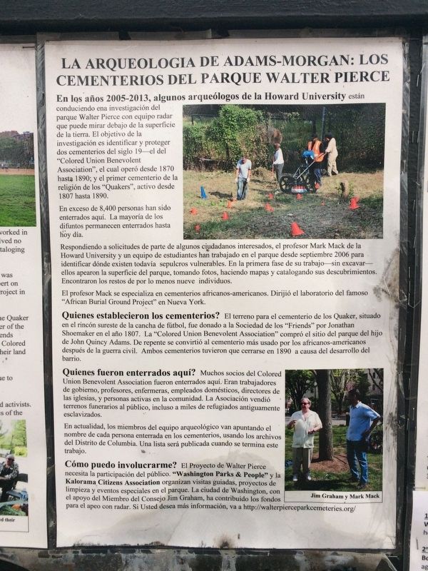
La Arqueologia de Adams-Morgan: los Cementerios del Parque Walter Pierce
En los años 2005-2013, algunos arqueólogos de la Howard University están conduciendo una investigación del parque Walter Pierce con equipo radar que puede mirar debajo de la superficie de la tierra. El objetivo de la investigación es identificar y proteger dos cementerios del siglo 19--el del “Colored Union Benevolent Association", el cual operó desde 1870 hasta 1890; y el primer cementerio de la religión de los "Quakers", activo desde 1807 hasta 1890.
En exceso de 8,400 personas han sido enterrados aquí. La mayoría de los difuntos permanecen enterrados hasta hoy día.
Respondiendo a solicitudes de parte de algunos ciudadanos interesados, el profesor Mark Mack de la Howard University y un equipo de estudiantes han trabajado en el parque desde septiembre 2006 para identificar dónde existen todavía sepulcros vulnerables. En la primera fase de su trabajo - sin excavar - ellos apearon la superficie del parque, tomando fotos, haciendo mapas y catalogando sus descubrimientos. Encontraron los restos de por lo menos nueve individuos.
El profesor Mack se especializa en cementerios
Quienes establecieron los cementerios?
El terreno para el cementerio de los Quaker, situado en el rincón sureste de la cancha de fútbol, fue donado a la Sociedad de los "Friends" por Jonathan Shoemaker en el año 1807. La "Colored Union Benevolent Association" compró el sitio del parque del hijo de John Quincy Adams. De repente se convirtió al cementerio más usado por los africanos-americanos después de la guerra civil. Ambos cementerios tuvieron que cerrarse en 1890 a causa del desarrollo del barrio.
Quienes fueron enterrados aquí?
Muchos socios del Colored Union Benevolent Association fueron enterrados aquí. Eran trabajadores de gobierno, profesores, enfermeras, empleados domésticos, directores de las iglesias, y personas activas en la comunidad. La Asociación vendió terrenos funerarios al público, incluso a miles de refugiados antiguamente esclavizados.
En actualidad, los miembros del equipo arqueológico van apuntando el nombre de cada persona enterrada en los cementerios, usando los archivos del Distrito de Columbia. Una lista será publicada cuando se termina este trabajo.
Cómo puedo involucrarme?
El Proyecto de Walter Pierce necesita la participación del público. "Washington Parks & People" y la Kalorama Citizens Association organizan visitas guiadas, proyectos de limpieza y eventos especiales en el parque. La ciudad de Washington, con el apoyo del Miembro del Consejo Jim Graham, ha contribuido los fondos para el apeo con radar. Si Usted desea más información, va a http://walterpierceparkcemeteries.org/
Pie de dibujo: Jim Graham y Mark Mack
Topics and series. This historical marker is listed in these topic lists: African Americans • Cemeteries & Burial Sites • Churches & Religion • War, US Civil. In addition, it is included in the Historically Black Colleges and Universities, and the Quakerism series lists. A significant historical year for this entry is 1807.
Location. This marker has been replaced by another marker nearby. It was located near 38° 55.406′ N, 77° 2.837′ W. Marker was in Northwest Washington in Washington, District of Columbia. It was in Adams Morgan. Marker was at the intersection of Calvert Street Northwest and Biltmore Street Northwest, on the left when traveling east on Calvert Street Northwest. On the grounds at Walter Pierce Park. Touch for map. Marker was at or near this postal address: 1957 Calvert Street Northwest, Washington DC 20009, United States of America. Touch for directions.
Other nearby markers. At least 8 other markers are within walking distance of this location. Archaeology in Adams Morgan: Surveying the Walter Pierce Park Cemeteries, 2005-2013 (a few steps from this marker); Seeking Freedom (a few steps from this marker); Resilience and Resistance (a few steps from this marker); The ›Duke‹ Ellington Memorial Bridge (a few steps from this marker); Soldiers, Sailors, and Refugees of War (a few steps from this marker); Rediscovery and Remembrance (within shouting distance of this marker); Historic Cemetery (about 400 feet away, measured in a direct line); Walter Pierce Park (approx. 0.2 miles away). Touch for a list and map of all markers in Northwest Washington.
Related marker. Click here for another marker that is related to this marker. This marker has been replaced with the linked marker.
Credits. This page was last revised on November 25, 2023. It was originally submitted on January 13, 2018, by Devry Becker Jones of Washington, District of Columbia. This page has been viewed 243 times since then and 8 times this year. Photos: 1, 2, 3. submitted on January 13, 2018, by Devry Becker Jones of Washington, District of Columbia. • Bill Pfingsten was the editor who published this page.

