Sioux Falls in Minnehaha County, South Dakota — The American Midwest (Upper Plains)
The Promise of Electricity
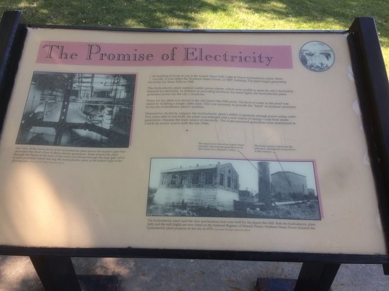
This view of the lower level of the Hydroelectric plant shows the massive pipes that channeled the river's flow to three electric generators. Water entered the plant through the flume at the back of the room and flowed through the large gate valves at each generator before leaving the hydroelectric plant, at the bottom right of the photograph.
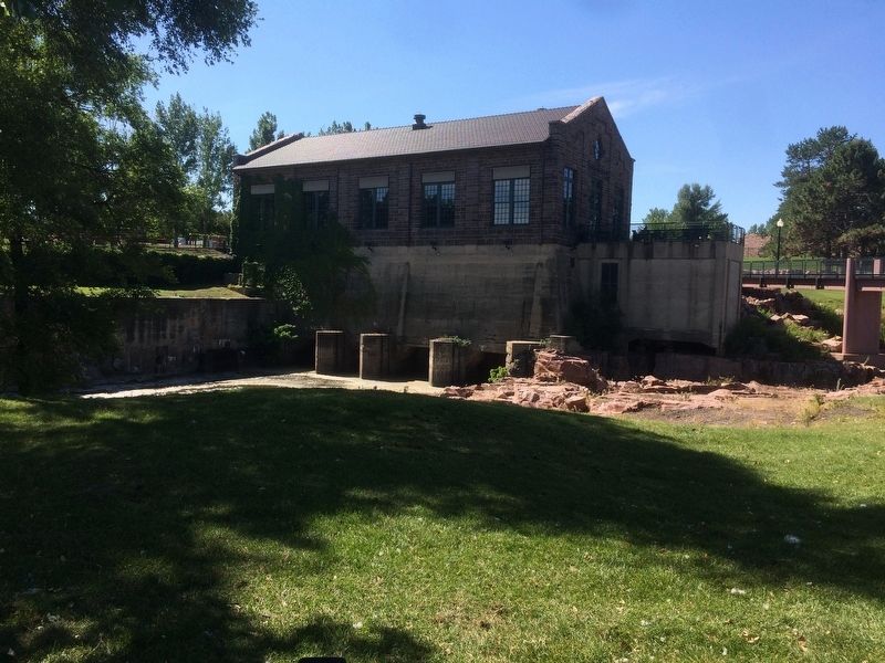
The building in front of you is the former Sioux Falls Light & Power hydroelectric plant. More recently, it was called the Northern States Power, or NSP, building. The plant began generating electricity for Sioux Falls in 1908.
This hydroelectric plant replaced earlier power plants, which were unable to meet the city's increasing demand for electricity. In addition to providing electricity for street lights, the hydroelectric plant generated power for the city's streetcars.
Water for the plant was stored in the old Queen Bee Mill pond. The level of water in the pond was raised by building a longer, taller dam. This was necessary to provide the "head" or pressure necessary to run the hydroelectric plant's turbines.
Demand for electricity out grew the hydroelectric plant's ability to generate enough power using water. Five years after it was built, the plant was enlarged and a new source of energy - coal fired steam generators- became the main source of electricity. The water powered generators were maintained as a back-up power source until the late 1940s.
The hydroelectric plant used the dam and headrace that were built for the Queen Bee Mill. Both the hydroelectric plant left) and the mill (right) are now listed on the National Register of Historic Places. Northern States Power donated the hydroelectric plant property to the city in 1974.
The surge tower served as a giant shock absorber, allowing the generators to be shut down in a moment's notice.
The flume carried water from the mill pond, through the surge tower, to the turbines.
Topics. This historical marker is listed in these topic lists: Industry & Commerce • Settlements & Settlers • Waterways & Vessels. A significant historical year for this entry is 1908.
Location. 43° 33.459′ N, 96° 43.311′ W. Marker is in Sioux Falls, South Dakota, in Minnehaha County. Marker is on North Weber Avenue. Marker is located in Falls Park. Touch for map. Marker is in this post office area: Sioux Falls SD 57104, United States of America. Touch for directions.
Other nearby markers. At least 8 other markers are within walking distance of this marker. Monarch of the Plains (a few steps from this marker); Falls Park Bridge (within shouting distance of this marker); In the Name of Progress (within shouting distance of this marker); Artisans at the Falls (within shouting distance of this marker); Legacy of Ice and Rock (about 400 feet away, measured in a direct line); Hazel O'Connor (about 400 feet away); Human Timeline (about 400 feet away); Prison Quarry (about 500 feet away). Touch for a list and map of all markers in Sioux Falls.
Credits. This page was last revised on January 17, 2018. It was originally submitted on January 14, 2018, by Ruth VanSteenwyk of Aberdeen, South Dakota. This page has been viewed 298 times since then and 13 times this year. Photos: 1, 2, 3. submitted on January 14, 2018, by Ruth VanSteenwyk of Aberdeen, South Dakota. • Bill Pfingsten was the editor who published this page.


