Southwest Federal Center in Southwest Washington in Washington, District of Columbia — The American Northeast (Mid-Atlantic)
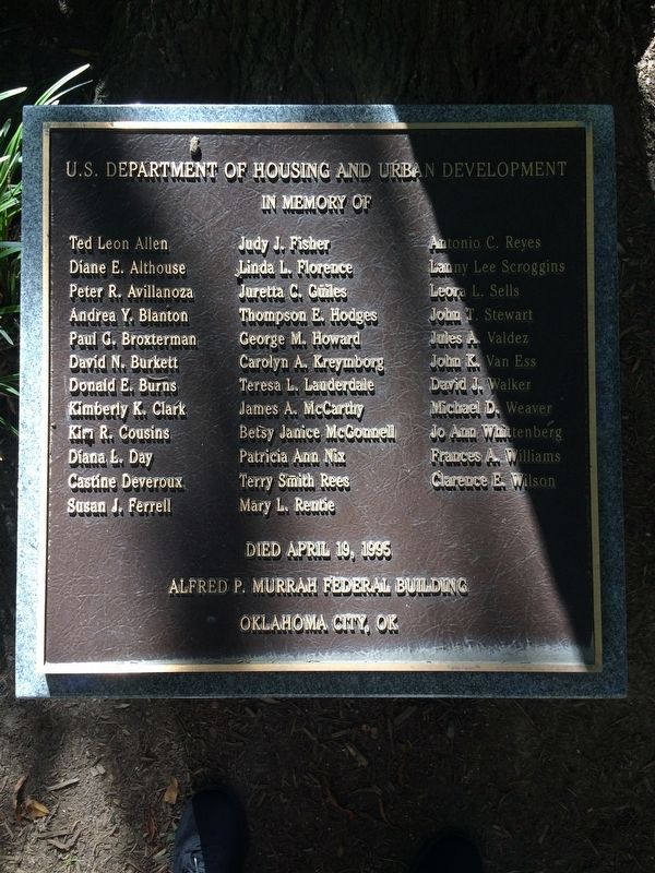
U.S. Department of Housing and Urban Development Oklahoma City Bombing Memorial

Photographed By Devry Becker Jones (CC0), October 20, 2017
1. U.S. Department of Housing and Urban Development Marker
Alfred P. Murrah Federal Building
Oklahoma City, OK
Erected by U.S. Department of Housing and Urban Development.
Topics. This historical marker and memorial is listed in these topic lists: Disasters • Government & Politics. A significant historical date for this entry is April 19, 1995.
Location. 38° 53.049′ N, 77° 1.394′ W. Marker is in Southwest Washington in Washington, District of Columbia. It is in Southwest Federal Center. Marker is on D Street Southwest west of 7th Street Southwest, on the right when traveling east. Touch for map. Marker is at or near this postal address: 451 7th Street Southwest, Washington DC 20024, United States of America. Touch for directions.
Other nearby markers. At least 8 other markers are within walking distance of this marker. Memorial Tree Planting (a few steps from this marker); The Oklahoma City Bombing (about 500 feet away, measured in a direct line); St. Dominic Church: Community Anchor (about 600 feet away); 9/11 Memorial (about 600 feet away); The 3 kW photovoltaic (PV) system (approx. 0.2 miles away); Equality in Public Education (approx. 0.2 miles away); Banneker Circle: Vista to the Past (approx. 0.2 miles away); Benjamin Banneker Park (approx. 0.2 miles away). Touch for a list and map of all markers in Southwest Washington.

Photographed By Devry Becker Jones (CC0), October 20, 2017
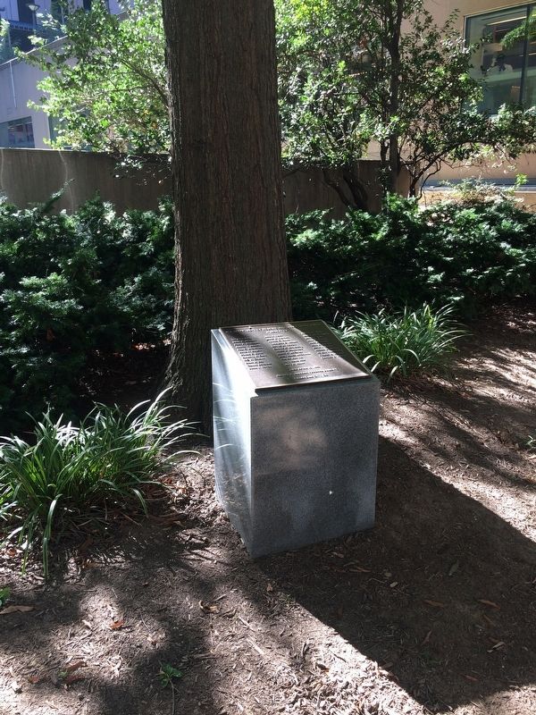
2. U.S. Department of Housing and Urban Development Marker
Credits. This page was last revised on November 4, 2023. It was originally submitted on October 20, 2017, by Devry Becker Jones of Washington, District of Columbia. This page has been viewed 296 times since then and 11 times this year. Last updated on January 23, 2018, by Devry Becker Jones of Washington, District of Columbia. Photos: 1, 2. submitted on October 20, 2017, by Devry Becker Jones of Washington, District of Columbia. • Bill Pfingsten was the editor who published this page.