Crescent City in Del Norte County, California — The American West (Pacific Coastal)
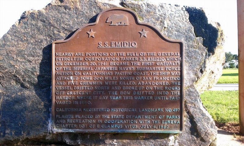
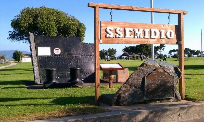
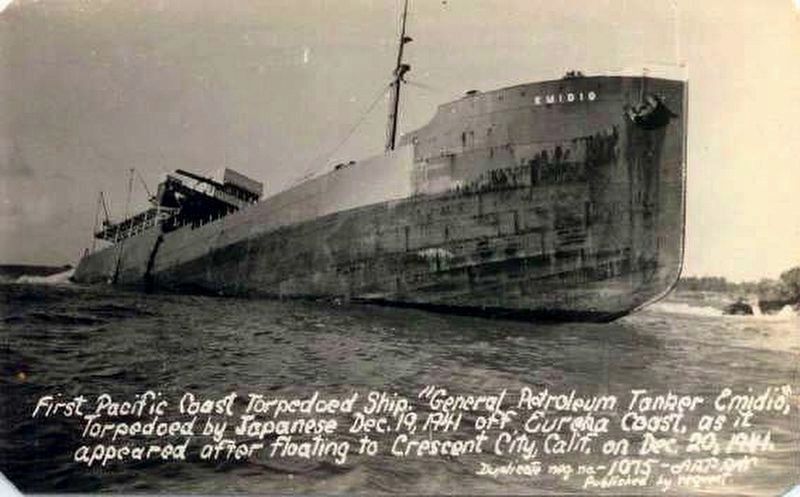
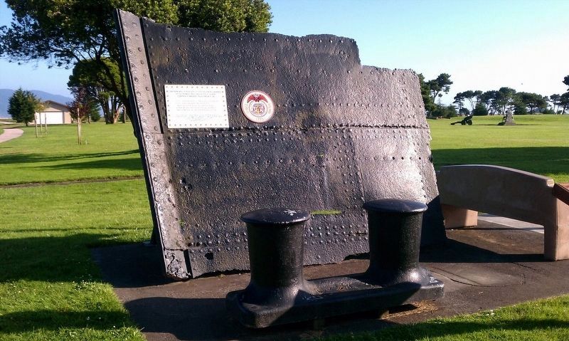
S.S. Emidio
Erected 1982 by State Department of Parks and Recreation and Eureka Chapter 101 E Clampus Vitus. (Marker Number 497.)
Topics and series. This memorial is listed in these topic lists: War, World II • Waterways & Vessels. In addition, it is included in the California Historical Landmarks, and the E Clampus Vitus series lists. A significant historical date for this entry is December 20, 1941.
Location. 41° 45.035′ N, 124° 11.794′ W. Marker is in Crescent City, California, in Del Norte County. Memorial is at the intersection of Front Street and Stamps Way, on the left when traveling south on Front Street. Touch for map. Marker is in this post office area: Crescent City CA 95531, United States of America. Touch for directions.
Other nearby markers. At least 8 other markers are within walking distance of this marker. Remembering Billy Boone (within shouting distance of this marker); Tsunami ! (about 800 feet away, measured in a direct line); Tsunamis are Synonymous With Crescent City (approx. 0.2 miles away); Redwood National Park (approx. 0.2 miles away); Crescent City Tsunami, 1964 (approx. 0.2 miles away); Dedication to Henry Sause, Jr. (approx. ¼ mile away); Tetrapod (approx. 0.3 miles away); Battery Point Lighthouse (approx. 0.6 miles away). Touch for a list and map of all markers in Crescent City.
More about this marker. Markers and memorial are located in Beach Front Park.
Also see . . . Military Museum. A detailed account of the attack on SS Emidio (Submitted on January 24, 2018, by Douglass Halvorsen of Klamath Falls, Oregon.)
Photographed By Douglass Halvorsen, September 2, 2012
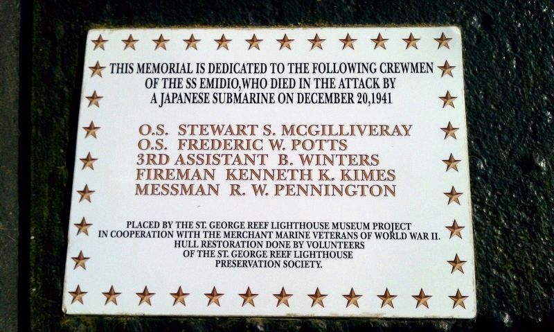
6. S.S. Emidio memorial plaque
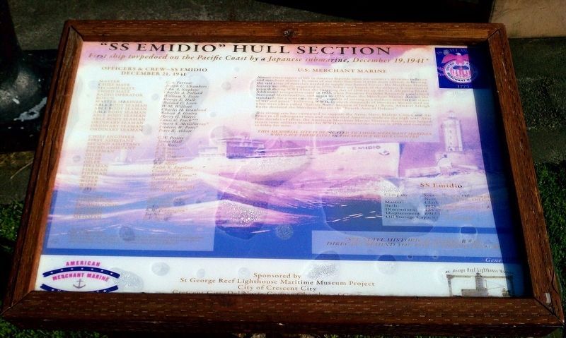
This memorial is dedicated to the following crewmen of the SS Emidio, who died in the attack by a Japanese Submarine on December 20, 1941
O.S. Stewart S. McGilliveray
O.S. Frederic W. Potts
3rd Assistant B. Winters
Fireman Kenneth K. Kimes
Messman R. W. Pennington
Placed by the St. George Reef Lighthouse Museum Project in cooperation with the Merchant Marine Veterans of World War II. Hull restoration done by volunteers of the St. George Reef Lighthouse Preservation Society.
Credits. This page was last revised on December 11, 2019. It was originally submitted on January 24, 2018, by Douglass Halvorsen of Klamath Falls, Oregon. This page has been viewed 515 times since then and 35 times this year. Last updated on December 11, 2019, by Craig Baker of Sylmar, California. Photos: 1, 2, 3, 4, 5, 6. submitted on January 24, 2018, by Douglass Halvorsen of Klamath Falls, Oregon. • J. Makali Bruton was the editor who published this page.
