Mobridge in Corson County, South Dakota — The American Midwest (Upper Plains)
Native American Scenic Byway
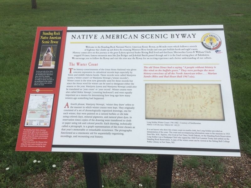
Welcome to the Standing Rock National Native American Scenic Byway, an 86 mile route which follows a stretch of highway that climbs up and down the stunning Missouri River breaks and runs past buffalo herds and eagle's nests. History comes alive on this journey as the great Lakota spiritual leader Sitting Bull lived and died here; Meriwether Lewis & William Clark stopped 14 times, famous mountain men like Jim Bridger and Jedediah Smith passed through and it is the final resting place of Sakakawea. We encourage you to follow the Byway and visit the sites near the Byway for an exciting experience and a better understanding of our culture.
The Winter Count
The history-consciousness of the Great Sioux Nation was given concrete expression in calendrical records kept especially by Teton and middle Dakota bands. These records were called Waniyetu iyawa ('winter count') or Waniyetu Wowapi ('winter records'). Winter count is the term now generally used for these records but since the Sioux word for winter can be used to designate either the season or the year. Waniyetu Iyawa and Waniyetu Wowapi could also be translated as 'year count' or 'year record'. Winter counts were also called Hekta Yawapi ('counting backward') and were equally important as a means for determining how long ago-how many winters ago-something had happened.
A fourth phrase, Waniyety Wowapi, 'winter they draw' refers to the manner in which winter counts were kept. They originally consisted of a set of chronologically organized drawings, one for each winter, that were painted on a tanned buffalo or elk hide using colored clays, mineral pigments, and natural plant dyes. In reservation times copies of the drawing were transferred to cloth or paper using ink and colored pencils. Each drawing, technically called a pictograph, is a graph representation of the event chosen as that year's memorable or remarkable occurrence. The pictographs functioned as a mnemonic aid for sequentially organizing, recordings, and recounting oral history.
The old Teton Sioux had a saying "A people without history is like wind on the buffalo grass. "They were perhaps the most history-conscious of all the North American tribes . . . Marian Sando (Bliss and Bad Heart Bull 1967:xix).
Long Soldier Winter Count 1798-1902 - Courtesy of Smithsonian NMAI 11/6720; test: NmAI OC 142.23
It is not known who drew this winter count on muslin cloth, but Long Soldier provided and interpretation of the years. The count and accompanying information came to the museum in 1923 from Mrs. M.K. Squires, who lived at Fort Yates, North Dakota, on the Standing Rock Reservation. Long Soldier was a Hunkpapa Chief who signed the 1868 Fort Laramie Treaty and settled on the Standing Rock Reservation. A copy of the winter count can be viewed at the Sitting Bull College Public Library in Fort Yates, ND.
Standing Rock Native American Scenic Byway
On the east side of Fort Yates, overlooking Oahe Reservoir, is the Standing Rock Monument from which the Standing Rock Agency derived its name. According to legend, the stone is the petrification of the Arikara wife of a Dakota man with her child on her back.
The Standing Rock Native American Scenic Byway offers access to authentic history and culture of the Lakota/Dakota people, along with casino entertainment, great food and lodging, and uncrowded outdoor recreation.
Grand vistas present the Missouri River along the same routes traveled by Lewis and Clark, Sakakawea, and Sitting Bull.
Topics. This historical marker is listed in this topic list: Native Americans. A significant historical year for this entry is 1967.
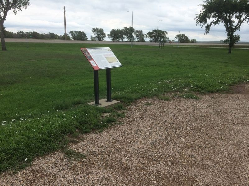
Location. 45° 34.4′ N, 100° 29.178′ W. Marker is in Mobridge, South Dakota, in Corson County. Marker is at the intersection of U.S. 12 and State Highway 1906 on U.S. 12. This marker is located in a roadside park on an island in the Missouri River at the Hwy 12 western approach to the Mobridge Bridge. Touch for map. Marker is in this post office area: Mobridge SD 57601, United States of America. Touch for directions.
Other nearby markers. At least 8 other markers are within 3 miles of this marker , measured as the crow flies. The Arikara People (a few steps from this marker); Leavenworth Battle (a few steps from this marker); The Fur Trade (within shouting distance of this marker); Jedediah Smith (within shouting distance of this marker); "MO.Bridge" (approx. 2.1 miles away); History Beneath the Waters (approx. 2.1 miles away); Ensign Nathaniel Pryor (approx. 2.3 miles away); Lewis & Clark (approx. 2.3 miles away). Touch for a list and map of all markers in Mobridge.
Credits. This page was last revised on January 27, 2018. It was originally submitted on January 25, 2018, by Ruth VanSteenwyk of Aberdeen, South Dakota. This page has been viewed 245 times since then and 31 times this year. Photos: 1, 2. submitted on January 25, 2018, by Ruth VanSteenwyk of Aberdeen, South Dakota. • Andrew Ruppenstein was the editor who published this page.

