Central Business District in Sacramento in Sacramento County, California — The American West (Pacific Coastal)
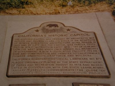
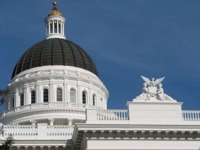
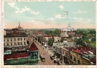
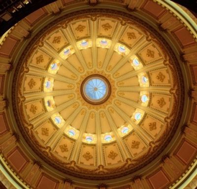
California’s Historic Capitol
Erected 1977 by State Dept of Parks & Recreation (1974), California State Legilature (1982), California Bicentennial Project. (Marker Number 872.)
Topics and series. This historical marker is listed in these topic lists: Landmarks • Notable Buildings. In addition, it is included in the California Historical Landmarks series list. A significant historical year for this entry is 1860.
Location. 38° 34.62′ N, 121° 29.694′ W. Marker is in Sacramento, California, in Sacramento County. It is in the Central Business District. Marker is at the intersection of 10th Street and Capitol Mall, on the right when traveling north on 10th Street. Marker is embedded in sidewalk in front of Capitol Building entrance. Touch for map. Marker is at or near this postal address: 10th Street, Sacramento CA 95814, United States of America. Touch for directions.
Other nearby markers. At least 8 other markers are within walking distance of this marker. California State Capitol Park (a few steps from this marker); The California Peace Officers Memorial (a few steps from this marker); California Mexican-American War Memorial (within shouting distance of this marker); Jesse M. Unruh State Office Building (within shouting distance of this marker); California State Capitol (about 300 feet away, measured in a direct line); First Sacramento High School (about 400 feet away); Sisters of Mercy (about 600 feet away); a different marker also named Sisters of Mercy (about 600 feet away). Touch for a list and map of all markers in Sacramento.
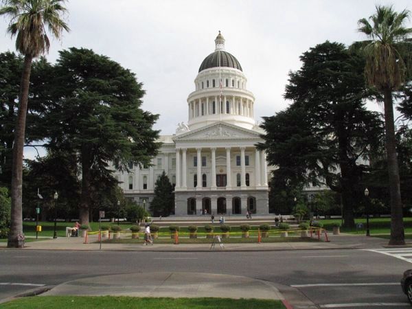
Regarding California’s Historic Capitol. Construction ended before the exterior stairs were built, and now the entrance is on a lower level behind where the stairs would be — See photo 2.
This is California Historical Landmark No. 872.
December 31, 2010
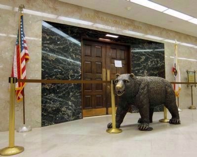
7. California’s Capitol - Entrance to the Governor's Office
This photo shows the entrance to the Governor's Office in the last days of the Schwarzenegger administration, with his name still above the entrance. His name has since been removed. (Schwarzenegger had the bronze bear installed in the spring of 2009. It stayed.)
Credits. This page was last revised on February 7, 2023. It was originally submitted on November 29, 2007. This page has been viewed 1,818 times since then and 28 times this year. Last updated on August 7, 2020, by Craig Baker of Sylmar, California. Photos: 1, 2. submitted on November 29, 2007, by Mathew H. Kohnen of San Jose, California. 3, 4, 5. submitted on December 29, 2008, by Syd Whittle of Mesa, Arizona. 6. submitted on September 10, 2008, by Syd Whittle of Mesa, Arizona. 7. submitted on February 28, 2011. 8. submitted on April 1, 2014. • J. Makali Bruton was the editor who published this page.
