Near Buena Vista in Marion County, Georgia — The American South (South Atlantic)
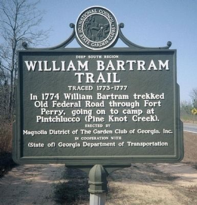
William Bartram Trail
Traced 1773-1777
— Deep South Region —
Erected by Magnolia District of the Garden Club of Georgia, Inc. in cooperation with (State of) Georgia Department of Transportation.
Topics and series. This historical marker is listed in these topic lists: Colonial Era • Environment • Exploration • Forts and Castles • Horticulture & Forestry • Roads & Vehicles • Settlements & Settlers • Waterways & Vessels. In addition, it is included in the William Bartram Trails series list. A significant historical year for this entry is 1774.
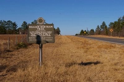
Location. 32° 28.54′ N, 84° 32.608′ W. Marker is near Buena Vista, Georgia, in Marion County. Marker is at the intersection of State Highway 41 and County Route 56, on the left when traveling north on State Highway 41. Marker is 0.2 miles south of Fort Perry Road. Touch for map. Marker is in this post office area: Buena Vista GA 31803, United States of America. Touch for directions.
Other nearby markers. At least 8 other markers are within 14 miles of this marker, measured as the crow flies. Old Federal Road (approx. 0.2 miles away); Fort Perry (approx. 0.2 miles away); Old Courthouse – 1848 (approx. 8.9 miles away); New Courthouse - 1850 (approx. 11 miles away); Private First Class Luther H. Story (approx. 11 miles away); Talbotton United Methodist Church (approx. 13.7 miles away); a different marker also named William Bartram Trail (approx. 13.8 miles away); Zion Episcopal Church (approx. 13.8 miles away). Touch for a list and map of all markers in Buena Vista.
Credits. This page was last revised on November 16, 2019. It was originally submitted on September 12, 2008, by David Seibert of Sandy Springs, Georgia. This page has been viewed 2,575 times since then and 21 times this year. Photos: 1. submitted on September 12, 2008, by David Seibert of Sandy Springs, Georgia. 2. submitted on February 7, 2010, by David Seibert of Sandy Springs, Georgia. • Kevin W. was the editor who published this page.

