Manteo in Dare County, North Carolina — The American South (South Atlantic)
Battle of Roanoke Island
Inscription.
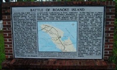
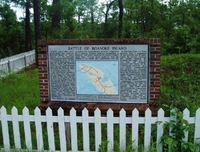
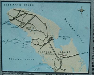
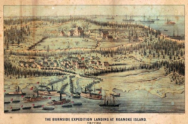
At 3 P.M. February 7, 1862, Union forces under Gen. Ambrose Burnside landed at Ashby Harbor (A). By midnight 7,500 Federals were ashore. A Confederate force of 400 men and 3 field-pieces was sent to resist the Federal landing. The Confederates were driven away by gunfire from the Federal fleet in Croatan Sound (B).
The Confederates withdrew north along the only road on the island (C), situated a little to the west of the present State Highway 345 (D), across which a line of breastworks had been constructed at Point E to delay the Federal advance. The Confederates relied on the swamps (F) on each side of the road to protect their flanks. The Confederate right (G) and left (H) flanks were protected by skirmishers.
The Federal 1st Brigade assaulted the Confederates in front, supported by 6 cannon. Federal infantry attempted to advance, but were repulsed by heavy Confederate fire. Troops were ordered into the swamp (F) to crush the Confederate left (H).
At this time Gen. J. L. Reno arrived with four regiments of the Federal 2nd Brigade, which he moved through the swamp against the Confederate right (G). By the time the Federals reached both flanks of the Confederate position, Gen. J. G. Parke, commanding the Federal 3rd Brigade, arrived and made an attack upon the Confederate front. Under pressure from three sides, the Confederates withdrew to the northern end of the island (I).
Additional Confederate forces arrived in time to become involved in the retreat. One hour later the Confederate commander surrendered his entire force, 2,488 men, to Gen. Burnside. Roanoke Island was lost--and with it Confederate control of the North Carolina Sound region.
CONFEDERATE TROOPS ENGAGED: Company B, 8th and Companies B, F, and E, 31st North Carolina Regiments; Companies E and K, 59th, two companies of the 46th, and one company of the 49th Virginia Regiment.
FEDERAL TROOPS ENGAGED: 21st, 23rd, 25th, and 27th Massachusetts Regiments; 9th and 51st New York Regiments; 9th New Jersey Regiment; 10th Connecticut Regiment.
Total number of troops engaged: Federal: over 5,000; Confederate: 400. (Marker Number BB-4.)
Topics and series. This historical marker is listed in this topic list: War, US Civil. In addition, it is included in the North Carolina Division of Archives and History series list. A significant historical month for this entry is February 1846.
Location. 35° 53.365′ N, 75° 39.629′ W. Marker is in Manteo, North Carolina, in Dare County. Marker is on Mills Landing Road (State Highway 345), on the left when traveling south. NC 345 south of junction with US 64/264. Touch for map. Marker is in this post office area: Manteo NC 27954, United States of America. Touch for directions.
Other nearby markers. At least 8 other markers are within 2 miles of this marker, measured as the crow flies. Andrew Cartwright (about 500 feet away, measured in a direct line); Burnside Expedition of 1862 (approx. half a mile away); Bowser Family Cemetery (approx. half a mile away); Red Wolf Country (approx. half a mile away); Confederate Channel Obstructions (approx. 1.4 miles away); Fort Bartow (approx. 1.4 miles away); Spirit of Roanoke Island (approx. 1.4 miles away); Roanoke Marshes Lighthouse (approx. 1.4 miles away). Touch for a list and map of all markers in Manteo.
Regarding Battle of Roanoke Island. Although it was one of the largest battles in North Carolina, no traces remain of the struggle. Time, weather, and development have erased the scars of war.
Also see . . .
1. The Battle of Roanoke Island. History of War entry:
As part of the opening moves in the war, the victory at Roanoke Island opened many options for the Federal Army. (Submitted on September 13, 2008, by Craig Swain of Leesburg, Virginia.)
2. The Civil War on Roanoke Island. National Park Service, Fort Raleigh National Historic Site entry (Submitted on February 15, 2021, by Larry Gertner of New York, New York.)
Credits. This page was last revised on February 15, 2021. It was originally submitted on September 12, 2008, by M. L. 'Mitch' Gambrell of Taylors, South Carolina. This page has been viewed 3,521 times since then and 125 times this year. Photos: 1, 2. submitted on September 12, 2008, by M. L. 'Mitch' Gambrell of Taylors, South Carolina. 3. submitted on June 16, 2010, by Paul Jordan of Burlington, N. C., U. S. A.. 4. submitted on February 15, 2021, by Larry Gertner of New York, New York. • Craig Swain was the editor who published this page.


