Newport in Lincoln County, Oregon — The American West (Northwest)
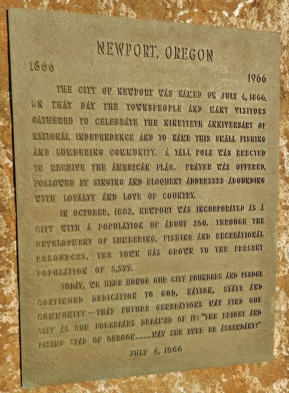
Newport, Oregon
1866 – 1966
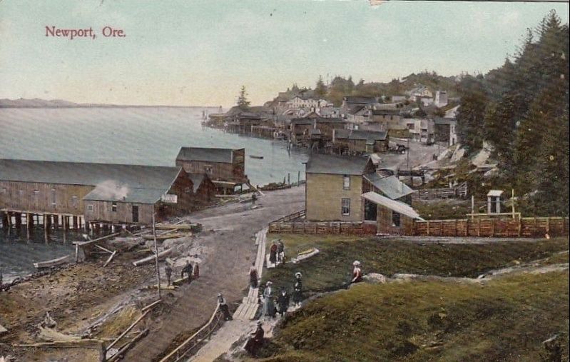
The city of Newport was named on July 4, 1866. On that day the townspeople and many visitors gathered to celebrate the ninetieth anniversary of National Independence Day and to name this small fishing and lumbering community. A tall pole was erected to receive the American flag. Prayer was offered, followed by singing and eloquent addresses abounding with loyalty and love of country.
In October, 1882, Newport was incorporated as a city with a population of about 250. Through the development of lumbering, fishing and recreational resources, the town has grown to the present population of 5,577.
Today, we here honor our city founders and pledge continued dedication to God, Nation, State and Community – that future generation may find our city as our forebears dreamed of it: “The bright and rising start of Oregon… may she ever be ascendant!”
Erected 1966 by City of Newport, Oregon.
Topics. This historical marker is listed in these topic lists: Industry & Commerce • Settlements & Settlers. A significant historical date for this entry is July 4, 1866.
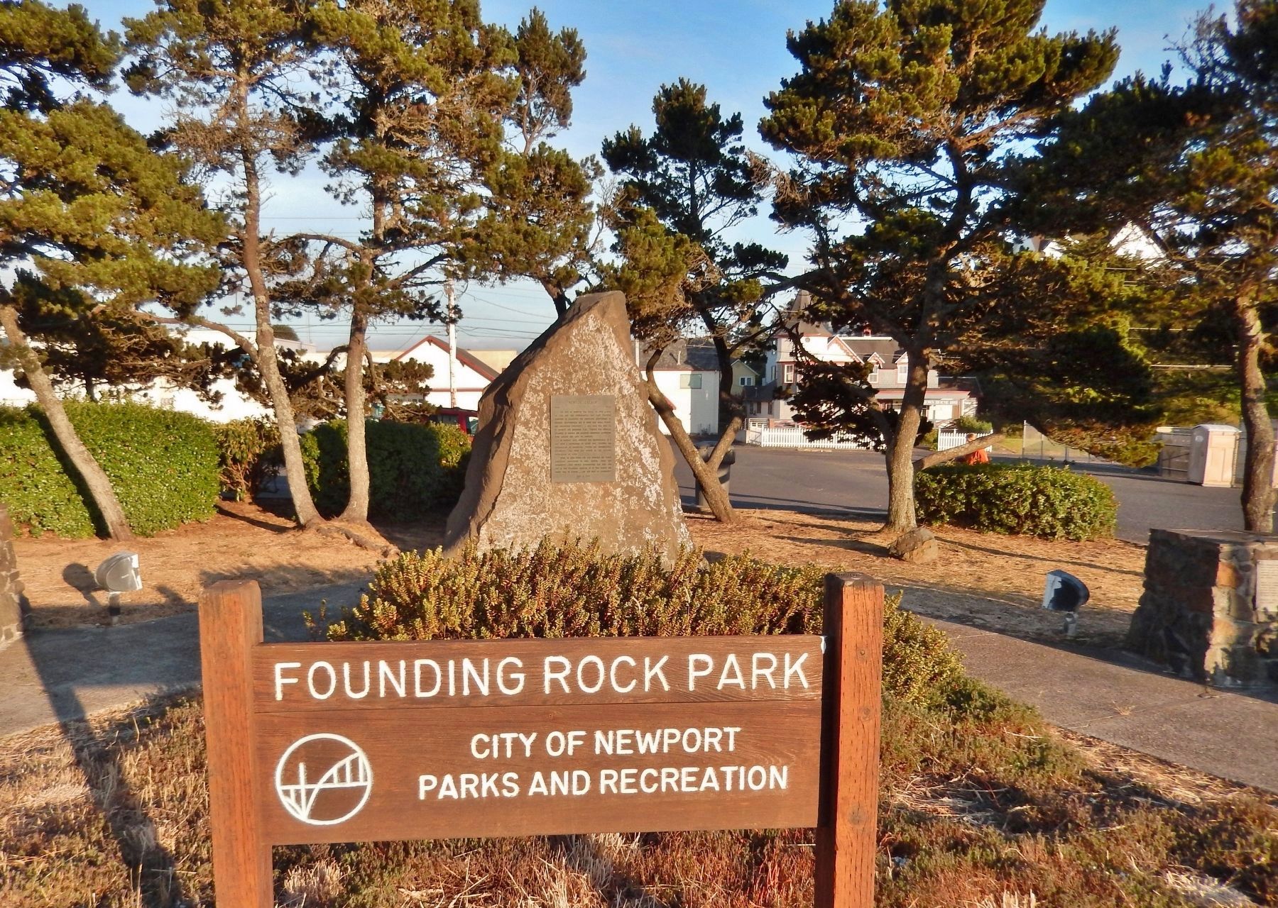
Location. 44° 37.927′ N, 124° 3.498′ W. Marker is in Newport, Oregon, in Lincoln County. Marker is on Oregon Coast Highway (U.S. 101) south of SW Alder Street, on the right when traveling north. Marker is the centerpiece of the small "Founding Rock Park" on the east side of the highway just south of SW Alder Street. Touch for map. Marker is in this post office area: Newport OR 97365, United States of America. Touch for directions.
Other nearby markers. At least 8 other markers are within walking distance of this marker. United States Coast Guard Motor Lifeboat CG 36503 (approx. 0.4 miles away); Yaquina Bay Light (approx. 0.6 miles away); Lighthouses of the Oregon Coast (approx. 0.6 miles away); Lighthouses Weren't Enough (approx. 0.6 miles away); Safety at Yaquina Bay Today (approx. 0.6 miles away); Yaquina Bay Bridge (approx. 0.7 miles away); Yaquina Bay (approx. 0.7 miles away); Protecting the Coast (approx. 0.9 miles away). Touch for a list and map of all markers in Newport.
More about this marker. Marker is a metal tablet mounted on the flat, polished side of a large pointed boulder - the Founding Rock.
Also see . . .
1. Newport.
As early as 1856, Yaquina Bay was visited by the sailing vessel Calumet, laden with supplies for Lieutenant Phil Sheridan and the nearby military garrison. When the Yaquina Bay oyster beds were discovered in 1862, great profits were made by exporting the delicacy to San Francisco and elsewhere. Settlers from the East Coast began homesteading in the Yaquina Bay area in 1864. (Submitted on February 20, 2018, by Cosmos Mariner of Cape Canaveral, Florida.)
2. Yaquina Bay.
Yaquina Bay is named after the Yaquina Tribe that occupied the territory along the Yaquina River. With the railroad addition In the late 1880s, many thought Yaquina Bay would be the commerce center for the Pacific Northwest. Wheat, lumber, and other goods were transported to Yaquina Bay as the area began to develop. Oyster companies and other merchandise organizations began to take residence in the Bay. (Submitted on February 20, 2018, by Cosmos Mariner of Cape Canaveral, Florida.)
Photographed By Cosmos Mariner, July 7, 2015
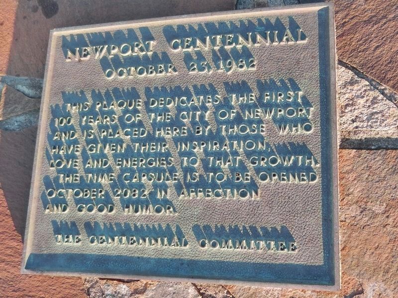
3. Newport Centennial Plaque (near marker)
Newport Centennial
October 23, 1982
The Time Capsule is to be opened October 2082 in affection and good humor.
The Centennial Committee
Photographed By Cosmos Mariner, July 7, 2015
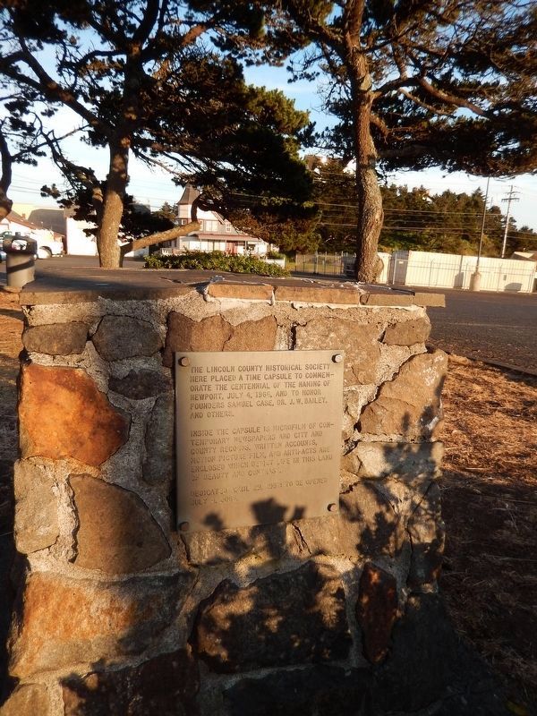
4. Time Capsule (near marker)
The Lincoln County Historical Society here placed a time capsule to commemorate the centennial of the naming of Newport, July 4, 1966, and to honor founders Samuel Case, Dr. J.W. Bailey and others.
Inside this capsule is a microfilm of contemporary newspapers and city and county records. Written accounts, motion picture film, and artifacts are enclosed which depict life in the land of beauty and contrast.
Dedicated April 29, 1967: to be opened July 4, 2066.
Credits. This page was last revised on October 19, 2020. It was originally submitted on February 20, 2018, by Cosmos Mariner of Cape Canaveral, Florida. This page has been viewed 491 times since then and 32 times this year. Photos: 1, 2, 3, 4, 5, 6. submitted on February 20, 2018, by Cosmos Mariner of Cape Canaveral, Florida. 7. submitted on February 20, 2018. • Andrew Ruppenstein was the editor who published this page.
