Near Central in Washington County, Utah — The American Mountains (Southwest)
The Old Spanish Trail and The California Road
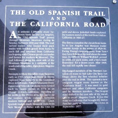
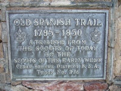
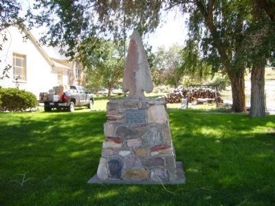
Inscription.
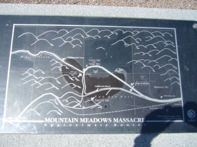
An arduous 1,200-mile route between Santa Fe and Los Angeles, the "Old Spanish Trail" passed through Mountain Meadows during its heyday, between 1830 and 1848. The trail served traders who loaded their pack mules with woolen goods from Santa Fe each fall and returned from Californian each spring with Chinese goods and mules and horses for markets in Missouri. The trail followed along the west side of the Mountain Meadows to a campsite at the south end of the valley, then down Magotsu Creek.
Attempts to blaze this trade route began as early as 1765, when Juan Maria de Rivera explored from Santa Fe to the Gunnison River, in Colorado. Fathers Athanasio Dominguez and Velez de Escalante were turned back by heavy snows in 1776 in an attempt to reach California. Traveling as far north as the Provo area, they gave up the venture while camped between modern Milford and Cedar City. Later, Spanish traders made frequent visits from New Mexico to barter with the Utes for pelts and slaves. Jedediah Smith explored the western stretch of the trail from Utah to California in 1826-27.
The first to complete the circuit from Santa Fe to Los Angeles was Mexican trader Antonio Armijo in the winter of 1829-30. Ewing Young's trapping party from Taos may have followed the trail about the same time. In 1830-31 William Wolfskill proved its utility for pack trains, and a brisk trade flourished for a dozen years. After 1848, the trail fell rapidly into disuse.
Discharged members of the Mormon Battalion en route to Salt Lake City from San Diego drove the first wheeled vehicles over the trail in 1848. This opened a new emigrant wagon route know as the "California Road." It was used by gold seekers and other California emigrants and by Mormon travelers. The wagon road shifted to the east side of the meadows to avoid Magotsu Creek. It was this route to California that brought the Baker-Fancher party to Mountain Meadows in September 1857.
Topics and series. This historical marker is listed in these topic lists: Exploration • Roads & Vehicles. In addition, it is included in the California Trail, and the Old Spanish National Trail series lists. A significant historical month for this entry is September 1857.
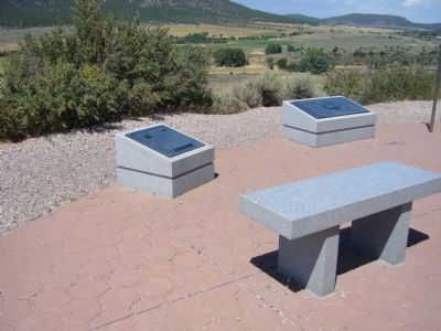
Location. 37° 28.631′ N, 113° 37.932′ W. Marker is near Central, Utah, in Washington County. Marker can be reached from Utah Route 18 at milepost 30.5. There is a parking area just off the highway and then a 200 yard path that leads to the marker. Touch for map. Marker is in this post office area: Central UT 84722, United States of America. Touch for directions.
Other nearby markers. At least 8 other markers are within walking distance of this marker. The Arkansas Wagon Train (here, next to this marker); 1990 Mountain Meadows Monument (a few steps from this marker); The Burial Sites
(within shouting distance of this marker); Leaders of the Arkansas Wagon Train (within shouting distance of this marker); The Mountain Meadows Massacre (within shouting distance of this marker); A Senator's Recollection (within shouting distance of this marker); The Surviving Children (about 300 feet away, measured in a direct line); Siege, Murder, and Burials at the Emigrants' Campsite (approx. 0.6 miles away). Touch for a list and map of all markers in Central.
Related markers. Click here for a list of markers that are related to this marker.
Also see . . . Old Spanish Trail Association. Maps, photos, history. (Submitted on February 21, 2018, by Craig Baker of Sylmar, California.)
Additional keywords. Mountain Meadows Massacre
Dan Sill Hill
Credits. This page was last revised on June 19, 2018. It was originally submitted on September 3, 2011, by Bill Kirchner of Tucson, Arizona. This page has been viewed 1,120 times since then and 23 times this year. Last updated on February 21, 2018, by Craig Baker of Sylmar, California. Photos: 1, 2, 3, 4. submitted on September 3, 2011, by Bill Kirchner of Tucson, Arizona. 5, 6. submitted on October 2, 2012, by Bill Kirchner of Tucson, Arizona. • Andrew Ruppenstein was the editor who published this page.
