Fredericksburg, Virginia — The American South (Mid-Atlantic)
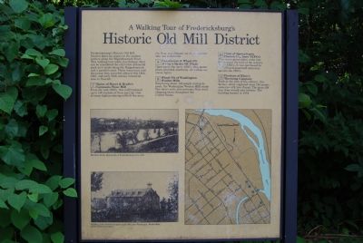
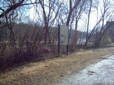
A Walking Tour of Fredericksburg’s Historic Old Mill District
Fredericksburg’s Historic Old Mill District dates its origins to the earliest settlers along the Rappahannock River. This walking tour takes you through what can be considered the city’s first industrial park as it winds along the Rappahannock and a parallel canal. These waterways and the power they provided allowed this 18th, 19th, and early 20th century industrial area to flourish.
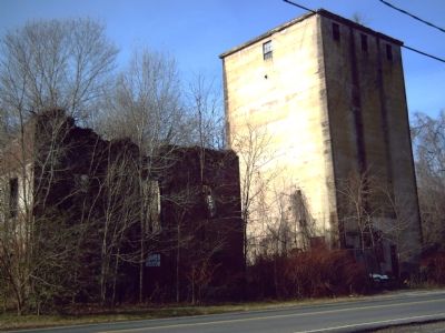
7. Ruins of Meyers & Brulle’s Germania Flour Mill
From the mid-1800s, this mill produced up to 100 bushels of flour per day. One of many high-producing mills in the area, the flour was shipped out of the area for sale and to bakeries.
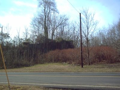
8. Foundation & Wheel Pit of City’s Hydro DC Plant
Opening in the early 1900;s, this power plant provided electricity for carbon arc street lights.
9. Wheel Pit of Washington Woolen Mills
Employing about 120 people during its peak, the Washington Woolen Mills made fine men’s suits and overcoats from wool, shipping them throughout the United States.
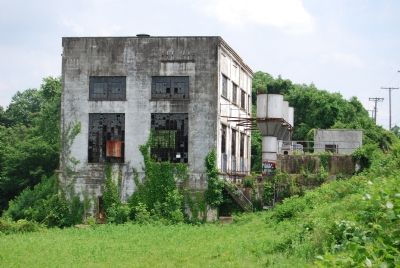
10. Plant of Spotsylvania Electric Co., later VEPCO
This water power plant came into being about the turn of the century. In the 1920s, it was purchased by VEPCO and generated electricity up to the 1960s.
11. Portions of Klotz’s Throwing Company
Built at the turn of the century, this factory which employed some 140 people, spun raw silk into thread. The spun silk was then wound onto bobbins. The building burned in 1934.
Topics. This historical marker is listed in this topic list: Industry & Commerce. A significant historical year for this entry is 1900.
Location. 38° 18.721′ N, 77° 27.897′ W. Marker is in Fredericksburg, Virginia. Marker is at the intersection of Caroline Street and Ford Street, on the right when traveling north on Caroline Street. Touch for map. Marker is in this post office area: Fredericksburg VA 22401, United States of America. Touch for directions.
Other nearby markers. At least 10 other markers are within walking distance of this marker. Hydroelectricity Brings Changes to Fredericksburg (within shouting distance of this marker); Germania Mill: Recovering from the Civil War (within shouting distance of this marker); Rappahannock River Heritage Trail (about 400 feet away, measured in a direct line); Water Powered Industries (about 700 feet away); French John's Wharf (approx. 0.2 miles away); Walker-Grant High School Class of 1950 Stages Graduation Protest at Fredericksburg Community Center (approx. ¼ mile away); Carl's (approx. ¼ mile away); A Canal Defines Its Neighborhood (approx. ¼ mile away); Elmhurst (approx. 0.3 miles away); 1868 (approx. 0.3 miles away). Touch for a list and map of all markers in Fredericksburg.
Also see . . .
1. Walk Through History . . . Mill Sites and Water Power. (Submitted on June 2, 2007, by Dawn Bowen of Fredericksburg, Virginia.)
2. The Fredericksburg Silk Mill. (Submitted on June 6, 2007, by Dawn Bowen of Fredericksburg, Virginia.)
Additional keywords. VEPCO: Virginia Electric and Power Company, now Dominion Virginia Power, a division of Dominion Resources, Inc.
Credits. This page was last revised on February 2, 2023. It was originally submitted on June 2, 2007, by Dawn Bowen of Fredericksburg, Virginia. This page has been viewed 4,579 times since then and 66 times this year. Last updated on June 11, 2007, by Dawn Bowen of Fredericksburg, Virginia. Photos: 1. submitted on June 2, 2007, by Dawn Bowen of Fredericksburg, Virginia. 2, 3, 4. submitted on February 2, 2008, by Kevin W. of Stafford, Virginia. 5. submitted on June 4, 2007, by Dawn Bowen of Fredericksburg, Virginia. • J. J. Prats was the editor who published this page.
