Near Corvallis in Benton County, Oregon — The American West (Northwest)
Camp Adair

Photographed By Barry Swackhamer, September 26, 2017
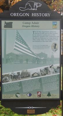
1. Camp Adair Marker
Caption: (oval photo, upper right) The camp was named after Lt. Henry R. Adair, a West Point graduate and Oregon pioneer descendant, killed in 1916 while serving with Gen. John Pershing on a military expedition into Mexico in pursuit of the noted Mexican leader Pancho Villa.
The height of Camp Adair’s population reached over 35,000. This bustling camp included 1,800 buildings-mess halls, barracks, offices, churches, cinemas, stores, servicemen’s clubs, post office, bank, hospital, and bakery, in addition to training grounds and artillery ranges. Two divisions equaled about 30,000 men, and the remaining population included people permanently assigned to work at the camp.
The influx of people brought by Camp Adair affected local communities in many ways. Housing became scarce as soldiers’ families sought nearby places to live. Several thousand local residents, some of whom had lived here since the Pioneer Era, were compelled to move - their farmsteads and even the village of Wells and its school were eliminated. Highways, a railroad, and several small communities, even cemeteries within the proposed camp area, were also relocated. Most displaced farm families took fair compensation money and relocated without complaint, given the emergency of the war effort.
As the last infantry division left camp in 1944, Italian prisoners of war (POWs) arrived, later joined by a large number of German POWs. A portion of the site served as a POW camp until 1946. At different times, troops and POWs were pressed into service harvesting hops, beans, cherries, and other crops.
In 1945, the hospital was turned over to the US Navy to treat injuries from the Pacific Theater and then converted to student housing for Oregon State College. When 45,000 acres of the camp were surplussed, original land owners were given the first option to purchase land. The rifle range and other property were assigned to the Oregon National Guard at their buy-out prices.
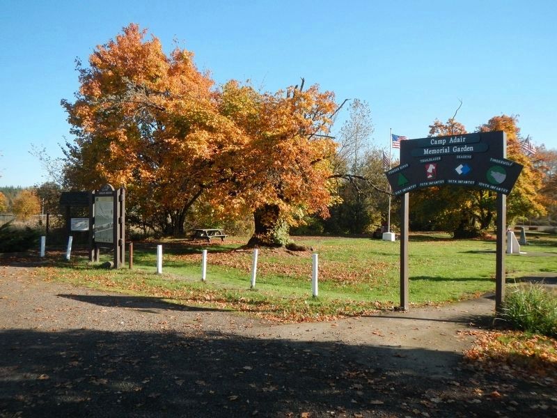
Four infantry divisions trained here between 1942 and 1944. 104th Timberwolf 1942-1943 European Theater, 96th Deadeye 1942-1943 Pacific Theater, 70th Trailblazer 1943-1944 European Theater, 91st Powder River 1943-1944 European Theater
Erected by Oregon Travel Experience.
Topics and series. This historical marker is listed in these topic lists: Forts and Castles • War, World II. In addition, it is included in the Oregon Beaver Boards series list.
Location. 44° 41.974′ N, 123° 12.505′ W. Marker is near Corvallis, Oregon, in Benton County. Marker can be reached from Camp Adair Road near Pacific Highway West (Oregon Route 99W), on the left when traveling east. Touch for map. Marker is at or near this postal address: 29694 Camp Adair Road, Corvallis OR 97330, United States of America. Touch for directions.
Other nearby markers. At least 8 other markers are within 10 miles of this marker, measured as the crow flies. The Trailblazers (a few steps from this marker); The Timberwolves (a few steps from this marker); The Wild West Division (within shouting distance of this marker); 96th Infantry Division (within shouting distance of this marker); The Van Buren Street Bridge (approx. 9.6 miles away); The Corvallis Ferry (approx. 9.6 miles away); Site of the Earliest Boat Landing (approx. 9.6 miles away); Benton County Courthouse (approx. 9.7 miles away). Touch for a list and map of all markers in Corvallis.
Also see . . .
1. Swamp Adair - Benton County Historical Society. They called it "Swamp Adair." ... At the Camp Adair site, there was level land for barracks and hilly terrain for combat training. The climate and natural land features of the Willamette Valley were like Germany where soldiers would go to fight. Full-scale models of European and Japanese towns were constructed for soldiers' training. (Submitted on February 25, 2018, by Barry Swackhamer of Brentwood, California.)
2. Oregon Travel Experience - Camp Adair Audio Tour. Official 'Beaver Board' website for Oregon State Historical Markers (Submitted on February 25, 2018, by Douglass Halvorsen of Klamath Falls, Oregon.)
Credits. This page was last revised on April 21, 2018. It was originally submitted on February 25, 2018, by Barry Swackhamer of Brentwood, California. This page has been viewed 247 times since then and 14 times this year. Photos: 1, 2. submitted on February 25, 2018, by Barry Swackhamer of Brentwood, California.
