Annapolis in Anne Arundel County, Maryland — The American Northeast (Mid-Atlantic)
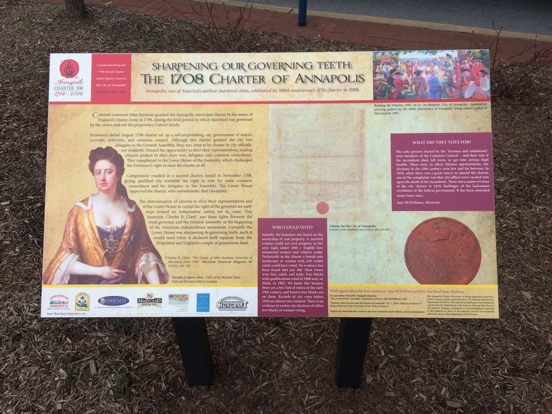
Sharpening Our Governing Teeth: The 1708 Charter of Annapolis
Annapolis Charter 300 1708-2008
— Commemorating the 1708 Royal Charter under Queen Anne to the City of Annapolis —

Photographed By Devry Becker Jones (CC0), March 2, 2018
1. Sharpening Our Governing Teeth: The 1708 Charter of Annapolis Marker
Annapolis, one of America's earliest chartered cities, celebrated its 300th anniversary of its charter in 2008.
Colonial Governor John Seymour granted the Annapolis municipal charter in the name of England's Queen Anne in 1708, during the brief period in which Maryland was governed by the crown and not the proprietary Calvert family.
Seymour's initial August 1708 charter set up a self-perpetuating city government of mayor, recorder, aldermen, and common council. Although this charter granted the city two delegates to the General Assembly, they, too were to be chosen by city officials, not residents. Denied the opportunity to elect their representatives, leading citizens pushed to elect their own delegates and common councilmen. They complained to the Lower House of the Assembly, which challenged the Governor's right to issue the charter at all.
Compromise resulted in a second charter, issued in November 1708, giving qualified city residents the right to vote for some common councilmen and for delegates to the Assembly. The Lower House approved the charter, with amendment, that December.
The determination of citizens to elect their representatives of the Lower House to curtail the right of the governor are early steps toward and independent nation yet to come. One historian, Charles B. Clark* saw these fights between the royal governor and the General Assembly as the beginning of the American independence movement. Certainly the lower House was sharpening its governing teeth, teeth it would need when it declared itself separate from the Proprietor and England a couple generations later.
*Charles B. Clark, "The Career of John Seymour, Governor of Maryland 1704-1709." Maryland Historical Magazine 48 (1953) 134-159.
Who Could Vote?
Initially, the franchise was based on the ownership of real property. A married woman could not own property in her own right under 18th c. English law; unmarried women and widows could. Technically in the charter a female sole landowner or woman with £20 visible estate could have voted. No evidence has been found that any did. Most voters were free, adult, and male. Free blacks with qualifications voted in 1800 and, we think, in 1802. We know this because there are a few lists of voters in the early 19th century, and known free blacks are on them. Records of city votes before 1820 are almost non-existent. There is no evidence in earlier city elections of either free blacks or women voting.
What Did They Vote For?
The only persons elected by the "freemen and inhabitants were members of the Common Council -- and then only if the incumbent died, left town, or got into serious

Photographed By Devry Becker Jones (CC0), March 2, 2018
2. Sharpening Our Governing Teeth: The 1708 Charter of Annapolis Marker
Jane McWilliams, Historian
Erected by the City of Annapolis.
Topics. This historical marker is listed in these topic lists: African Americans • Colonial Era • Government & Politics • Women. A significant historical month for this entry is August 1708.
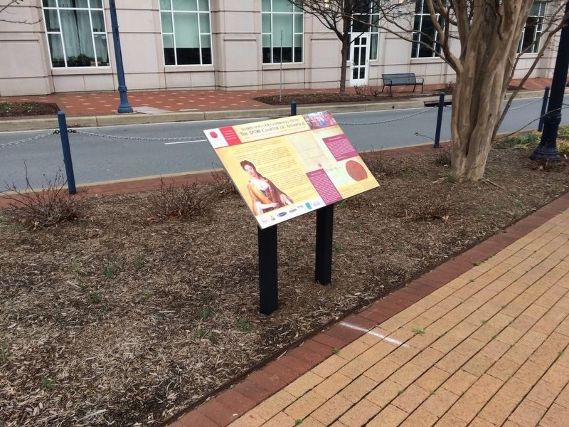
Location. 38° 58.575′ N, 76° 30.252′ W. Marker is in Annapolis, Maryland, in Anne Arundel County. Marker is at the intersection of West Street (Maryland Route 450) and Westgate Circle, in the median on West Street. Touch for map. Marker is at or near this postal address: 6 Spa View Circle, Annapolis MD 21401, United States of America. Touch for directions.
Other nearby markers. At least 8 other markers are within walking distance of this marker. Brown-Leanos Memorial Park (within shouting distance of this marker); Annapolis During The Civil War (within shouting distance of this marker); A National Cemetery System (about 300 feet away, measured in a direct line); Annapolis National Cemetery (about 300 feet away); The City Water System (about 400 feet away); An Environmental Perspective (about 400 feet away); Anne Catharine Green (about 400 feet away); George H. Phelps, Jr. (about 700 feet away). Touch for a list and map of all markers in Annapolis.
Credits. This page was last revised on October 14, 2022. It was originally submitted on March 2, 2018, by Devry Becker Jones of Washington, District of Columbia. This page has been viewed 305 times since then and 32 times this year. Photos: 1, 2. submitted on March 2, 2018, by Devry Becker Jones of Washington, District of Columbia. • Bill Pfingsten was the editor who published this page.