François Coulee
Acadiana Park Nature Station
— Atchafalaya Water Heritage Trail —
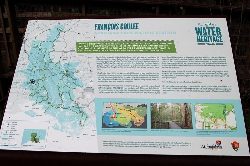
This otherwise flat region, sloping, hill-like formations are visible and represent the Mississippi River escarpment (bluff-like shelf) that divides this area into floodplain and prairie. The Vermilion River flows at the base of this escarpment.
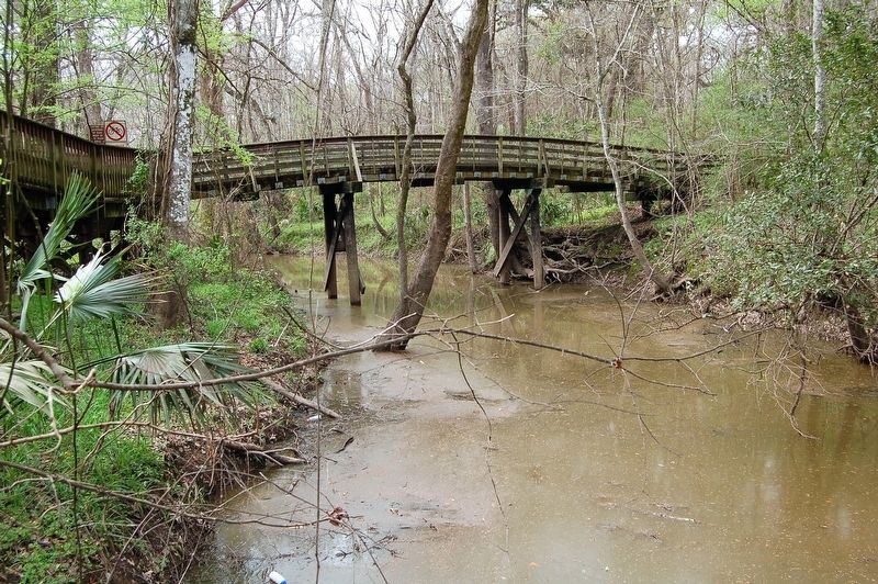
François Coulee (also called the Dan Debaillon Coulee) is the active waterway found within the 150-acre Acadiana Park Nature Station and Trails in Lafayette. The term coulee comes from the French word couler, meaning “to flow.” This small stream drains from west to east along an ancient course of the Mississippi River and into the Vermilion River. The Acadiana Park Nature Station is located in a wooded section next to Acadiana Park at the juncture of two major ecosystems— the Mississippi River floodplain and the remnants of a Gulf Coast tallgrass prairie on a prairie terrace.
All soils in the Nature Station trail system are alluvial (deposited by water at various times and through different methods) and create a topography unique to southwestern Louisiana. In this otherwise flat region, sloping, hill-like formations are visible and represent the Mississippi River escarpment (bluff-like shelf) that divides this area into floodplain and prairie. The Vermilion River flows at the base of this escarpment.
The Gulf Coast prairie terrace is made up mostly
of loess (wind-blown silt) -covered alluvial sediment deposited 80 to 100,000 years ago by the early Pleistocene Gulf of Mexico. Its elevation is about 50 feet higher than the neighboring floodplain of the Mississippi and Atchafalaya basins. The floodplain in the northern portion of the park, however, was formed about 6,000 years ago by an old westerly course of the Mississippi River, with the present-day Vermilion as a major distributary. At the end of the ice age, the ancient Mississippi carved deep trenches to drain tremendous volumes of water from melting glaciers in the Mississippi Basin. During the approximately 1,300 years the ancient river was active here, portions of these trenches ran as deep as 300 feet. Once glacier meltwater subsided, the trenches filled gradually with rich, black, clay-like sediments.Today the floodplain forest at the Acadiana Park Nature Station is only a tiny sample of a vast ecosystem that extends from the Gulf to Tennessee. Visitors can explore this unusual topography via the station’s six miles of hiking trails and a wide range of public education programs held throughout the year.
Visit Atchafalaya.org for more information about this site.
This site’s geology/geomorphology: Holocene alluvial deposits (natural levees, distributaries and abandoned channels) of small river along escarpment with Pleistocene coastal plain stream deposits blanketed by Peoria Loess - adjacent to Holocene backswamp deposits of Mississippi and Atchafalaya rivers.
Erected by State of Louisiana and National Park Service.
Topics and series. This historical marker is listed in these topic lists: Environment • Waterways & Vessels. In addition, it is included in the Atchafalaya Water Heritage Trail series list.
Location. 30° 15.472′ N, 91° 59.207′ W. Marker is in Lafayette, Louisiana, in Lafayette Parish. Marker can be reached from East Alexander Street. Touch for map. Marker is at or near this postal address: 1205 East Alexander Street, Lafayette LA 70501, United States of America. Touch for directions.
Other nearby markers. At least 8 other markers are within 3 miles of this marker, measured as the crow flies. Pierre Dugat Home Site (approx. 0.2 miles away); Holy Rosary Institute (approx. 1.7 miles away); La Place des Créoles (approx. 2.7 miles away); Welcome to Freetown / Bienvenue à Freetown (approx. 2.9 miles away); Bendel Housekeeper's Home (approx. 2.9 miles away); Pavy Studio (approx. 2.9 miles away); Broussard House (approx. 2.9 miles away); 9-11 Memorial (approx. 2.9 miles away). Touch for a list and map of all markers in Lafayette.
More about this marker. Turn left at East Alexander Street. Proceed to the "Acadiana Park Campground and Nature
Credits. This page was last revised on May 28, 2023. It was originally submitted on March 10, 2018, by Cajun Scrambler of Assumption, Louisiana. This page has been viewed 511 times since then and 64 times this year. Photos: 1, 2, 3. submitted on March 10, 2018.


