Kennesaw in Cobb County, Georgia — The American South (South Atlantic)
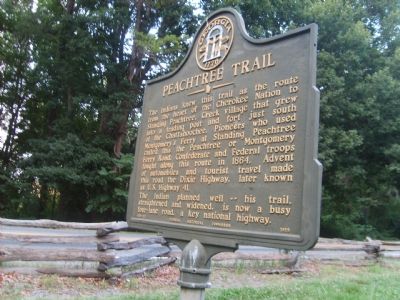
Peachtree Trail
The Indian planned well—his trail straightened and widened, is now a busy four-lane road, a key national highway.
Erected 1959 by Georgia Historical Commission. (Marker Number 033-112.)
Topics and series. This historical marker is listed in these topic lists: Native Americans • Roads & Vehicles • Settlements & Settlers. In addition, it is included in the Georgia Historical Society series list. A significant historical year for this entry is 1864.
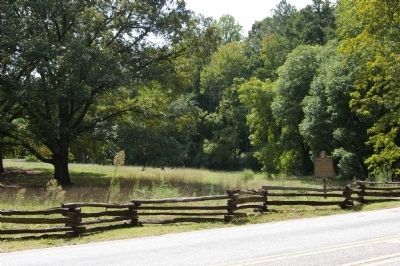
Location. 33° 59.087′ N, 84° 34.725′ W. Marker is in Kennesaw, Georgia, in Cobb County. Marker is on Old 41 Highway (Georgia Route 293) west of Stilesboro Rd. The marker is at the entrance to Kennesaw Mountain National Battlefield Park. Touch for map. Marker is in this post office area: Kennesaw GA 30144, United States of America. Touch for directions.
Other nearby markers. At least 8 other markers are within walking distance of this marker. Eyes for the Armies (within shouting distance of this marker); A Grim and Silent Kennesaw (about 500 feet away, measured in a direct line); Clash at Kennesaw (about 600 feet away); Lining Up for Death (about 600 feet away); The Railroad War (approx. 0.2 miles away); Federal 15th Corps (approx. 0.3 miles away); Digging in for Defense (approx. half a mile away); Tribute to Georgian Generals (approx. half a mile away). Touch for a list and map of all markers in Kennesaw.
More about this marker. Highway 41 was straightened further and moved from this roadway next to this marker to a new right-of-way just north of here.
Credits. This page was last revised on May 27, 2020. It was originally submitted on July 14, 2007, by Michael Cruce of Marietta, Georgia. This page has been viewed 2,161 times since then and 25 times this year. Last updated on September 15, 2008, by David Seibert of Sandy Springs, Georgia. Photos: 1. submitted on July 14, 2007, by Michael Cruce of Marietta, Georgia. 2. submitted on September 15, 2008, by David Seibert of Sandy Springs, Georgia. • Kevin W. was the editor who published this page.

