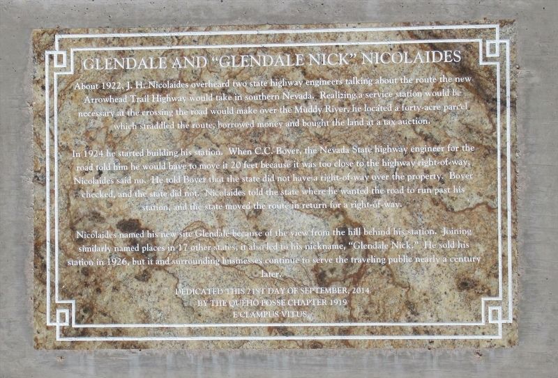
Glendale and "Glendale Nick" Nicolaides
In 1924 he started building his station. When C. C. Boyer, the Nevada State highway engineer for the road told him he would have to move it 20 feet because it was too close to the highway right-of-way, Nicolaides said no. He told Boyer that the state did not have a right-of-way over the property. Boyer checked, and the state did not. Nicolaides told the state where he wanted the road to run past his station, and the state moved the route in return for a right-of-way.
Nicolaides named his new site Glendale because of the view from the hill behind his station. Joining similarly named places in 17 other states, it also led to his nickname, "Glendale Nick." He sold his station in 1926, but it and the surrounding business continue to serve the traveling public nearly a century later.
Dedicated this 21st Day of September, 2014 by the Queho Posse Chapter 1919 E Clampus Vitus
Erected 2014 by Queho Posse Chapter 1919 E
Topics and series. This historical marker is listed in these topic lists: Industry & Commerce • Roads & Vehicles. In addition, it is included in the E Clampus Vitus series list. A significant historical month for this entry is September 2014.
Location. 36° 39.928′ N, 114° 34.155′ W. Marker is in Moapa, Nevada, in Clark County. Marker is on Glendale Boulevard, on the left when traveling east. Marker is in front of the Gas Station. Touch for map. Marker is at or near this postal address: 2300 Glendale Boulevard, Moapa NV 89025, United States of America. Touch for directions.
Other nearby markers. At least 8 other markers are within 13 miles of this marker, measured as the crow flies. Moapa Valley (approx. 4.8 miles away); Overton (approx. 11.1 miles away); Early Settlements in the Moapa Valley (approx. 11.2 miles away); Moapa Valley Pioneers (approx. 11.7 miles away); Pueblo Grande de Nevada (approx. 11.7 miles away); Fay Perkins, Sr. (approx. 11.7 miles away); Lost City Museum (approx. 11.7 miles away); Pioneers (approx. 12˝ miles away).
Credits. This page was last revised on March 10, 2018. It was originally submitted on March 10, 2018, by Frank Gunshow Sanchez of Hollister, California. This page has been viewed 244 times since then and 12 times this year. Photo 1. submitted on March 10, 2018. • Andrew Ruppenstein was the editor who published this page.
Editor’s want-list for this marker. Wide view photograph of the marker and its surroundings • Can you help?
