Annapolis in Anne Arundel County, Maryland — The American Northeast (Mid-Atlantic)
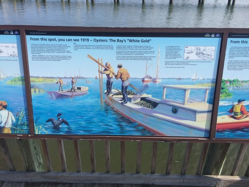
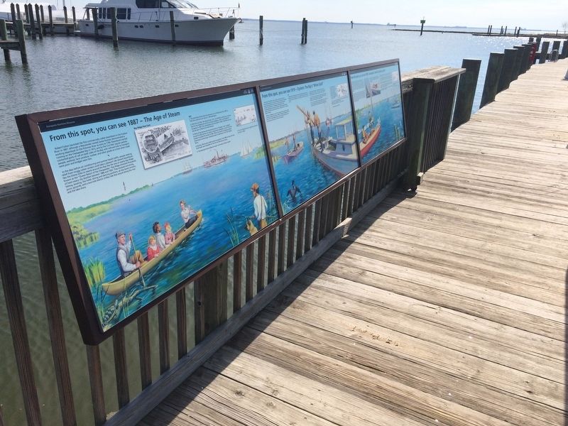
From this spot, you can see 1919 - Oysters: The Bay's "White Gold"
Annapolis Maritime Museum

Photographed By Devry Becker Jones (CC0), March 10, 2018
1. From this spot, you can see 1919 - Oysters: The Bay's "White Gold" Marker
At the turn of the 20th century, eight or more oyster houses surrounded Annapolis City Dock and harbor. Oysters were shucked, packed and shipped all around the country by steamboat and railroad. The market for "Chesapeake white gold" was so lucrative, Maryland and Virginia watermen sometimes exchanged gunfire with the Maryland Oyster Police — and each other — over the right to harvest.
William J. McNasby, Sr., son of Irish immigrants, founded his oyster house at Annapolis City Dock in 1886. He moved the business to this site in 1919. The McNasby Oyster Company building behind you is now the last remnant of a once-thriving industry.
Key
1. Watermen harvested oysters with long-shafted hand tongs from workboats called "deadrises." The V-shaped hull and other features of these craft were designed to suit the Bay's shallow, often choppy waters.
2. Single-masted "shipjacks" replaced larger schooners for dredging oysters under sail. In 1919, there were 2,000 skipjacks harvesting oysters on the Bay; today, only a handful remain.
3. "Buy boats" ferried the harvest to market at oyster houses like McNasby's so that the watermen could keep working out on the Bay. (From a photograph by A. Aubrey Bodine)
4. The U.S. Navy erected the tall Eiffel-shaped towers on Greenbury Point in 1918 to beam radio signals across the Atlantic. They transmitted news of the armistice that ended World War I.
5. The Greenbury Point Shoal Lighthouse was a screwpile structure like the one at Thomas Point. It replaced the original land-based lighthouse in 1891 and was taken down after it was damaged by the hurricane of 1933.
6. One of the three 110-foot submarine chasers built at the Chance Marine yard in Eastport for the U.S. Navy in World War I.
(See the Eastport Walking Tour for more information.)
7. The common loon dives for fish.
Topics. This historical marker is listed in these topic lists: Animals • Industry & Commerce • War, World I • Waterways & Vessels. A significant historical year for this entry is 1886.
Location. 38° 58.129′ N, 76° 28.561′ W. Marker is in Annapolis, Maryland, in Anne Arundel County. Marker can be reached from 2nd Street near Bay Shore Avenue, on the right when traveling north. Touch for map. Marker is at or near this postal address: 799 2nd Street, Annapolis MD 21403, United States of America. Touch for directions.
Other nearby markers. At least 8 other markers are within walking distance of this marker. Oysters: Vital to Commerce. Vital to Culture. (here, next to this marker); Oysters: Vital to Nature. Vital to Our Future. (here, next to this marker); From this spot, you can see 1887 - The Age of Steam (here, next to this marker);

Photographed By Devry Becker Jones (CC0), March 10, 2018
2. From this spot, you can see 1919 - Oysters: The Bay's "White Gold" Marker
Credits. This page was last revised on May 10, 2020. It was originally submitted on March 11, 2018, by Devry Becker Jones of Washington, District of Columbia. This page has been viewed 251 times since then and 39 times this year. Photos: 1, 2. submitted on March 11, 2018, by Devry Becker Jones of Washington, District of Columbia. • Bill Pfingsten was the editor who published this page.