Annapolis in Anne Arundel County, Maryland — The American Northeast (Mid-Atlantic)
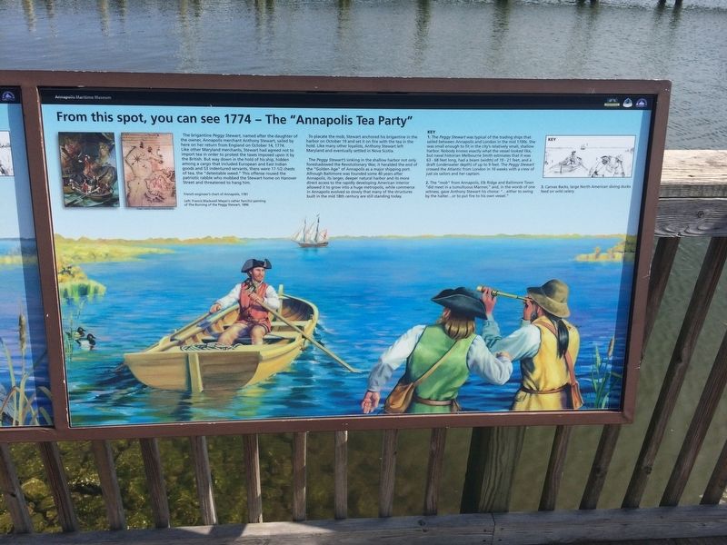
From this spot, you can see 1774 - The "Annapolis Tea Party"
Annapolis Maritime Museum

Photographed By Devry Becker Jones (CC0), March 10, 2018
1. From this spot, you can see 1774 - The "Annapolis Tea Party" Marker
The brigantine Peggy Stewart, named after the daughter of the owner, Annapolis merchant Anthony Stewart, sailed by here on her return from England on October 14, 1774. Like other Maryland merchants, Stewart had agreed not to import tea in order to protest the taxes imposed upon it by the British. But way down in the hold of his ship, hidden among a cargo that included European and East Indian goods and 53 indentured servants, there were 17-1/2 chests of tea, the "detestable weed." This offense roused the patriotic rabble who mobbed the Stewart home on Hanover Street and threatened to hang him.
To placate the mob, Stewart anchored his brigantine in the harbor on October 19 and set it on fire with the tea in the hold. Like many other loyalists, Anthony Stewart left Maryland and eventually settled in Nova Scotia.
The Peggy Stewart's sinking in the shallow harbor not only foreshadowed the Revolutionary War, it heralded the end of the "Golden Age" of Annapolis as a major shipping port. Although Baltimore was founded some 40 years after Annapolis, its larger, deeper natural harbor and its more direct access to the rapidly developing American interior allowed it to grow into a huge metropolis, while commerce in Annapolis evolved so slowly that many of the structures built in the mid 18th century are still standing today.
Key
1. The Peggy Stewart was typical of the trading ships that sailed between Annapolis and London in the mid 1700s. She was small enough to fit in the city's relatively small, shallow harbor. Nobody knows exactly what the vessel looked like, but naval historian Melbourne Smith estimates that it was 63-68 feet long, had a beam (width) of 19-21 feet and a draft (underwater depth) of up to 9 feet. The Peggy Stewart crossed the Atlantic from London in 10 weeks with a crew of just six sailors and her captain.
2. The "mob" from Annapolis, Elk Ridge and Baltimore Town "did meet in a tumultuous Manner," and, in the words of one witness, gave Anthony Stewart his choice: "…either to swing by the halter…or to put fire to his own vessel."
3. Canvas Backs, large North American diving ducks feed on wild celery.
Topics. This historical marker is listed in these topic lists: Colonial Era • Industry & Commerce • War, US Revolutionary • Waterways & Vessels. A significant historical date for this entry is October 14, 1774.
Location. 38° 58.131′ N, 76° 28.564′ W. Marker is in Annapolis, Maryland, in Anne Arundel County. Marker can be reached from 2nd Street south of Bay Shore Avenue, on the right when traveling north. Touch for map. Marker

Photographed By Devry Becker Jones (CC0), March 10, 2018
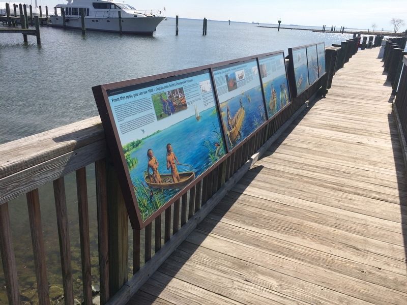
2. From this spot, you can see 1774 - The "Annapolis Tea Party" Marker
Other nearby markers. At least 8 other markers are within walking distance of this marker. From this spot, you can see 1672 - Providence: Settlement on the Severn (here, next to this marker); From this spot, you can see 1608 - Captain John Smith's Chesapeake Voyages (here, next to this marker); From this spot, you can see 1887 - The Age of Steam (here, next to this marker); From this spot, you can see 1919 - Oysters: The Bay's "White Gold" (here, next to this marker); Oysters: Vital to Commerce. Vital to Culture. (here, next to this marker); Oysters: Vital to Nature. Vital to Our Future. (here, next to this marker); Oysters: Vital to the Lifeline of the Chesapeake (here, next to this marker); From this spot, you can see 1998 - Annapolis: America's Sailing Capital (a few steps from this marker). Touch for a list and map of all markers in Annapolis.
Credits. This page was last revised on March 14, 2024. It was originally submitted on March 11, 2018, by Devry Becker Jones of Washington, District of Columbia. This page has been viewed 459 times since then and 50 times this year. Last updated on April 5, 2021, by Carl Gordon Moore Jr. of North East, Maryland. Photos: 1, 2. submitted on March 11, 2018, by Devry Becker Jones of Washington, District of Columbia.