Memphis in Shelby County, Tennessee — The American South (East South Central)
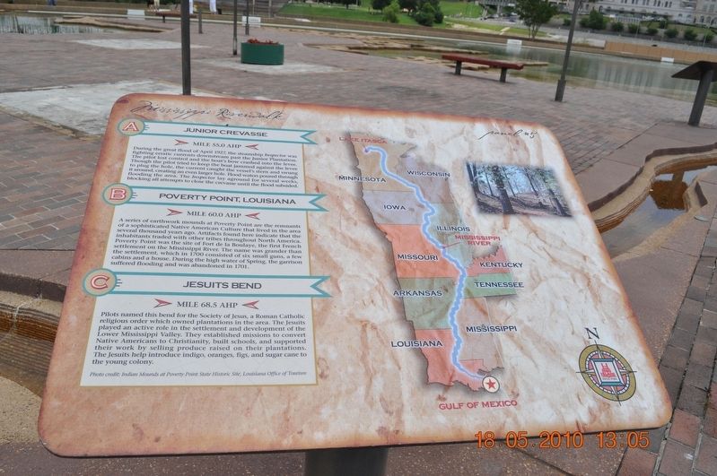
Junior Crevasse/Poverty Point, Louisiana/Jesuits Bend
Panel #5 Mississippi Riverwalk
Inscription.
A) Junior Crevasse
Mile 55.0 AHP
During the great flood of April 1927, the steamship Inspector was fought erratic currents downstream past the Junior Plantation. The pilot lost control and the boat’s bow crashed into the levee. Thought the pilot tried to keep the boat jammed against the levee to plug the hole, the current caught the vessel’s stern and swung it around, creating an even larger hole. Flood waters poured through flooding the area. The Inspector lay aground for several weeks, blocking all attempt to close the crevasse until the flood subsided.
B) Poverty Point, Louisiana
Mile 60.0 AHP
A series of earthwork mounds at Poverty Point are the remnants of a sophisticated Native American Culture that lived in the area several thousand years ago. Artifacts found here indicate the inhabitants traded with other tribes throughout North America. Poverty Point was the site of Fort de la Boutaye, the first French settlement, which in 1700 consists of six small guns, a few cabins, and a house. During the high water of Spring, the garrison suffered flooding and was abandoned in 1701.
C) Jesuits Bend
Mile 68.5 AHP
Pilots named this bend for the Society of Jesus, a Roman Catholic religious order which owned plantations in the area. The Jesuits played an active role in the settlement and development of the Lower Mississippi Valley. They established missions to convert Native Americans to Christianity, built schools, and supported their work by selling produce raised on their plantations. The Jesuits help introduce indigo, oranges, figs, and sugar cane to the young colony.
Photo Credit: Indian Mounds at Poverty Point State Historic Site, Louisiana Office of Tourism
Erected by Mississippi Riverwalk. (Marker Number 5.)
Topics. This historical marker is listed in these topic lists: Disasters • Native Americans • Settlements & Settlers • Waterways & Vessels. A significant historical month for this entry is April 1927.
Location. 35° 8.968′ N, 90° 3.507′ W. Marker is in Memphis, Tennessee, in Shelby County. Marker can be reached from Island Drive, 0.8 miles West A.W. Willis Avenue when traveling south. Located in Mud Island River Park. Touch for map. Marker is at or near this postal address: 125 N Front St, Memphis TN 38103, United States of America. Touch for directions.
Other nearby markers. At least 8 other markers are within walking distance of this marker. The Mississippi Riverwalk (here, next to this marker); Ohio River (here, next to this marker); Cairo, Illinois (here, next to this marker); Islands No. 2, 3, and 4 / Fort Jefferson, Kentucky / Bird’s Point, Missouri (here, next to this marker); Island No. 5 (Wolf Island)/Belmont, Missouri/Columbus, Kentucky (here, next to this marker); Donaldson Point, Missouri/Island No. 8/Hickman, Kentucky/Dorena Crevasse (here, next to this marker); New Madrid, Missouri/Cates Casting Field/Island No. 10 (here, next to this marker); Tiptonville, Tennessee/Bixby Towhead (here, next to this marker). Touch for a list and map of all markers in Memphis.
Credits. This page was last revised on March 13, 2018. It was originally submitted on March 12, 2018, by Sandra Hughes Tidwell of Killen, Alabama, USA. This page has been viewed 169 times since then and 13 times this year. Photo 1. submitted on March 12, 2018, by Sandra Hughes Tidwell of Killen, Alabama, USA. • Bernard Fisher was the editor who published this page.
Editor’s want-list for this marker. Wide shot of marker and its surroundings. • Can you help?
