Memphis in Shelby County, Tennessee — The American South (East South Central)
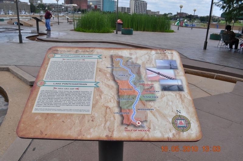
Bonnet Carre Spillway/Lake Pontchartrain
Panel #10 Mississippi Riverwalk
A) Bonnet Carre Spillway
Mile 128.0 AHP
Completed in 1935, the Bonnet Carre Spillway protects New Orleans, LA and the levees around it by diverting flood waters into Lake Pontchartrain. The one and a half mile long concrete structure consist of 350 bays which hold 7,000 large timbers called “needles”. These needles can be independently raised and lowered by a crane running alongside it to provide an adjustable opening. Water entering the spillway is channeled by guide levees to the lake. When not in use, the floodway is a game and fish preserve, and home to a herd of goats which keeps the vegetation closely clipped. The spillway’s first test came during the flood of 1937. Responding to a warning from upriver, a few bays were opened each day until the spillways poured a mile wide stream of floodwater into Lake Pontchartrain. Terrible flooding occurred upriver but the water level at New Orleans stayed almost stationary. The effectiveness of the Bonnet Carre Spillway and the Morganza Floodway, upriver, have made the New Orleans area virtually flood proof.
B) Lake Pontchartrain
Mile 128.5 AHP
Lake Pontchartrain, which forms the northern boundary of New Orleans is actually a lagoon, a land-locked bay of the Gulf of Mexico. Its waters rise and fall slightly with the tides. A five and a half mile Industrial Canal links the lake to the Mississippi River, and Pontchartrain connects eastward to the Gulf through the narrow Rigolets passage into Lake Borgne. The lake is 45 miles long and 25 miles wide. Its semi-salty waters teem with fish and the 112-mile shoreline is a major recreational area. The Pontchartrain Causeway crosses the lake north from New Orleans. The 24-mile long concrete highway is one of the world’s longest causeways over water.
Photo Credit:(1) Lake Pontchartrain Coastline, Louisiana Office of Tourism (2) Bonnet Carre Spillway, courtesy of USACE, (3) Lake Pontchartrain Causeway, Louisiana Office of Tourism
Erected by Mississippi Riverwalk. (Marker Number 10.)
Topics. This historical marker is listed in these topic lists: Disasters • Industry & Commerce • Waterways & Vessels.
Location. 35° 8.968′ N, 90° 3.507′ W. Marker is in Memphis, Tennessee, in Shelby County. Marker can be reached from Island Drive, 0.8 miles south of West A.W. Willis Avenue when traveling south. Located in Mud Island River Park. Touch for map. Marker is at or near this postal address: 125 N Front St, Memphis TN 38103, United States of America. Touch for directions.
Other nearby markers. At least 8 other markers are within walking distance of this marker. The Mississippi Riverwalk (here, next to this marker); Ohio River (here, next to this marker); Cairo, Illinois (here, next to this marker); Islands No. 2, 3, and 4 / Fort Jefferson, Kentucky / Bird’s Point, Missouri (here, next to this marker); Island No. 5 (Wolf Island)/Belmont, Missouri/Columbus, Kentucky (here, next to this marker); Donaldson Point, Missouri/Island No. 8/Hickman, Kentucky/Dorena Crevasse (here, next to this marker); New Madrid, Missouri/Cates Casting Field/Island No. 10 (here, next to this marker); Tiptonville, Tennessee/Bixby Towhead (here, next to this marker). Touch for a list and map of all markers in Memphis.
Also see . . . Lake Pontchartrain. Lake Pontchartrain is named for Louis Phélypeaux, comte de Pontchartrain. He was the French Minister of the Marine, Chancellor, and Controller-General of Finances during the reign of France's "Sun King", Louis XIV, for whom the colony of La Louisiane was named. (Submitted on March 12, 2018, by Sandra Hughes Tidwell of Killen, Alabama, USA.)
Credits. This page was last revised on August 27, 2020. It was originally submitted on March 12, 2018, by Sandra Hughes Tidwell of Killen, Alabama, USA. This page has been viewed 195 times since then and 12 times this year. Photo 1. submitted on March 12, 2018, by Sandra Hughes Tidwell of Killen, Alabama, USA. • Bernard Fisher was the editor who published this page.
Editor’s want-list for this marker. Wide shot of marker and its surroundings. • Can you help?
