Memphis in Shelby County, Tennessee — The American South (East South Central)
Port Hudson, Louisiana/Fausse River Cutoff
Panel #19 Mississippi Riverwalk
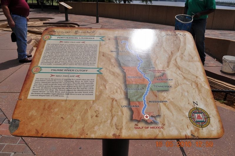
A) Port Hudson, Louisiana
Mile 256.0 AHP
This settlement began as a trading post and by the time of the U.S. Civil War, it was an important shipping center with both a steamboat landing and a rail line to the east. The Confederates heavily fortified it early in the war and it became one of their mightiest river strongholds. In March 1863, U. S. Admiral Farragut tried to run his fleet past the gun batteries at Port Hudson, while a large Union Infantry Force attacked it on the land side. All but two of the Union boats were disabled and the land attack was repelled. Two months later, Federal Forces cut Port Hudsonís supply lines and held the town under siege for 43 days. After the fall of Vicksburg in July 1863, Port Hudson became the last Confederate city on the Mississippi River to surrender. After the war, the town was forced to move east to escape the riverís encroachments. Floods, a sagging cotton industry, and the decline of river traffic, eventually put an end to the once thriving town.
B) Fausse River Cutoff
Mile 258.5 AHP
The river was the process of making this cutoff when the first Frenchmen canoed the Lower Mississippi River. In 1699, local Native Americans advised the explorers, Iberville and Bienville, that they could avoid the long river bend to the west by carrying their canoes across the narrow neck of land along the cutoff route. By 1721, an observer noted that the old bed was dry and the cutoff channel was very deep. The French named the abandoned bend “Fausse River” or False River, and its banks became lined with the homes of wealthy sugar planters. False River is now an enclosed crescent-shaped lake of 4,000 acres.
Erected by Mississippi Riverwalk. (Marker Number 19.)
Topics. This historical marker is listed in these topic lists: Native Americans • Settlements & Settlers • War, US Civil • Waterways & Vessels.
Location. 35° 8.968′ N, 90° 3.507′ W. Marker is in Memphis, Tennessee, in Shelby County. Marker can be reached from Island Drive, 0.8 miles south of West A.W. Willis Avenue. Located in Mud Island River Park. Touch for map. Marker is at or near this postal address: 125 N Front St, Memphis TN 38103, United States of America. Touch for directions.
Other nearby markers. At least 8 other markers are within walking distance of this marker. The Mississippi Riverwalk (here, next to this marker); Ohio River (here, next to this marker); Cairo, Illinois (here, next to this marker); Islands No. 2, 3, and 4 / Fort Jefferson, Kentucky / Birdís Point, Missouri (here, next to this marker); Island No. 5 (Wolf Island)/Belmont, Missouri/Columbus, Kentucky (here, next to this marker); Donaldson Point, Missouri/Island No. 8/Hickman, Kentucky/Dorena Crevasse (here, next to this marker); New Madrid, Missouri/Cates Casting Field/Island No. 10 (here, next to this marker); Tiptonville, Tennessee/Bixby Towhead (here, next to this marker). Touch for a list and map of all markers in Memphis.
Credits. This page was last revised on April 15, 2019. It was originally submitted on March 14, 2018, by Sandra Hughes Tidwell of Killen, Alabama, USA. This page has been viewed 163 times since then and 7 times this year. Photo 1. submitted on March 14, 2018, by Sandra Hughes Tidwell of Killen, Alabama, USA. • Bernard Fisher was the editor who published this page.
Editor’s want-list for this marker. Wide shot of marker and its surroundings. • Can you help?
