Memphis in Shelby County, Tennessee — The American South (East South Central)
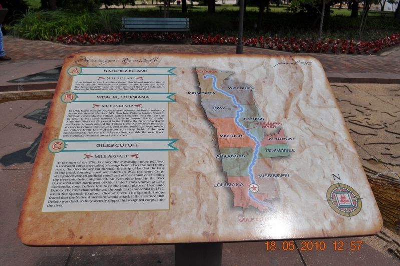
Natchez Island / Vidalia, Louisiana / Giles Cutoff
Panel # 25
Inscription.
A. Natchez Island
Mile 357.5 AHP
Now joined to the Louisiana shore, this island was the site of one of the last steamboat accidents on the Mississippi River. The Tennessee Belle was a 38-year veteran of the river trade when she caught fire and sank off the Natchez Island in 1942.
B. Vidalia, Louisiana
Mile 363.3 AHP
In 1789, Spain built an outpost here to counter the British influence across the river at Natchez, MS. Don Jose Vidal, a former Spanish Official, established a village called Concord Port on this site I 1801. It was later named Vidalia in honor of its founder. After the Giles Cutoff opened in the 1930’s, the river moved west and began to undermine the Vidalia levee. A new levee was built six blocks behind the old one, and many buildings were moved on rollers from the waterfront to safety behind the new embankment. The town’s oldest section, outside the new levee, was eventually washed away by the river.
C. Giles Cutoff
Mile 367.0 AHP
At the turn of the 20th Century, the Mississippi River followed a westward curve here called Marengo Bend. Over the next thirty years, the river slowly cut through the strip of land at the base of the bend forming a natural cutoff. In 1933, the Army Corps of Engineers dug an artificial cutoff east of the natural one to bring the river into better alignment. An even older bend in the river lies several miles northwest of Giles Cutoff. Now known as Lake Concordia, some believe this to be the burial place of Hernando DeSoto. The river channel flowed through Lake Concordia in 1542, when the Spanish Explored died of fever. The Spanish troops feared that the Native Americans would attack if they learned that DeSoto was dead, so they secretly slipped his weighted corps into the river. (Marker Number 25.)
Topics. This historical marker is listed in these topic lists: Exploration • Man-Made Features • Settlements & Settlers • Waterways & Vessels.
Location. 35° 8.968′ N, 90° 3.507′ W. Marker is in Memphis, Tennessee, in Shelby County. Marker is on Riverside Drive. Mud Island Mississippi Riverwalk. Touch for map. Marker is at or near this postal address: 125 N Front St, Memphis TN 38103, United States of America. Touch for directions.
Other nearby markers. At least 8 other markers are within walking distance of this marker. The Mississippi Riverwalk (here, next to this marker); Ohio River (here, next to this marker); Cairo, Illinois (here, next to this marker); Islands No. 2, 3, and 4 / Fort Jefferson, Kentucky / Bird’s Point, Missouri (here, next to this marker); Island No. 5 (Wolf Island)/Belmont, Missouri/Columbus, Kentucky (here, next to this marker); Donaldson Point, Missouri/Island No. 8/Hickman, Kentucky/Dorena Crevasse (here, next to this marker); New Madrid, Missouri/Cates Casting Field/Island No. 10 (here, next to this marker); Tiptonville, Tennessee/Bixby Towhead (here, next to this marker). Touch for a list and map of all markers in Memphis.
Also see . . . Vidalia, Louisiana. Vidalia was founded by Don José Vidal, when the territory was under Spanish rule, before the United States acquired it in the Louisiana Purchase of 1803. The Great Sandbar Duel, featuring Jim Bowie, is one of the stories still told by local residents. (Submitted on March 18, 2018, by Sandra Hughes Tidwell of Killen, Alabama, USA.)
Credits. This page was last revised on August 5, 2020. It was originally submitted on March 18, 2018, by Sandra Hughes Tidwell of Killen, Alabama, USA. This page has been viewed 328 times since then and 45 times this year. Photo 1. submitted on March 18, 2018, by Sandra Hughes Tidwell of Killen, Alabama, USA. • Bill Pfingsten was the editor who published this page.
