Gloucester in Essex County, Massachusetts — The American Northeast (New England)
Solomon Jacobs Landing & Park
"King of the Mackerel Killers"
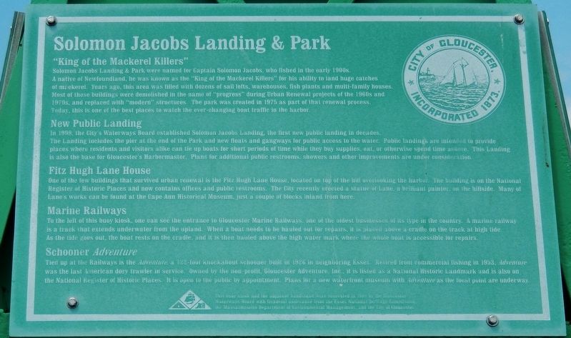
Solomon Jacobs Landing & Park were named for Captain Solomon Jacobs, who fished in the early 1900s. A native of Newfoundland, he was known as the "King of the Mackerel Killers" for his ability to land huge catches of mackerel. Years ago, this area was filled with dozens of sail lofts, warehouses, fish plants and multi-family houses. Most of those buildings were demolished in the name of "progress" during Urban Renewal projects of the 1960s and 1970s, and replaced with "modern" structures. The park was created in 1975 as part of that renewal process. Today, this is one of the best places to watch the ever-changing boat traffic in the harbor.
New Public Landing
In 1999, the City's Waterways Board established Solomon Jacobs Landing, the first new public landing in decades. The Landing includes the pier at the end of the Park and new floats and gangways for public access to the water. Public landings are to provide places where residents and visitors alike can tie up boats for short periods of time while they buy supplies, eat, or otherwise spend time ashore. This Landing is also the base tor Gloucester's Harbormaster. Plans for additional public restrooms, showers and other improvements are under consideration.
Fitz Hugh Lane House
One of the few buildings that survived urban renewal is the Fitz Hugh Lane House, located on top of the hill overlooking the harbor. The building is on the National Register of Historic Places and now contains offices and public restrooms. The City recently erected a statue of Lane, a brilliant painter, on the hillside. Many of Lane's works can be found at the Cape Ann Historical Museum, just a couple of blocks inland from here.
Marine Railways
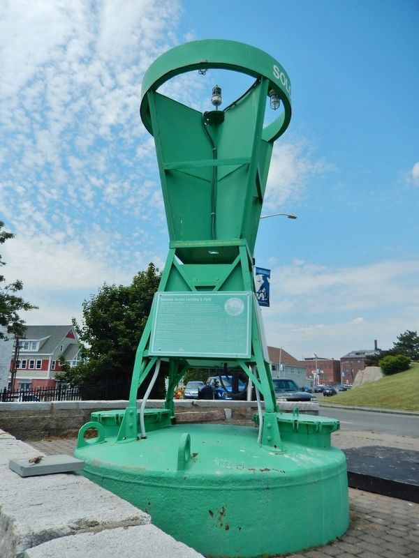
To the left of this buoy kiosk, one can see the entrance to Gloucester Marine Railways, one of the oldest businesses of its type in the country. A marine railway is a track that extends underwater from the upland. When a boat needs to be hauled out for repairs, it is placed above a cradle on the track at high tide. As the ride goes out, the boat rests on the cradle, and it is then hauled above the high water mark where the boat is accessible for repairs.
Schooner Adventure
Tied up at the Railways is the Adventure, a 122-foot knockabout schooner built in 1926 in neighboring Essex. Retired from commercial fishing in 1953, Adventure was the last American dory trawler in service. Owned by the non-profit, Gloucester Adventure, Inc., it is listed as a National Historic Landmark and is also on the National Register of Historic Places. It is open to the public by appointment. Plans for a new waterfront museum with Adventure as the focal point are underway.
This buoy kiosk and the adjacent bandstand were renovated in 1999 by the Gloucester Waterways Board with financial assistance from the Essex National Heritage Commission, the Massachusetts Department of Environmental Management, and the City of Gloucester.
Erected 1999 by Gloucester Waterways Board, Essex National Heritage Commission, Massachusetts Department of Environmental Management, and the City of Gloucester.
Topics. This historical marker is listed in these topic lists: Parks & Recreational Areas • Waterways & Vessels.
Location. 42° 36.669′ N, 70° 39.577′ W. Marker is in Gloucester, Massachusetts, in Essex County. Marker is on Harbor Loop south of Rogers Street (Massachusetts Route 127), on the right when traveling south. Marker is located in a small kiosk at the south end of Captain Solomon Jacobs Park. Touch for map. Marker is at or near this postal address: 19 Harbor Loop, Gloucester MA 01930, United States of America. Touch for directions.
Other nearby markers. At least 8 other markers are within walking distance of this marker. Dogtown & Babson Builders (a few steps from this marker); Charles Heberle (about 600 feet away, measured in a direct line); Rocky Neck (about 700 feet away); Porter Anchor (approx. 0.2 miles away); Captain Howard Blackburn (approx. 0.2 miles away); Captain Alfred (Centennial) Johnson (approx. 0.2 miles away); Admiralty Anchor (approx. 0.2 miles away); Cape Ann Granite (approx. 0.2 miles away). Touch for a list and map of all markers in Gloucester.
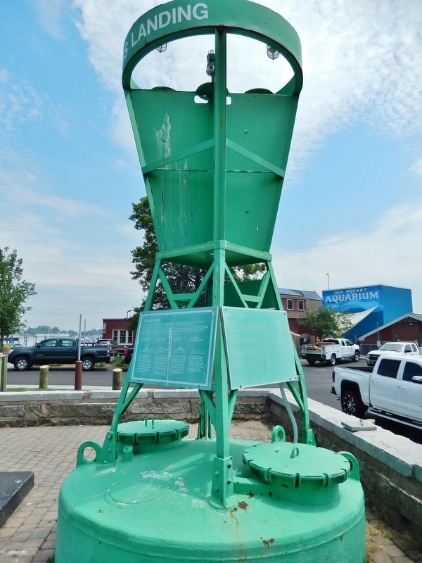
More about this marker. Marker consists of three panels:
(1) Solomon Jacobs Landing & Park,
(2) About This Buoy, and
(3) Always Ready
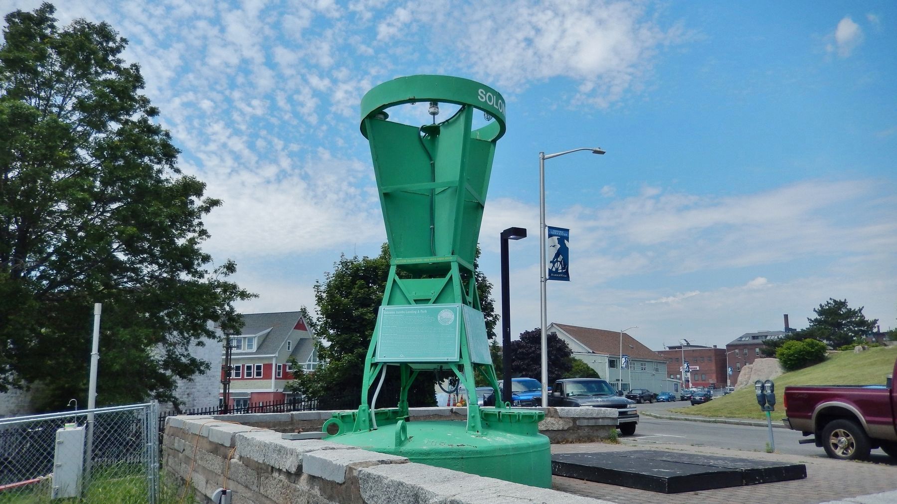
These are large, green, metal plaques mounted on each of three sides of the tall, green, retired navigation buoy.
The panels are faded and somewhat difficult to read.

Photographed By Cosmos Mariner, June 23, 2017
5. "About This Buoy" panel (enhanced readability rendition on right)
Why is it Here?
This retired navigation buoy was donated to the City of Gloucester by the U.S. Coast Guard. A veteran of many years at sea, it served as an important guide for Gloucester's fishing fleet in various locations. In 1999 The Gloucester Waterways Board converted the buoy into this landlocked guidepost to educate and inform boaters and visitors who use our Public Landings. Other buoys may be found on the City's Maritime Trail.
Shape and Color
This buoy's distinctive shape indicates that it was an especially important aid to navigation. Its green color reveals that it marked the left (port) side of a channel as boats approached from the sea.
Night and Fog
The green light at the top flashed in a distinctive pattern that could identity it from a distance at night. It also had a bell that helped to warn mariners during periods of poor visibility. The buoy's upper faceted surfaces served as excellent reflectors of radar waves transmitted by boats.
What You Don't See
Like an iceberg, much of a buoy is located below the water. The whole buoy was 26 feet long and weighed 12,000 pounds when in use. During renovation the 4,500 pound counterweight was cut off and recycled. The buoy has been buried up to the former water line to demonstrate how it would appear from a boat.
Look Around
Many similar buoys on “active duty” in the Harbor or Annisquam River can be seen from vantage points around the City.
Photographed By Cosmos Mariner, June 23, 2017
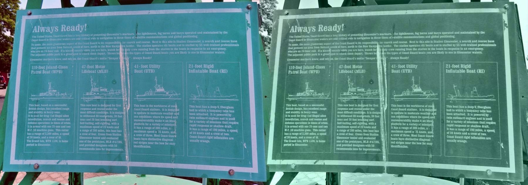
6. "Always Ready" panel (enhanced readability rendition on right)
The United States Coast Guard has a long history of protecting Gloucester's mariners. The lighthouses, fog horns and buoys operated and maintained by the Coast Guard in Gloucester waters are still critical aids to navigation in these times of satellite communications and global positioning.
To some, the more glamorous aspect of the Coast Guard is its responsibility for search and rescue. Next to this site is Station Gloucester, a search and rescue base that protects an area from Nahant, south of here, north to the New Hampshire border. The station operates six boats and is staffed by 55 well-trained professionals who are on 24-hour call. If a klaxon sounds while you are here, watch for the crew running from the station to the boats in response to an emergency. The adjacent public park is a great spot to watch them depart. Shown below are the types of Coast Guard boats you are likely to see in Gloucester waters.
Gloucester mariners know, and rely on, the Coast Guard's motto “Semper Paratus” - Always Ready!
110-foot Island-Class Patrol Boat (WPB)
This boat, based on a successful British design, has excellent range and stability in heavy seas. It is used for drug and illegal alien interdiction, search and rescue and defense operations in times of crisis. It is armed with one 25-mm and two M-2 .50 machine guns. This cutter has a range of 3,300 miles, a speed of 26 knots, and a crew of 16. The Grand Isle, WPB 1338, is home ported in Gloucester.
47-foot Motor Lifeboat (MLB)
This new boat is designed for first response and rescue under the most difficult conditions. It is design to withstand 80 knot winds, 30 foot seas and 20 foot breaking surf. Self-bailing, self-righting, with a maximum speed of 25 knots and a range of 200 miles, this boat has a crew of four. Crews from Station Gloucester tested and evaluated one of the prototypes, MLB #47205, and provided designers with 50 recommendations for improvements.
41-foot Utility Boat (UTB)
This boat is the workhorse of most Coast Guard stations. It is designed to operate in moderate weather and sea conditions where its speed and maneuverability make it an ideal platform for a variety of missions. It has a range of 300 miles, a maximum speed of 25 knots, and a crew of three. Most Coast Guard boats have distinctive diagonal red stripes near the bow for easy identification.
21-foot Rigid Inflatable Boat (RI)
This boat has a deep-V, fiberglass hull to which a buoyancy tube has been attached. It is powered by twin outboard engines and is used for a variety of missions that require rapid response or shallow draft. It has a range of 100 miles, a speed of 38 knots and a crew of two. Coast Guard rigid inflatables are usually orange.
Credits. This page was last revised on March 26, 2018. It was originally submitted on March 26, 2018, by Cosmos Mariner of Cape Canaveral, Florida. This page has been viewed 900 times since then and 119 times this year. Photos: 1, 2, 3, 4, 5, 6. submitted on March 26, 2018, by Cosmos Mariner of Cape Canaveral, Florida. • Andrew Ruppenstein was the editor who published this page.
