Bald Head Island in Brunswick County, North Carolina — The American South (South Atlantic)
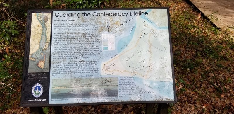
Guarding the Confederacy Lifeline
Why Put a Fort on Bald Head?
The geography of the Cape Fear made it difficult for Union blockading ships to halt commerce vessels, called blockade-runners, from smuggling military supplies in and cotton out of Wilmington. Two ocean inlets—Old Inlet at the mouth of the Cape Fear River, and New Inlet five miles to the north—provided blockade runners with two access points to the harbor. Bald Head Island and Frying Pan Shoals separated the two entrances.
The key to controlling the inlets and Wilmington was Bald Head Island. An intricate system of Confederate defenses was designed and built under the direction of Major General W.H.C. Whiting. Fort Holmes on Bald Head Island and Fort Caswell on Oak Island guarded Old Inlet, while Fort Fisher safeguarded New Inlet. Fort Johnson at Smithville and Fort Anderson at Brunswick Point protected the river approaches to Wilmington.
At the height of its occupation in 1864 Fort Holmes, named for Lieutenant General Theophilus H. Holmes of North Carolina, was garrisoned by more than 1,100 Confederate soldiers. They evacuated Fort Holmes on January 16, 1865, the day after Union forces captured Fort Fisher. In the process, they destroyed barracks, storehouses, and cannons. The lighthouse was left untouched. Union forces occupied Bald Head Island three days later.
—Chris E. Fonvielle, Jr.
(captions)
Nothing stays the same on a coastal Barrier Island. The forces of nature continuously shift the places where the water and land meet causing portions of Fort Holmes to be covered by sand debris and even water as early as 1870s. This map shows Fort in the 1860s against the island as we know it today.
See if you can find Old Baldy!
Blockading fleet of Wilmington, Old Inlet first Illustrated Weekly 1864
Courtesy of New Hanover County Public Library
Erected by Old Baldy Foundation.
Topics. This historical marker is listed in these topic lists: Forts and Castles • War, US Civil. A significant historical date for this entry is January 16, 1865.
Location. 33° 52.334′ N, 77° 59.985′ W. Marker is on Bald Head Island, North Carolina, in Brunswick County. Marker is on Light House Wynd north of North Bald Head Wynd, on the left when traveling north. Touch for map. Marker is in this post office area: Southport NC 28461, United States of America. Touch for directions.
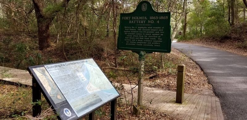
Other nearby markers. At least 8 other markers are within 3 miles of this marker, measured as the crow flies. Fort Holmes, 1863-1865 Battery No. 4 (here, next to this marker); Fort Holmes, 1863-1865 Encampment Site (about 500 feet away, measured in a direct line); Revolutionary War Fort (about 500 feet away); Fort Holmes, 1863-1865 Battery Holmes (approx. ¼ mile away); Fort Holmes, 1863-1865 Batteries No. 1 and No. 2 (approx. half a mile away); Confederate Blockade Runner Ella (approx. 0.9 miles away); Captain Charlie’s Station (approx. 2.6 miles away); Generator House (approx. 2.6 miles away). Touch for a list and map of all markers in Bald Head Island.
Also see . . . Welcome to Old Baldy. Old Baldy Foundation (Submitted on April 1, 2018.)
Credits. This page was last revised on January 31, 2021. It was originally submitted on April 1, 2018, by Charles Keller of Myrtle Beach, South Carolina. This page has been viewed 340 times since then and 11 times this year. Last updated on January 30, 2021, by Bradley Owen of Morgantown, West Virginia. Photos: 1, 2. submitted on April 1, 2018, by Charles Keller of Myrtle Beach, South Carolina. • J. Makali Bruton was the editor who published this page.

