Funkstown in Washington County, Maryland — The American Northeast (Mid-Atlantic)
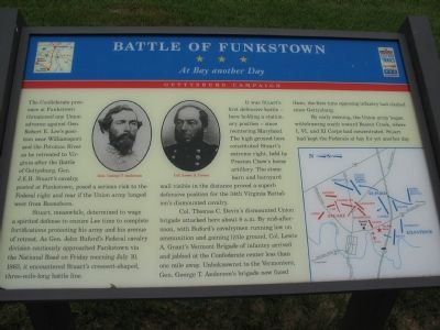
Battle of Funkstown
At Bay another Day
— Gettysburg Campaign —
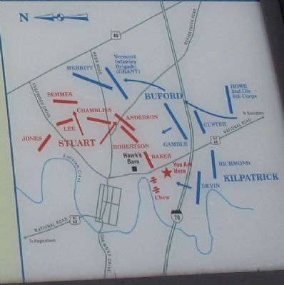
Stuart, meanwhile, determined to wage a spirited defense to ensure Lee time to complete fortifications protecting his army and his avenue of retreat. As Gen. John Buford’s Federal cavalry division cautiously approached Funkstown via the National Road on Friday morning July 10, 1863, it encountered Stuart’s crescent-shaped, three-mile-long battle line.
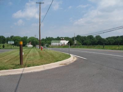
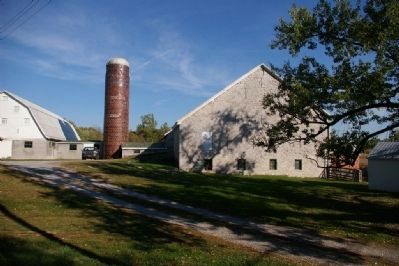
It was Stuart’s first defensive battle – here holding a stationary position – since reentering Maryland. The high ground here constituted Stuart’s extreme right, held by Preston Chew’s horse artillery. The stone barn and barnyard wall visible in the distance proved a superb defensive position for the 34th Virginia Battalion’s dismounted cavalry.
Col. Thomas C. Devin’s dismounted Union brigade attacked here about 8 a.m. By mid-afternoon, with Buford’s cavalrymen running low on ammunition and gaining little ground, Col. Lewis A. Grant’s Vermont Brigade of infantry arrived and jabbed at the Confederate center less than one mile away. Unbeknownst to the Vermonters, Gen. George T. Anderson’s brigade now faced them, the first time opposing infantry had clashed since Gettysburg.
By early evening, the Union army began withdrawing south towards Beaver Creek, where I, VI, and XI Corps had concentrated. Stuart had kept the Federals at bay for yet another day.
Topics and series. This historical marker is listed in this topic list: War, US Civil. In addition, it is included in the Maryland Civil War Trails series list. A significant historical date for this entry is July 10, 1892.
Location. 39° 36.033′ N, 77° 42.183′ W. Marker is in Funkstown, Maryland, in Washington County. Marker is on Old National Road (U.S. Alt 40), on the right when traveling south. Touch for map. Marker is in this post office area: Funkstown MD 21734, United States of America. Touch for directions.
Other nearby markers. At least 8 other markers are within walking distance of this marker. A different marker also named Battle of Funkstown (approx. 0.4 miles away); Claggett's Mill Bridge (approx. half a mile away); Claggett’s Millrace Bridge (approx. half a mile away); This Plot is Dedicated to Public Use (approx. 0.6 miles away); Keller Home (approx. 0.6 miles away); Baltimore Street (approx. 0.6 miles away); Civil War Hospital Site (approx. ¾ mile away); Veterans Memorial (approx. 0.8 miles away). Touch for a list and map of all markers in Funkstown.
More about this marker. Marker also displays pictures of Gen. George T. Anderson and Col. Lewis A. Grant, in addition to a map of the battlefield.
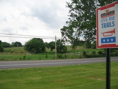
Additional keywords. Maryland Civil War Trails
Credits. This page was last revised on June 16, 2016. It was originally submitted on June 14, 2007, by Craig Swain of Leesburg, Virginia. This page has been viewed 6,220 times since then and 86 times this year. Photos: 1, 2, 3, 4. submitted on June 14, 2007, by Craig Swain of Leesburg, Virginia. 5. submitted on March 10, 2008, by Christopher Busta-Peck of Shaker Heights, Ohio. • J. J. Prats was the editor who published this page.
