Jenner in Sonoma County, California — The American West (Pacific Coastal)
Welcome to Fort Ross
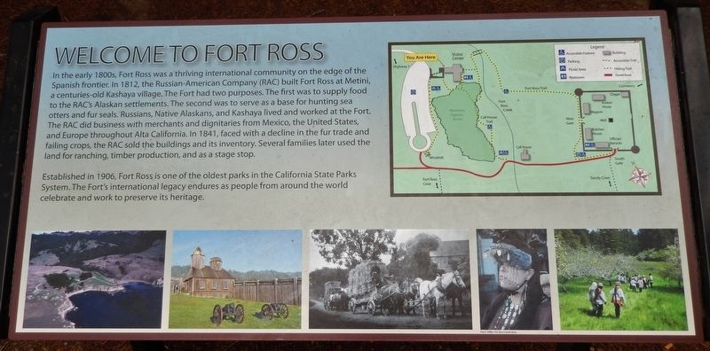
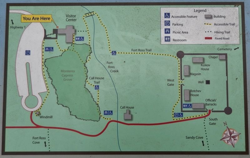
In the early 1800s, Fort Ross was a thriving international community on the edge of the Spanish frontier. In 1812, the Russian-American Company (RAC) built Fort Ross at Metini, a centuries-old Kashaya village. The Fort had two purposes. The first was to supply food to the RAC's Alaskan settlements. The second was to serve as a base for hunting sea otters and fur seals. Russians, Native Alaskans, and Kashaya lived and worked at the Fort. The RAC did business with merchants and dignitaries from Mexico, the United States, and Europe throughout Alta California. In 1841, faced with a decline in the fur trade and failing crops, the RAC sold the buildings and its inventory. Several families later used the land for ranching, timber production, and as a stage stop.
Established in 1906, Fort Ross is one of the oldest parks in the California State Parks System. The Fort's international legacy endures as people from around the world celebrate and work to preserve its heritage.
Topics. This historical marker is listed in these topic lists: Forts and Castles • Native Americans • Settlements & Settlers. A significant historical year for this entry is 1812.
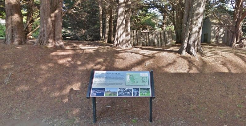
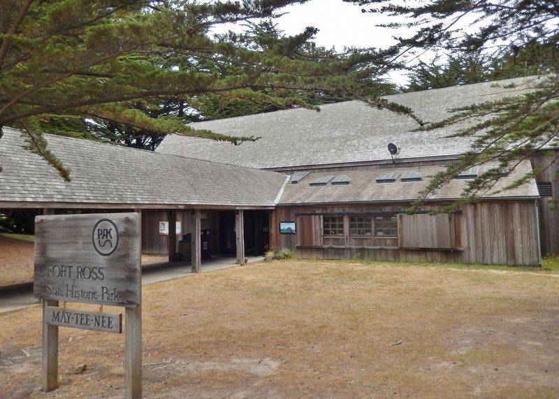
Location. 38° 30.972′ N, 123° 14.774′ W. Marker is in Jenner, California, in Sonoma County. Marker can be reached from Fort Ross Road south of Coast Highway (California Route 1). Marker is located near the Fort Ross State Historic Park main parking lot, by the Visitor Center entrance. Touch for map. Marker is in this post office area: Jenner CA 95450, United States of America. Touch for directions.
Other nearby markers. At least 8 other markers are within walking distance of this marker. Fort Ross (within shouting distance of this marker); California's First Windmill (about 400 feet away, measured in a direct line); re-creating the Fort Ross Windmill (about 600 feet away); The Call Family Residence (about 800 feet away); The Russian Village Site - Sloboda (approx. 0.2 miles away); The Native Alaskan Village (approx. 0.2 miles away); Sandy Beach Cove (approx. 0.2 miles away); Fort Ross Chapel (approx. 0.2 miles away). Touch for a list and map of all markers in Jenner.
Also see . . .
1. History of the Russian Settlement at Fort Ross, California.
For the small group of California natives, that cool, overcast day in March 1812 was a forerunner of massive change. They stood there in astonishment as a large sailing ship came to anchor in the little cove beneath their quiet bluff top settlement. For the next few days, they continued to watch as some twenty-five Russians and eighty Alaskans came ashore, set up a temporary camp, and began building houses and a sturdy wooden stockade - the colony and fortification of Ross. The Kashaya people assembled to watch the spectacle had no way of knowing that their hunting and gathering lifestyle would be changed forever. These Russians had come to hunt sea otter, to grow wheat and other crops for the Russian settlements in Alaska, and to trade with Spanish California. (Submitted on April 5, 2018, by Cosmos Mariner of Cape Canaveral, Florida.)
2. Establishment of the California Settlement.
On August 30, 1812 (in the old style Russian calendar), the name-day of Tsar Alexander I, the Russians held a special religious service at the colony, marking the completion of the stockade. The stockade was built of redwood, much in the same configuration as seen today. Two blockhouses with cannon ports were constructed at the northwest and southeast corners of the stockade. The northwest blockhouse had seven sides and the southeast one had eight, each structure being two stories high. Between twelve and forty cannons were placed within the stockade and blockhouses. (Submitted on April 5, 2018, by Cosmos Mariner of Cape Canaveral, Florida.)
3. Russians establish Fort Ross.
Fort Ross, proved unable to fulfill either of its expected functions for very long. By the 1820s, the once plentiful sea otters in the region had been hunted almost to extinction. Likewise, the colonists’ attempts at farming proved disappointing, because the cool foggy summers along the coast made it difficult to grow the desired fruits and grains. Potatoes thrived, but they could be grown just as easily in Alaska. Disappointed with the commercial potential of the Fort Ross settlement and realizing they had no realistic chance of making a political claim for the region, the Russians decided to sell out. After making unsuccessful attempts to interest both the British and Mexicans in the fort, the Russians finally found a buyer in John Sutter. An American emigrant to California, Sutter bought Fort Ross in 1841 with an unsecured note for $30,000 that he never paid. (Submitted on April 5, 2018, by Cosmos Mariner of Cape Canaveral, Florida.)
Photographed By Cosmos Mariner, July 11, 2014
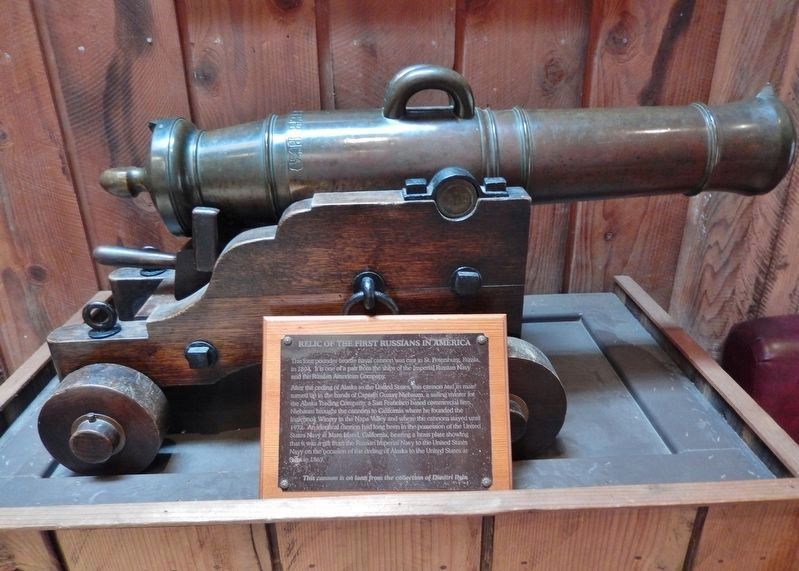
5. Relic of the First Russians in America (located inside Visitor Center)
This four pounder bronze naval cannon was cast in St. Petersburg Russia, in 1804.
It is one of a pair from the ships of the Imperial Russian Navy and the Russian American Company.
After the ceding of Alaska to the United States, this cannon and its mate turned up in the hands of Captain Gustav Niebaum, a sailing master for the Alaska Trading Company, a San Francisco based commercial firm. Niebaum brought the cannons to California where he founded the Inglenook Winery in the Napa Valley and where the cannons stayed until 1972. An identical cannon had long been in the possession of the United States Navy at Mare Island, California, bearing a brass plate showing that it was a gift from the Russian Imperial Navy to the United States Navy on the occasion of the ceding of Alaska to the United States at Sitka in 1867.
This cannon is on load from the collection of Dimitri Ilyin
Photographed By Cosmos Mariner, July 11, 2014
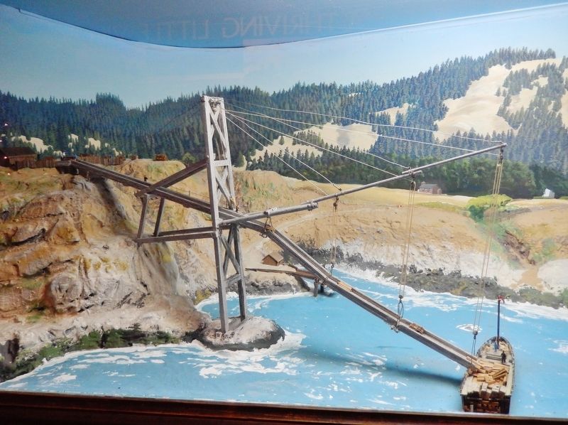
6. Fort Ross Loading Chute Diorama (located inside Visitor Center)
This diorama depicts the Fort Ross loading chute which was used from 1868 to 1898.
It was built by James Dixon when he and his partner Charles Fairfax owned Fort Ross from 1867 to 1873. Lumber, tan oak bark, and later firewood and split stakes, were shipped to San Francisco. Cargo was transferred from the marine terrace down to sailing schooners anchored in the cove north of the fort. The chute was flexible so it could be raised or lowered by means of ropes and pulleys.
In December of 1898 the Fort Ross chute collapsed in a bad storm, and was replaced with a different loading arrangement by George W. Call, the owner at that time. Similar chutes were built and used in other small coves, known as "dogholes," along the California North Coast. Each chute was adapted to the conditions of its particular location. Travel by land was difficult, and the sea served as the highway along the coast during the 1860's, 70's and 80's. The Fort Ross cove had deeper water and more shelter from the prevailing winds than any other cove between San Francisco and Eureka, and was a busy small harbor.
Diorama by Ben Cummings
Chute Model by George Call Pearce & John W. Stafford
Credits. This page was last revised on April 6, 2018. It was originally submitted on April 5, 2018, by Cosmos Mariner of Cape Canaveral, Florida. This page has been viewed 298 times since then and 29 times this year. Photos: 1, 2, 3, 4, 5, 6. submitted on April 5, 2018, by Cosmos Mariner of Cape Canaveral, Florida. • Andrew Ruppenstein was the editor who published this page.
