Salida in Chaffee County, Colorado — The American Mountains (Southwest)
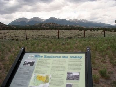
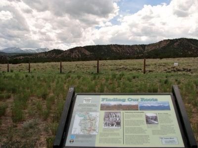
Finding Our Roots / New Faces Along the River / Pike Explores the Valley
Marker A:
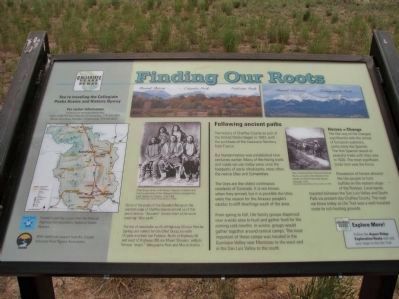
Following ancient paths
The history of Chaffee County as part of the United States began in 1803, with the purchase of the Louisiana Territory from France.
But human history was established here centuries earlier. Many of the hiking trails and roads we use today were once the footpaths of early inhabitants, most often the native Utes and Comanches.
The Utes are the oldest continuous residents of Colorado. It is not known when they arrived, but it is possible the Utes were the reason for the Anasazi people’s exodus to cliff dwellings south of the area.
From spring to fall, Ute family groups dispersed over a wide area to hunt and gather food for the coming cold months. In winter, groups would gather together around central camps. The most important of these camps was located in the Gunnison Valley near Montrose to the west and in the San Luis Valley to the south.
Horses = Change
The Ute way of life changed significantly with the arrival of European explorers, particularly the Spanish. The first Spanish record of peaceful trades with the Utes was in 1626. The most significant trade item was the horse.
Possession of horses allowed the Ute people to hunt buffalo on the eastern slope of the Rockies. Local bands traveled between the San Luis Valley and South Park via present day Chaffee County. The road we know today as Ute Trail was a well traveled route to rich hunting grounds.
Marker B:
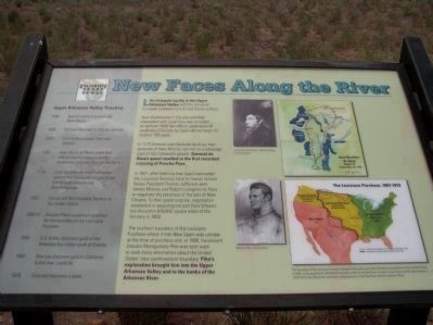
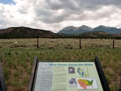
Life changed rapidly in the Upper Arkansas River Valley with the arrival of European explorers and the United States settlers.
Spanish presence in the area and thier interaction with local Utes was recorded as early as 1626, but official exploration of southwest Colorado by Spain did not begin for another 150 years.
In 1779 General Juan Bautista de Anza, then governor of New Mexico, set out on a campaign against the Comanche people. General de Anza's quest resulted in the first recorded crossing of Poncha Pass.
The southern boundary of the Louisiana Purchase where it met New Spain was unclear at the time of purchase and, in 1806, Lieutenant Zelubon Pike was sent west to seek more information about the United States' new southwestern boundary. Pike's exploration brought him into the Upper Arkansas Valley and to the banks of the Arkansas River.
Marker C:
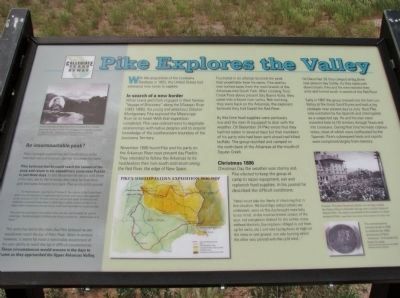
With the acquisition of the Louisiana Purchase in 1803, the United States had extensive new lands to explore.
In search of a new border
While Lewis and Clark engaged in their
Photographed By Cosmos Mariner
2. Finding Our Roots Marker - A
Some of the peaks of the Sawatch Range on the western edge of Chaffee County remind us of this area’s history. “Sawatch” derives from a Ute word meaning “blue earth.”
The trio of mountains south of Highway 50 near Poncha Springs are named for Ute Chief Ouray, his wife Chipeta and their son Pahlone. North of Highway 50 and west of Highway 285 are Mount Shavano, with its famous “angel,” Taberguache Peak and Mount Antero.
November 1806 found Pike and his party on the Arkansas River near present day Pueblo. They intended to follow the Arkansas to its headwaters then turn south and return along the Red River, the edge of New Spain.
Frustrated in an attempt to climb the peak that would later bear his name, Pike and his men turned away from the main branch of the Arkansas into South Park. After crossing Trout Creek Pass above present day Buena Vista, they came into a broad river valley. Not realizing they were back on the Arkansas, the explorers believed they had found the Red River.
By this time food supplies were perilously low and the men ill-equipped to deal with the weather. On December 24 Pike wrote that they had not eaten in several days but the members of his party who had been sent ahead had killed buffalo. The group reunited and camped on the north bank of the Arkansas at the mouth of Squaw Creek.
Christmas 1806
Christmas Day the weather was stormy and Pike elected to keep the group at camp to repair equipment, eat and replenish food supplies. In his journal he described the difficult conditions:
“Here I must take the liberty of observing that in this situation, the hardships and privations we underwent, were on this day brought more fully to our mind… in the most inclement season of the year; not one person clothed for the winter, many without blankets, (having been obliged to cut them up for socks, etc.) and now laying down at night on the snow or wet ground; one side burning whilst the other was pierced with the cold wind…”
On December 26 they camped at Big Bend near present day Salida. As they continued downstream, Pike and his men realized their error and turned south in search of the Red River.
Early in 1807 the group crossed into the San Luis Valley at the Great Sand Dunes and built a log stockade near present day La Jara. Here Pike was overtaken by the Spanish and interrogated as a suspected spy. He and his men were escorted back to US territory through Texas and into Louisiana. During that time he made copious notes, most of which were confiscated by the Spanish. Pike’s subsequent book and reports were completed largely from memory.
Erected by Federal Highway Administration and Greater Arkansas River Association.
Topics. This historical marker is listed in these topic lists: Exploration • Native Americans • Settlements & Settlers. A significant historical month for this entry is November 1806.
Location. 38° 35.522′ N, 106° 5.096′ W. Marker is in Salida, Colorado, in Chaffee County. Marker is on U.S. 285, on the right when traveling south. Touch for map. Marker is in this post office area: Salida CO 81201, United States of America. Touch for directions.
Other nearby markers. At least 8 other markers are within 14 miles of this marker, measured as the crow flies. Christmas 1806 (a few steps from this marker); The Jackson Hotel (approx. 5˝ miles away); The Salida Steam Plant (approx. 6.3 miles away); Chaffee County Honor Roll Board (approx. 6.4 miles away); Peaks to Pastures (approx. 8.3 miles away); Valley Ranching (approx. 8.3 miles away); Whose Water Is It? (approx. 8.3 miles away); Lt. Zebulon Pike's Southwestern Expedition (approx. 13.4 miles away). Touch for a list and map of all markers in Salida.
Credits. This page was last revised on November 22, 2020. It was originally submitted on January 4, 2014, by Cosmos Mariner of Cape Canaveral, Florida. This page has been viewed 936 times since then and 15 times this year. Last updated on April 9, 2018, by Cosmos Mariner of Cape Canaveral, Florida. Photos: 1, 2, 3, 4, 5, 6. submitted on November 28, 2013, by Cosmos Mariner of Cape Canaveral, Florida. • Andrew Ruppenstein was the editor who published this page.
