Jacksonville in Pulaski County, Arkansas — The American South (West South Central)
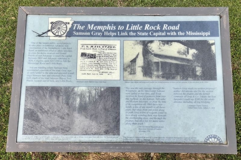
The Memphis to Little Rock Railroad
Samson Gray Helps Link the State Capital with the Mississippi
One of the largest public works projects to take place in territorial Arkansas was construction of the Memphis to Little Rock Road, an ambitious effort to allow travelers to cross the dense swamps and Grand Prairie of east Arkansas to reach the capital. Between 1824 and Arkansas statehood in 1836, Congress spent $267,000 to link the Mississippi River and Little Rock.
You are standing where Samson Gray constructed a portion of the road. Gray was an early settler in the area and operated a mail stage between here and Arkansas Post. Gray built much of the road between Bayou Two Prairie, located east of here, and Little Rock.
"This was the only passage through the Wilderness, as the Mississippi bottoms were called at that time, and Texas received its flood of pioneers from over this highway, as did Kansas, Nebraska and Western Missouri, so from the time of its completion till 1860 there was hardly a day of any month in all those years, but what, from any point along its path, long trains of wagons could be seen slowly wending their way beneath the overhanging trees, and through the swamps that often lay for many miles along their track."
-The Goodspeed Biographical and Historical Memoirs of Eastern
Arkansas, 1890
Samson Gray made no written proposal neither did anyone else for the section between the prairie and the former contracts of Gray & Co. I made the best bargain I could say $500 for the whole distance including all log bridging."
-Lieutenant Charles Thomas, United States Army, January 4, 1828
Erected by the Arkansas Humanities Council and the Department of Arkansas Heritage, the Arkansas Historic Preservation and Reed's Bridge Battlefield Preservation Society.
Topics. This historical marker is listed in these topic lists: Natural Features • Roads & Vehicles. A significant historical date for this entry is January 4, 1828.
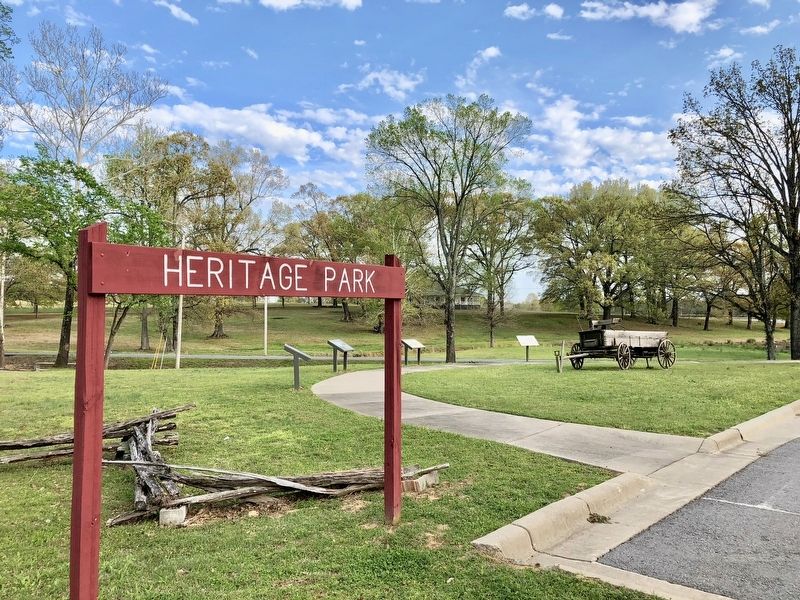
Location. 34° 51.135′ N, 92° 6.796′ W. Marker is in Jacksonville, Arkansas, in Pulaski County. Marker can be reached from the intersection of East Trickey Lane and Military Road. Located within Heritage Park. Touch for map. Marker is at or near this postal address: 300 East Trickey Lane, Jacksonville AR 72076, United States of America. Touch for directions.
Other nearby markers. At least 8 other markers are within walking distance of this marker. The Trail of Tears through Jacksonville (here, next to this marker); They Passed This Way (a few steps from this marker); The Brigade Moved Forward (a few steps from this marker); Memphis Military Road (within shouting distance of this marker); Shared Gray Jacob Gray
(within shouting distance of this marker); Battle of Reed's Bridge (within shouting distance of this marker); Our Batteries Opened a Tremendous Fire (approx. 0.4 miles away); A Gallant Charge (approx. half a mile away). Touch for a list and map of all markers in Jacksonville.
Also see . . . Encyclopedia of Arkansas History & Culture - The Memphis and Little Rock Railroad. (Submitted on April 18, 2018, by Mark Hilton of Montgomery, Alabama.)
Credits. This page was last revised on October 9, 2021. It was originally submitted on April 18, 2018, by Mark Hilton of Montgomery, Alabama. This page has been viewed 302 times since then and 23 times this year. Photos: 1, 2. submitted on April 18, 2018, by Mark Hilton of Montgomery, Alabama.

