Near Garysville in Prince George County, Virginia — The American South (Mid-Atlantic)
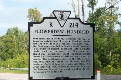
Flowerdew Hundred
Erected 2005 by Department of Historic Resources. (Marker Number K-214.)
Topics and series. This historical marker is listed in these topic lists: Colonial Era • War, US Civil • Wars, US Indian. In addition, it is included in the Virginia Department of Historic Resources (DHR) series list. A significant historical year for this entry is 1619.
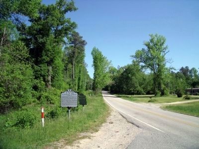
Location. 37° 14.869′ N, 77° 9.009′ W. Marker is near Garysville, Virginia, in Prince George County. Marker is at the intersection of James River Drive (Virginia Route 10) and Flowerdew Hundred Road (County Route 639), on the right when traveling west on James River Drive . Touch for map. Marker is in this post office area: Hopewell VA 23860, United States of America. Touch for directions.
Other nearby markers. At least 8 other markers are within 5 miles of this marker, measured as the crow flies. Powell's Creek (a few steps from this marker); The Cattle Raid (approx. 2.1 miles away); Merchant's Hope Church (approx. 3 miles away); Westover (approx. 4.4 miles away); Westover Plantation (approx. 4.4 miles away); Richmond Condita (approx. 4.4 miles away); Hood's (approx. 4.4 miles away); Capt. John Woodliffe (approx. 4.8 miles away).
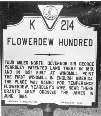
More about this marker. This marker replaced a 1948 marker with the same name and number which read, “Four miles north, Governor Sir George Yeardley patented land there in 1619, and in 1621 built at windmill point the first windmill in English America. The place was named for Temperance Flowerdew, Yeardley’s wife. Near there Grant’s army crossed the James in June, 1864.”
Also see . . . Wikipedia Entry for George Yeardley. “It is often assumed that Yeardley named this plantation “Flowerdew Hundred” after his wife, as a kind of romantic tribute. However, the land appears to have been in use by Stanley Flowerdew, Yeardley’s brother-in-law, before it was patented by Yeardley, so the plantation may have been associated with the Flowerdew name before Yeardley’s patent. Note that Yeardley named his Mulberry Island plantation “Stanley Hundred,” undoubtedly after his Stanley in-laws. In other words, both of Yeardley's plantations were named in honor of his wealthy in-laws.” (Submitted on September 13, 2011, by J. J. Prats of Powell, Ohio.)
Credits. This page was last revised on June 16, 2016. It was originally submitted on September 21, 2008, by Kathy Walker of Stafford, Virginia. This page has been viewed 2,237 times since then and 70 times this year. Photos: 1. submitted on September 21, 2008, by Kathy Walker of Stafford, Virginia. 2. submitted on September 13, 2011, by J. J. Prats of Powell, Ohio. 3. submitted on April 29, 2010, by Bernard Fisher of Richmond, Virginia. • Craig Swain was the editor who published this page.


