Tellico Plains in Monroe County, Tennessee — The American South (East South Central)
The Tennessee Overhill Experience
From Furs to Factories
Early Iron and Logging Industries
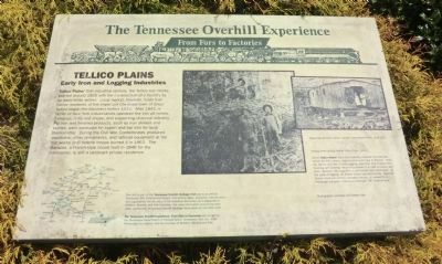
Tellico Plains’ first industrial venture, the Tellico Iron Works, started around 1825 with the construction of a foundry by an early white settler. Local legend, however, holds that native residents of the important Cherokee town of Great Tellico began the bloomery before 1812. After 1843, a family of New York industrialists operated the iron pit mines, furnaces, mills and shops, and supporting charcoal industry. Pig iron and finished products, such as iron skillets and kettles, were produced for export and bar iron for local blacksmiths. During the Civil War, Confederates produced munitions and other armaments, and railroad equipment at the iron works until federal troops burned it in 1863. The Mansion, a French-style house built in 1846 for the ironmaster, is still a landmark private residence.
(captions)
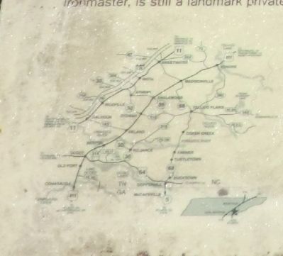
(lower right)This site is part of the Tennessee Overhill Heritage Trail and is an official Tennessee 200 Bicentennial Project. Interpretive signs, museums, historic sites and a guidebook tell the story of the industrial Revolution as it happened in McMinn, Monroe, and Polk Counties. For more information concerning other sites, contact the Tennessee Overhill Heritage Association at 423-263-7232
The Tennessee Overhill Experience: From Furs to Factories was funded by the Tennessee Department of Transportation; Tennessee 200, Inc; East Tennessee Foundation; and the counties of McMinn, Monroe, and Polk.
(upper center) Felling trees at Big Fodder Stack Cave, 1918
While Tellico Plains’ early iron industry required considerable timber for fuel, nearby virgin forests continued to flourish. From the 1870s until the 1920s, logging sawmills, and related wood finishing and tanning industries ushered in a cash economy and jobs; however, the magnificent, old forests were destroyed. At peak of logging, 40 timber crews operated locally. Babcock Street, lined with former company houses, is named for a Pittsburg company that once employed 700 workers here.
(upper right) Mess Hall at Tellico River Lumber Camp near Citico, circa 1915.
Photographs courtesy of Charles Hall
Erected by The Tennessee Overhill Heritage Association.
Topics and series. This historical marker is listed in these topic lists: Industry & Commerce • Settlements & Settlers • War, US Civil. In addition, it is included in the A Tennessee Overhill Experience - From Furs to Factories series list. A significant historical year for this entry is 1825.
Location. 35° 22.03′ N, 84° 17.968′ W. Marker is in Tellico Plains, Tennessee, in Monroe County. Marker is on Cherohola Skyway (Tennessee Route 165) east of Hunt Street, on the left when traveling east. The marker is located in front of the Tellico Plains Public Library. Touch for map. Marker is at or near this postal address: 209 Cherohola Skyway, Tellico Plains TN 37385, United States of America. Touch for directions.
Other nearby markers. At least 8 other markers are within 8 miles of this marker, measured as the crow flies. Boyhood Home of Ray H. Jenkins (a few steps from this marker); Fort Loudoun Massacre (a few steps from this marker); Cherokee Heritage Trails (about 700 feet away, measured in a direct line); Tellico Iron Works (about 700 feet away); Scott Mansion (approx. 1.4 miles away); Early Gold Mining (approx. 7˝ miles away); Unicoi Turnpike Trail (approx. 7˝ miles away); Gold Mining at Coker Creek (approx. 7˝ miles away). Touch for a list and map of all markers in Tellico Plains.
Related markers. Click here for a list of markers that are related to this marker. The Tennessee Overhill Experience
Also see . . . Tennessee Overhill Heritage Association (TOHA). (Submitted on July 16, 2014.)
Credits. This page was last revised on April 26, 2018. It was originally submitted on July 16, 2014, by Don Morfe of Baltimore, Maryland. This page has been viewed 636 times since then and 41 times this year. Last updated on April 26, 2018, by Cosmos Mariner of Cape Canaveral, Florida. Photos: 1, 2, 3. submitted on July 16, 2014, by Don Morfe of Baltimore, Maryland. • Andrew Ruppenstein was the editor who published this page.


