Wallisville in Chambers County, Texas — The American South (West South Central)
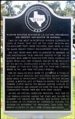
Mission Nuestra Senora de la Luz del Orcoquisac and Presidio San Agustin de Ahumada
Inscription.
Two of the most misfortune-ridden outposts of Spain in Texas, “Our Lady of the Light” mission and its auxiliary fort, were founded near here in 1756 to guard against French encroachment from the east.
The two friars who were to minister to members of the Orcoquisac tribe arrived shortly after the 30 soldiers who were to man the fort. Soon, however, the elder friar died. The younger, asking to be relieved of his duties, complained vividly of biting insects, extremes of heat and cold, and the thick and stinking water in the lake near the lonely mission.
The 50 families who were to establish a town at the site never arrived, and although valiant efforts were made at improvement, conditions instead became worse. A woeful lack of training among the soldiers sparked unrest among the Indians. Meager supplies of food, clothing, and ammunition were the rule, and some commanders treated their men with great cruelty.
In 1767, an official inspector reported that due to the terrain, discord among the staff, and failure to convert the Indians, the presidio and mission should be closed. In 1771, fearing an invasion of Apaches, the authorities withdrew the personnel, and these two remote outposts of Spain were totally abandoned.
Erected 1970 by Texas Historical Commission . (Marker Number 9128.)
Topics. This historical marker is listed in these topic lists: Churches & Religion • Forts and Castles • Native Americans • Settlements & Settlers. A significant historical year for this entry is 1756.
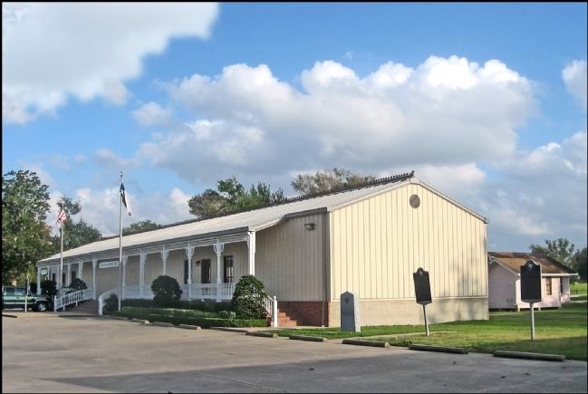
Location. 29° 50.303′ N, 94° 44.177′ W. Marker is in Wallisville, Texas, in Chambers County. Marker is on Feeder Road to Interstate 10, 0.3 miles west of Wallisville Liberty Road, on the right when traveling east. Marker may be visible from Interstate-10 but best viewed from the eastbound feeder road. Touch for map. Marker is at or near this postal address: 20136 I-10, Wallisville TX 77597, United States of America. Touch for directions.
Other nearby markers. At least 8 other markers are within 6 miles of this marker, measured as the crow flies. Joseph Blancpain's French Trading Post (here, next to this marker); Mission Nuestra Señora de la Luz (here, next to this marker); Site of Old Wallisville (within shouting distance of this marker); Wallisville Cemetery (approx. ¾ mile away); St. Emily Methodist Church (approx. 4.8 miles away); Turtle Bayou Resolutions (approx. 5 miles away); Chambers County Youth Project Show (approx. 5.2 miles away); Lone Star Canal (approx. 5½ miles away). Touch for a list and map of all markers in Wallisville.
Also see . . .
1. A Report on this Mission and Area by University of Texas Archeology (pdf file).
(Submitted on October 15, 2012, by Jim Evans of Houston, Texas.)
2. The Mission in The Handbook of Texas. (Submitted on October 15, 2012, by Jim Evans of Houston, Texas.)
3. Article on the Mission by Stephen F. Austin University Heritage. (Submitted on October 15, 2012, by Jim Evans of Houston, Texas.)
4. El Orcoquisac in The Handbook of Texas. (Submitted on October 15, 2012, by Jim Evans of Houston, Texas.)
Credits. This page was last revised on May 8, 2018. It was originally submitted on October 15, 2012, by Jim Evans of Houston, Texas. This page has been viewed 1,014 times since then and 33 times this year. Last updated on May 7, 2018, by Brian Anderson of Humble, Texas. Photos: 1, 2. submitted on October 15, 2012, by Jim Evans of Houston, Texas. • Bernard Fisher was the editor who published this page.

