Ezequiel Montes, Querétaro, Mexico — The Central Highlands (North America)
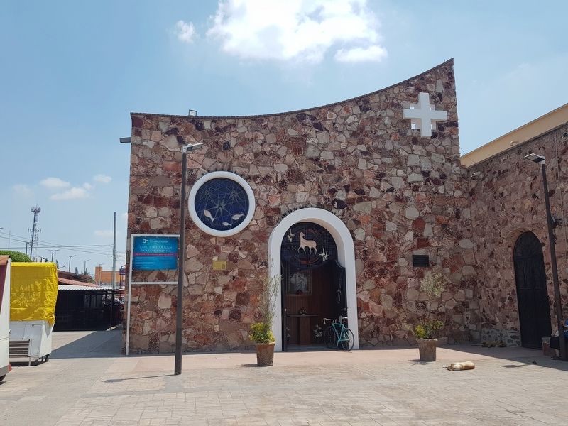
The Parish of Divine Providence
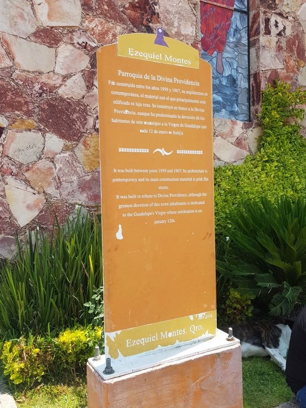
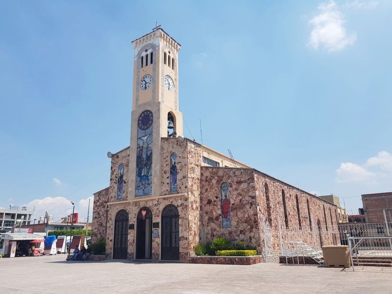
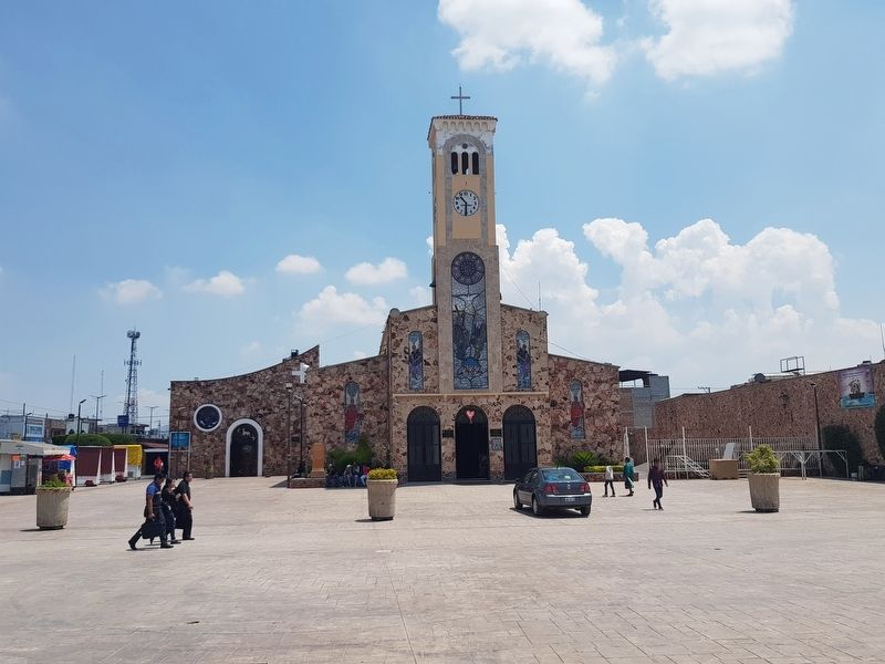
Fue construída entre los años 1959 y 1967, su arquitectura es contemporánea, el material con el que principalmente esta edificada es laja rosa. Se construyó en honor a la Divina Providencia, aunque ha predominado la devoción de los habitantes de este municipio a la Virgen de Guadalupe que cada 12 de enero se festeja.
It was built between years 1959 and 1967. Its architecture is contemporary and its main construction material is pink flat Stone. It was built in tribute to Divine Providence, although the greatest devotion of this town inhabitants is dedicated to the Guadalupe’s Virgin whose celebration is on january 12th.
Erected 2002.
Topics. This historical marker is listed in these topic lists: Churches & Religion • Man-Made Features. A significant historical date for this entry is January 12, 1959.
Location. 20° 39.987′ N, 99° 53.884′ W. Marker is in Ezequiel Montes, Querétaro. Marker is on Constitución just south of Calle Mariano Matamoros, on the left when traveling south. Touch for map. Marker is in this post office area: Ezequiel Montes QUE 76650, Mexico. Touch for directions.
Other nearby markers. At least 8 other markers are within 10 kilometers of this marker, measured as the crow flies. Ezequiel Montes (about 120 meters away, measured in a direct line); Miguel Hidalgo y C. (about 120 meters away); The Temple of Saint Michael Archangel (approx. 7.1 kilometers away); Temple of San Gaspar (approx. 8.7 kilometers away); Monument to Ezequiel Montes (1820-1883) (approx. 8.9 kilometers away); The Temple of Our Lady of Refuge (approx. 8.9 kilometers away); Lope Díez de Aux de Armendáriz (approx. 9.2 kilometers away); The Temple of the Holy Ladder (approx. 9.2 kilometers away). Touch for a list and map of all markers in Ezequiel Montes.
Photographed By J. Makali Bruton
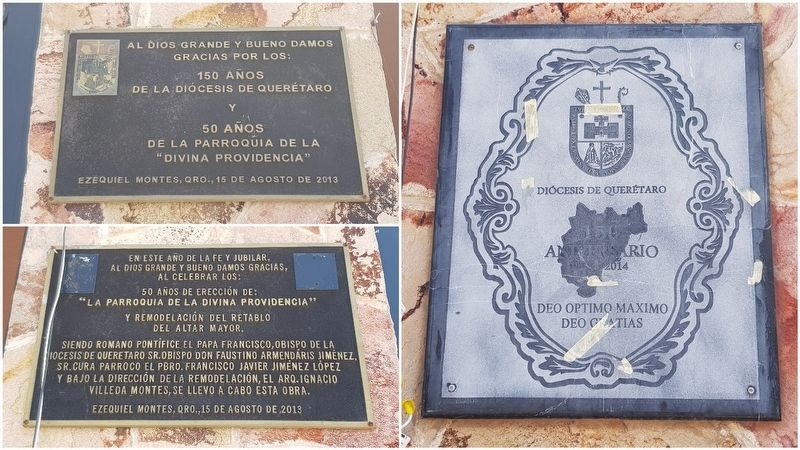
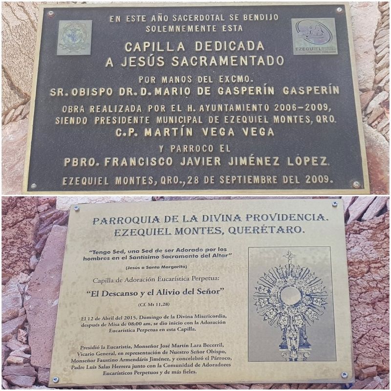
3. Additional markers on the Chapel of the Blessed Sacrament at The Parish of Divine Providence
These two additional markers are to the left and right of the entrance to the chapel. One marker notes the construction of the chapel in 2009 and the second notes that in April 2015 Perpetual Eucharistic Adoration was begun here.
Credits. This page was last revised on May 12, 2018. It was originally submitted on May 12, 2018, by J. Makali Bruton of Accra, Ghana. This page has been viewed 100 times since then and 9 times this year. Photos: 1, 2, 3, 4, 5, 6. submitted on May 12, 2018, by J. Makali Bruton of Accra, Ghana.
